Study of the formation has provided clues on the development of rivers systems in the region. In particular, evidence from the formation suggests that the Pecos River may originally have flowed west to join the Santa Fe River, rather than east to join the Rio Grande as it now does.
The age is constrained by an ash bed from the Jemez Mountains near the top of the formation, dated via argon-argon dating to 1.48 ± 0.02 Ma, and an inset fluvial deposit dated to 1.25 ± 0.06 Ma. Some portions of the formation may have continued accumulating sediments from mountain front canyons east of Santa Fe into the late Pleistocene. The base of the formation is thought to vary in age from ~2.7–3.5(?) Ma in the western Santa Fe embayment to ~1.6 Ma near the Sangre de Cristo Mountains.
The formation correlates with Pliocene–early Pleistocene aggradation in the Española and Albuquerque Basins, suggesting a regional climate influence on deposition in the uppermost Santa Fe Group. The good preservation of the Ancha Formation relative to piedmont regions to the south and eroded upland regions to the north suggests that late Pliocene volcanism and tectonism may have provided accommodation space.[1]
The Ancha Formation was likely deposited in the Santa Fe area by the Santa Fe River and other large streams. However, it contains clasts of rock unlike that of the southwestern Sangre de Cristo Mountains, suggesting that the Pecos River originally drained into the Santa Fe River watershed.[3]
Ancha Formation at reference section south-southeast of Santa Fe.
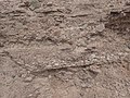
Close view of Ancha Formation at reference section.
Horizontal Ancha Formation beds resting on nearly vertical Galisteo Formation beds.
Natural resources
The Ancha Formation is a thin (less than 45m (148ft) saturated thickness) but locally important aquifer for domestic wells south of Santa Fe. Its porosity is much greater than the underlying beds of the Tesuque Formation.[1]
Koning and coinvestigators redefined the formation in 2002 and designated four additional reference sections to supplement the poorly exposed type section. Their definition removed the lower beds at the type section from the formation and reassigned them to the underlying Tesuque Formation.[1]
Smith, Gary A. (2004). "Middle to late Cenozoic development of the Rio Grande rift and adjacent regions in northern New Mexico". In Mack, G.H.; Giles, K.A. (eds.). The geology of New Mexico. A geologic history: New Mexico Geological Society Special Volume 11. pp.331–358. ISBN9781585460106.
This page is based on this Wikipedia article Text is available under the CC BY-SA 4.0 license; additional terms may apply. Images, videos and audio are available under their respective licenses.