Esterbrook, Wyoming

Last updated

Esterbrook, Wyoming
CDP
Esterbrook Chapel.jpg
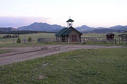
Esterbrook Church and Laramie Peak in the background
USA Wyoming location map.svg
Red pog.svg
Esterbrook, Wyoming
Location of Esterbrook, Wyoming
Coordinates: 42°24′32″N105°22′54″W / 42.40889°N 105.38167°W / 42.40889; -105.38167
Country United States
State Wyoming
County Converse
Area
  Total3.4 sq mi (8.8 km2)
  Land3.4 sq mi (8.8 km2)
  Water0.0 sq mi (0.0 km2)
Elevation
6,516 ft (1,986 m)
Population
 (2010) [1]
  Total52
  Density15/sq mi (5.9/km2)
Time zone UTC-7 (Mountain (MST))
  Summer (DST) UTC-6 (MDT)
Area code 307
FIPS code 56-25185 [2]
GNIS feature ID1599634 [3]

Esterbrook is a village, and the locus of a same-named census-designated place (CDP), in Converse County, Wyoming, United States in the Medicine Bow National Forest. The population was 52 at the 2010 census.

Contents

Geography

According to the United States Census Bureau, the CDP has a total area of 3.4 square miles (8.8 km2), all land.

Demographics

As of the census [2] of 2000, there were 32 people, 16 households, and 12 families residing in the CDP. The population density was 9.4 people per square mile (3.6/km2). There were 102 housing units at an average density of 30.1/sq mi (11.6/km2). The racial makeup of the CDP was 100.00% White.

There were 16 households, out of which 6.3% had children under the age of 18 living with them, 75.0% were married couples living together, and 25.0% were non-families. 18.8% of all households were made up of individuals, and 6.3% had someone living alone who was 65 years of age or older. The average household size was 2.00 and the average family size was 2.25.

In the CDP, the population was spread out, with 9.4% under the age of 18, 6.3% from 18 to 24, 3.1% from 25 to 44, 50.0% from 45 to 64, and 31.3% who were 65 years of age or older. The median age was 57 years. For every 100 females, there were 88.2 males. For every 100 females age 18 and over, there were 107.1 males.

The median income for a household in the CDP was $33,750, and the median income for a family was $33,750. Males had a median income of $0 versus $0 for females. The per capita income for the CDP was $15,918. None of the population or families were below the poverty line.

History

Esterbrook, founded in 1896 as a mining city, is named after Esterbrook Creek, which was named after Mrs. Esther Cooper, a local settler. In 1946 the Esterbrook Community Church (one of 29 mission churches in the Episcopal Missionary District of Wyoming) was built with a window behind the altar having a view to Laramie Peak.

Education

Public education in the community of Esterbrook is provided by Converse County School District #1. [4] Zoned campuses include White School (grades K-8) and Douglas High School (grades 9-12).

See also

Related Research Articles

<span class="mw-page-title-main">Washakie County, Wyoming</span> County in Wyoming, United States

Washakie County is a county in the U.S. state of Wyoming. As of the 2020 United States Census, the population was 7,685. Its county seat is Worland.
<span class="mw-page-title-main">Platte County, Wyoming</span> County in Wyoming, United States

Platte County is a county located in the U.S. state of Wyoming. As of the 2020 United States Census, the population was 8,605. Its county seat is Wheatland.
<span class="mw-page-title-main">Laramie County, Wyoming</span> County in Wyoming, United States

Laramie County is a county located at the southeast corner of the state of Wyoming. As of the 2020 United States Census, the population was 100,512 or 17.4% of the state's total 2020 population, making it the most populous county in Wyoming, but the least populous county in the United States to be the most populous in its state.
<span class="mw-page-title-main">Converse County, Wyoming</span> County in Wyoming, United States

Converse County is a county located in the U.S. state of Wyoming. As of the 2020 United States Census, the population was 13,751. Its county seat is Douglas.

<span class="mw-page-title-main">Albany County, Wyoming</span> County in Wyoming, United States

Albany County is a county in the U.S. state of Wyoming. As of the 2020 United States Census, the population was 37,066. Its county seat is Laramie, the site of the University of Wyoming. Its southern border lies on the northern Colorado state line.
<span class="mw-page-title-main">Elfin Cove, Alaska</span> Census-designated place in Alaska, United States

Elfin Cove is a census-designated place (CDP) near the northwestern corner of Chichagof Island in Hoonah-Angoon Census Area, Alaska, United States. The population was 20 at the 2010 census, down from 32 at the 2000 census.

Iron Post is a census-designated place (CDP) in Mayes County, Oklahoma, United States. The population was 117 at the 2000 census, but had declined to 92 in 2010, a loss of more than 21 percent.

<span class="mw-page-title-main">Donaldson, Pennsylvania</span> CDP in Pennsylvania, United States

Donaldson is a census-designated place (CDP) in Frailey Township, Schuylkill County, Pennsylvania, United States. The population was 325 at the 2000 census.
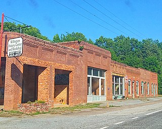
<span class="mw-page-title-main">Willington, South Carolina</span> CDP in South Carolina, United States

Willington is a census-designated place (CDP) in McCormick County, South Carolina, United States. The population was 177 at the 2000 census.

<span class="mw-page-title-main">Albany, Wyoming</span> CDP in Wyoming, United States

Albany is a census-designated place (CDP) in Albany County, Wyoming, United States. The population was 31 at the 2020 census.

<span class="mw-page-title-main">Atlantic City, Wyoming</span> CDP in Wyoming, United States

Atlantic City is a census-designated place (CDP) in Fremont County, Wyoming, United States. The population was 37 at the 2010 census. The community is a small mining settlement in a gulch near South Pass in southwestern Wyoming. It was founded as a mining camp following the 1867 gold rush in the region. The town declined following the end of the placer gold rush in the early 1870s, but continued to exist as advances in mining technology allowed further extraction of gold. From the 1960s until 1983, it was the location of US Steel iron ore mine. The town is accessible by gravel roads from nearby Wyoming Highway 28.

<span class="mw-page-title-main">Ethete, Wyoming</span> CDP in Wyoming, United States

Ethete is a census-designated place (CDP) in Fremont County, Wyoming, United States. The population was 1,553 at the 2010 census. The town is located on the Wind River Indian Reservation. It grew up around the Episcopal St. Michael's Mission.

<span class="mw-page-title-main">Fort Washakie, Wyoming</span> CDP in Wyoming, United States

Fort Washakie is a census-designated place (CDP) in Fremont County, Wyoming, United States, within the Wind River Indian Reservation and along U.S. Route 287. The population was 1,759 at the 2010 census. The headquarters for the Eastern Shoshone Tribe is located in Fort Washakie, as well as the Bureau of Indian Affairs agency for the Wind River Indian Reservation.

<span class="mw-page-title-main">Fort Laramie, Wyoming</span> Town in Wyoming, United States

Fort Laramie is a town in Goshen County, Wyoming, United States. The population was 206 at the 2020 census. The town is named after historic Fort Laramie, an important stop on the Oregon, California and Mormon trails, as well as a staging point for various military excursions and treaty signings. The old fort was located south of town across the North Platte River, at the mouth of the Laramie River.

<span class="mw-page-title-main">Fox Farm-College, Wyoming</span> Census-designated place in Wyoming, United States

Fox Farm-College is a census-designated place (CDP) in Laramie County, Wyoming, United States. It is part of the Cheyenne, Wyoming Metropolitan Statistical Area. The population was 3,876 people at the 2020 census.

<span class="mw-page-title-main">Ranchettes, Wyoming</span> Census-designated place in Wyoming, United States

Ranchettes is a census-designated place (CDP) in Laramie County, Wyoming, United States. It is part of the Cheyenne, Wyoming Metropolitan Statistical Area. The population was 5,798 at the 2010 census.

<span class="mw-page-title-main">South Greeley, Wyoming</span> Census-designated place in Wyoming, United States

South Greeley is a census-designated place (CDP) in Laramie County, Wyoming, United States. It is part of the Cheyenne, Wyoming Metropolitan Statistical Area. The population was 4,733 at the 2020 census. The population was 4,217 at the 2010 census.

<span class="mw-page-title-main">McKinnon, Wyoming</span> Census-designated place in Sweetwater County, Wyoming, United States

McKinnon is a census-designated place (CDP) in Sweetwater County, Wyoming, United States. The population was 60 at the 2010 census.

Washam is a census-designated place (CDP) in Sweetwater County, Wyoming, United States. The population was 51 at the 2010 census.

<span class="mw-page-title-main">Fort Bridger, Wyoming</span> Census-designated place in Uinta County, Wyoming, United States

Fort Bridger is a census-designated place (CDP) in eastern Uinta County, Wyoming, United States. The population was 345 at the 2010 census. The community takes its name from the eponymous Fort Bridger, established in 1842, which is located within the boundaries of the CDP.
References

  1. "2010 City Population and Housing Occupancy Status". U.S. Census Bureau. Retrieved July 13, 2012.[ dead link ]
  2. 1 2 "U.S. Census website". United States Census Bureau . Retrieved January 31, 2008.
  3. "US Board on Geographic Names". United States Geological Survey. October 25, 2007. Retrieved January 31, 2008.
  4. "2020 CENSUS - SCHOOL DISTRICT REFERENCE MAP: Converse County, WY" (PDF). U.S. Census Bureau . Retrieved September 22, 2024. - Text list