Tomsk Oblast is a federal subject of Russia. It lies in the southeastern West Siberian Plain, in the southwest of the Siberian Federal District. Its administrative center is the city of Tomsk. Population: 1,047,394.

The administrative units of Pakistan comprise four provinces, one federal territory, and two disputed territories: the provinces of Punjab, Sindh, Khyber Pakhtunkhwa, and Balochistan; the Islamabad Capital Territory; and the administrative territories of Azad Jammu and Kashmir and Gilgit–Baltistan. As part of the Kashmir conflict with neighbouring India, Pakistan has also claimed sovereignty over the Indian-controlled territories of Jammu and Kashmir and Ladakh since the First Kashmir War of 1947–1948, but has never exercised administrative authority over either region. All of Pakistan's provinces and territories are subdivided into divisions, which are further subdivided into districts, and then tehsils, which are again further subdivided into union councils.

Stavropol Krai, also known as Stavropolye (Ставропо́лье), is a federal subject of Russia. It is geographically located in the North Caucasus region in Southern Russia, and is administratively part of the North Caucasian Federal District. Stavropol Krai has a population of 2,907,593, according to the 2021 Census.

Krasnodar Krai is a federal subject of Russia, located in the North Caucasus region in Southern Russia and administratively a part of the Southern Federal District. Its administrative center is the city of Krasnodar. The third most populous federal subject, the krai had a population of 5,838,273 as of the 2021 Census.

Kirov Oblast is a federal subject of Russia located in Eastern Europe. Its administrative center is the city of Kirov. As of the 2010 census, the population is 1,341,312.

Volgograd Oblast is a federal subject of Russia, located in the lower Volga region of Southern Russia. Its administrative center is Volgograd. The population of the oblast was 2,500,781 in the 2021 Census.

The Nenets Autonomous Okrug is a federal subject of Russia and an autonomous okrug of Arkhangelsk Oblast. Its administrative center is the town of Naryan-Mar. It has an area of 176,700 square kilometers (68,200 sq mi) and a population of 42,090 as of the 2010 Census, making it the least populous federal subject.

Khanty-Mansi Autonomous Okrug–Yugra is a federal subject of Russia. It has a population of 1,532,243 as of the 2010 Census.
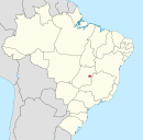
A capital district, capital region, or capital territory is normally a specially designated administrative division where a country's seat of government is located. As such, in a federal model of government, no state or territory has any political or economic advantage relative to the others because of the national capital lying within its borders. A capital territory can be a specific form of federal district.

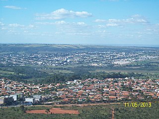
Planaltina is an administrative region in the Federal District in Brazil. It is located in the east of the Federal District, bordering Fercal, Sobradinho, and Itapoã to the west, and Paranoá to the south. With an area of 1.534 square kilometers, it is the largest administrative region of the Federal District. Planaltina has a population of 177.540. The region seat was founded in 1859 and is the oldest city in the Federal District.

Sobradinho is an administrative region in the Federal District in Brazil. It is bordered by Fercal to the north, Planaltina to the east, Itapoã to the south, and Lago Norte and Sobradinho II to the west.

Gama is an administrative region in the Federal District in Brazil. It is bordered by Recanto das Emas to the north, Riacho Fundo II and Park Way to the northeast, and Santa Maria to the east.

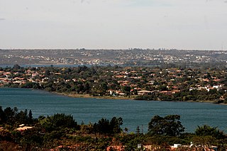
Lago Norte is an administrative region in the Federal District in Brazil. Located to the north side of Paranoá Lake, it is bordered by Brasília, Sobradinho II, and Sobradinho to the north, Itapoã and Paranoá to the east. Lago Norte shares a maritime border with Lago Sul, Paranoá, and Brasília through the Paranoá Lake. It completely surrounds the administrative region of Varjão. Most of its inhabited area is located on a peninsula of Lake Paranoá. Lago Norte is home to the Brasilia Digital TV Tower. Lago Norte was founded on January 10, 1960, receiving the status of administrative region, according to Law 641, of January 10, 1994. In a 2010 report, its population was 41,627. Its current administrator is Marcelo Ferreira da Silva.

Recanto das Emas is an administrative region in the Federal District in Brazil. It is located to the westmost area of the Federal District, being bordered by Samambaia to the north, Riacho Fundo II to the east, Gama to the south, and the border to Goiás to the west. Recanto das Emas was founded on July 28, 1993, receiving the status of administrative region, according to Law 510, of July 28, 1993.

Itapoã is an administrative region in the Federal District in Brazil. Itapoã was founded on January 3, 2005, receiving the status of administrative region, according to Law 3527, of January 3, 2005.

Jardim Botânico is an administrative region in the Federal District in Brazil. The administrative region is basically made up of gated communities. The area formerly belonged to the Taboquinha and Papuda farms, although there is controversy regarding the correct delimitation of each. Jardim Botânico was founded on December 13, 1999, receiving the status of administrative region, according to Law 3435, of August 31, 2004.

Santa Maria is an administrative region in the Federal District in Brazil. Santa Maria was founded on February 10, 1991, receiving the status of administrative region, according to Law 348, of November 4, 1992.

Varjão is an administrative region in the Federal District in Brazil. Varjão was founded on April 19, 1991, receiving the status of administrative region, according to Law 3153, of May 6, 2003.

São Sebastião is an administrative region in the Federal District in Brazil. São Sebastião was founded on June 25, 1993, receiving the status of administrative region, according to Law 467, of June 25, 1993.

Sobradinho II is an administrative region in the Federal District in Brazil. It is located to the northeast of Brasília. Sobradinho II is bordered by Fercal to the north, Sobradinho to the east, and Brasília to the southwest. Sobradinho II was founded on October 11, 1991, receiving the status of administrative region, according to Law 3314, of January 27, 2004.


