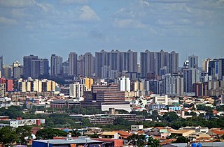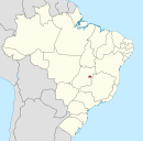
Brasília is the federal capital of Brazil and seat of government of the Federal District, located in the Brazilian highlands in the country's Central-West region. It was founded by President Juscelino Kubitschek on 21 April 1960, to replace Rio de Janeiro as the national capital. Brasília is Brazil's third-most populous city after São Paulo and Rio de Janeiro. Among major Latin American cities, it has the highest GDP per capita.

The Federal District is one of 27 federative units of Brazil. Located in the Center-West Region, it is the smallest Brazilian federal unit and the only one that has no municipalities, being divided into 35 administrative regions. The federal capital of Brazil, Brasília, which is also the seat of government of the Federal District, is located in its territory. The Federal District is almost completely surrounded by the state of Goiás, but it shares a small border with Minas Gerais.

Planaltina is an administrative region in the Federal District in Brazil. It is located in the east of the Federal District, bordering Fercal, Sobradinho, and Itapoã to the west, and Paranoá to the south. With an area of 1.534 square kilometers, it is the largest administrative region of the Federal District. Planaltina has a population of 177.540. The region seat was founded in 1859 and is the oldest city in the Federal District.

Gama is an administrative region in the Federal District in Brazil. It is bordered by Recanto das Emas to the north, Riacho Fundo II and Park Way to the northeast, and Santa Maria to the east.

Taguatinga is an administrative region in the Federal District in Brazil. It is bordered by Brasília to the north, Vicente Pires, Águas Claras, and Arniqueira to the east, Riacho Fundo and Riacho Fundo II to the south, Samambaia to the southwest, Ceilândia to the west, and Brazlândia to the northwest. Taguatinga has a population of 222,598, being the fourth largest administrative region by population.

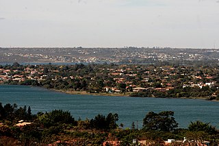
Lago Norte is an administrative region in the Federal District in Brazil. Located to the north side of Paranoá Lake, it is bordered by Brasília, Sobradinho II, and Sobradinho to the north, Itapoã and Paranoá to the east. Lago Norte shares a maritime border with Lago Sul, Paranoá, and Brasília through the Paranoá Lake. It completely surrounds the administrative region of Varjão. Most of its inhabited area is located on a peninsula of Lake Paranoá. Lago Norte is home to the Brasília Digital TV Tower. Lago Norte was founded on January 10, 1960, receiving the status of administrative region, according to Law 641, of January 10, 1994. In a 2010 report, its population was 41,627. Its current administrator is Marcelo Ferreira da Silva.

The administrative regions of the Federal District are administrative divisions of the Federal District, Brazil. They have similar jurisdiction to municipalities, albeit with a much lesser degree of autonomy. However, administrators are not directly elected, but appointed by the Governor of the Federal District. Moreover, administrative regions have no specific legislative representation apart from the district-wide Legislative Chamber of the Federal District.

Águas Claras is an administrative region in the Federal District in Brazil. It is bordered by Vicente Pires to the north, Guará and Park Way to the east, Arniqueira to the south, and Taguatinga to the west.

Brazlândia is the second oldest administrative region in the Federal District in Brazil. It is bordered by Sobradinho II to the northeast, Brasília to the east, and Taguatinga and Ceilândia to the south. Brazlândia was founded on June 5, 1933, receiving the status of administrative region, according to Law 4545, of December 10, 1964. Its current administrator is Devanir Gonçalves de Oliveira. It has a population of approximately 55,000 people.

Paranoá is an administrative region in the Federal District in Brazil. It is located to the east of Paranoá Lake, being bordered by Lago Norte, Itapoã and Planaltina to the north, São Sebastião and Jardim Botânico to the south. It shares a border with Lago Sul and Brasília through Paranoá Lake. Paranoá was founded on October 25, 1957, receiving the status of administrative region, according to Law 4545, of December 10, 1964. As of a 2010 census, it has a population of 46,527.

Núcleo Bandeirante is an administrative region in the Federal District in Brazil. It is located to the west of Paranoá Lake, being bordered by Arniqueira, Park Way, and Guará to the north, Candangolândia to the east, and Park Way and Riacho Fundo to the south. Núcleo Bandeirante was founded on December 19, 1956, receiving the status of administrative region, according to Law 4545, of December 10, 1964.

Recanto das Emas is an administrative region in the Federal District in Brazil. It is located to the westmost area of the Federal District, being bordered by Samambaia to the north, Riacho Fundo II to the east, Gama to the south, and the border to Goiás to the west. Recanto das Emas was founded on July 28, 1993, receiving the status of administrative region, according to Law 510, of July 28, 1993.

Cruzeiro is an administrative region in the Federal District in Brazil. It is bordered by SIA and Brasília to the north, and Sudoeste/Octogonal to the southeast. Created in 1959, Cruzeiro is divided into two broad sections: the original town, Cruzeiro Velho, made up mostly of one- and two-story houses, and Cruzeiro Novo, made up of several similar four-story buildings since 1970. Cruzeiro has a total area of 319,3 hectares.

Guará is an administrative region in the Federal District in Brazil. It is bordered by SIA to the north, Sudoeste/Octogonal and Candangolândia to the west, Núcleo Bandeirante to the south, Park Way to the southeast, and Águas Claras to the east, and Vicente Pires to the northeast. Guará was founded on May 5, 1969, receiving the status of administrative region, according to Law 49, of October 25, 1989.

Samambaia is an administrative region in the Federal District in Brazil. It is bordered by Ceilândia and Sol Nascente/Pôr do Sol to the north, Taguatinga to the east, and Riacho Fundo II and Recanto das Emas to the south. With a population of 232,893, it is the second largest administrative region by population, behind Ceilândia. Samambaia was founded on October 25, 1989, receiving the status of administrative region, according to Law 49, of October 25, 1989. Its current administrator is Marcos Leite de Araújo.

Vicente Pires is an administrative region in the Federal District in Brazil. It is bordered by Taguatinga to the west, Águas Claras to the south, Guará to the southeast, Brasília to the north, and Brazlândia to the northwest. According to a 2016 report, Vicente Pires has a population of 72,879. Vicente Pires is the 16th largest administrative region by population.

Park Way is an administrative region in the Federal District in Brazil. It is located southwest of Paranoá Lake. Consisting of two separated portions, it is bordered clockwise by Águas Claras, Guará, Núcleo Bandeirante, and Arniqueira in its northern half; and Núcleo Bandeirante, Candangolândia, Lago Sul, Jardim Botânico, Santa Maria, Gama, Riacho Fundo and Riacho Fundo II in its southern half. Park Way was founded on March 13, 1961, receiving the status of administrative region, according to Law 3255, of December 29, 2003.

Setor de Indústria e Abastecimento is an administrative region in the Federal District in Brazil. It is bordered by Brasília to the north and northeast, Cruzeiro and Sudoeste/Octogonal to the east, Guará and Vicente Pires to the south, and SCIA to the west. Setor de Indústria e Abastecimento is, alongside SCIA, an industrial hub in the Federal District, being host to various industries such as construction, logistics, and commerce. Setor de Indústria e Abastecimento was founded on April 21, 1969, receiving the status of administrative region, according to Law 3618, of July 14, 2005.

Riacho Fundo II is an administrative region in the Federal District in Brazil. Riacho Fundo II was founded on May 6, 1995, receiving the status of administrative region, according to Law 3153, of May 6, 2003. It is bordered by Samambaia to the north, Riacho Fundo to the northeast, Park Way to the southeast, and Gama and Recanto das Emas to the southwest.

Sol Nascente/Pôr do Sol is an administrative region in the Federal District in Brazil. For 20 years, Sol Nascente/Pôr do Sol was part of the administrative region of Ceilândia, until it was separated from the latter in 2019. It is composed of two distinct housing sectors, whose urban spots do not touch, but are conurbated with Ceilândia.


