The Agate Basin Site is a Paleoindian archeological site in Niobrara County, Wyoming. The location was discovered by William H. Spencer of Spencer, Wyoming in 1916, who found well-preserved stone blades and points in Moss Agate Arroyo. In 1941 Spencer mentioned the find to Robert E. Frison, a deputy game warden at Newcastle, who visited the site and contacted Dr. Frank H.H. Roberts of the Bureau of American Ethnology at the Smithsonian Institution. Roberts visited the site in 1942, but it would not be until 1959 that a full investigation began by the University of Wyoming on what proved to be a buffalo kill site. Further investigation took place under the direction of Dr. George C. Frison.
The Dead Indian Campsite is an archeological site in the Sunlight Basin of the Absaroka Mountains in Park County, Wyoming, United States. The site was found during the construction of the Sunlight Basin Road in 1967. The location was used as a butchering site, and excavations by the University of Wyoming in 1969 uncovered numerous stone tools, as well as the bones of elk, deer, mountain sheep, porcupine and wolf. A stone cairn was found to contain antler sets. The site was used in different eras for 4500 years.

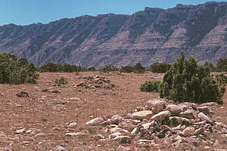
Mummy Cave is a rock shelter and archeological site in Park County, Wyoming, United States, near the eastern entrance to Yellowstone National Park. The site is adjacent to the concurrent U.S. Routes 14/16/20, on the left bank of the North Fork of the Shoshone River at an altitude of 6,310 feet (1,920 m) in Shoshone National Forest.
The Bishop Road Site in Campbell County, Wyoming is an archeological site along Piney Creek. It was discovered during surveys for a proposed coal slurry pipeline. The site contained buried lithic artifacts, bone fragments and hearths. Projectile points characteristic of the Late Archaic and Late Prehistoric periods were found, with possible early and middle Archaic points as well.

The Vore Buffalo Jump is an archeological site in Crook County, Wyoming. A sinkhole, formed where gypsum soil was eroded, leaving a steep-sided pit about 40 feet (12 m) deep and 200 feet (61 m) in diameter. Native American hunters could stampede bison in the direction of the pit, which was deep enough to kill or disable the animals that were driven into it. The location is one of a number of buffalo jump sites in the north central United States and southern Canada. The Vore site was used as a kill site and butchering site from about 1500 AD to about 1800 AD. Archeological investigations in the 1970s uncovered bones and projectile points to a depth of 15 feet (4.6 m). About ten tons of bones were removed from the site. About five percent of the site has been excavated, and the pit is estimated to contain the remains of 20,000 buffalo.
The Triangulation Point Draw Site is an archeological site in Uinta County, Wyoming. The camp was occupied by Native Americans from both the Great Basin and the northwestern Plains during the Late Prehistoric period. Surface artifacts found at the site include chipped stone points and tools, ground stone tools, fire locations and organic stains. Buried artifacts include fire rings and habitation-related disturbances. Projectile points at the site include Plains side-notched, Rose Spring corner-notched and Late Prehistoric corner-notched points, as well as a Late Prehistoric small corner-notched point similar to those found in Mummy Cave, more than 200 miles (320 km) to the north.
The Bad Pass Trail, also known as the Sioux Trail, was established by Native Americans on the border of present-day Montana and Wyoming as a means of access from the Bighorn Basin in Wyoming to Bison-hunting grounds in the Grapevine Creek area of Montana. Marked by stone cairns, the trail led across Bad Pass and was established in pre-Columbian times. After Europeans arrived in the area it was frequented by fur trappers and mountain men, beginning in 1824. Trappers assembled pack trains at the junction of the Shoshone River and the Bighorn River, using the Bad Pass Trail to avoid Bighorn Canyon. The trail ended at the mouth of Grapevine Creek on the Bighorn, from which the pack train could float down the Bighorn on rafts to the Yellowstone River and then to the Missouri and on to St. Louis.

The Trappers Point Site is an archaeological site located near Pinedale, Wyoming. The site, which dates to the Early Archaic period, is the oldest known location used for the mass killing of pronghorn antelope. In addition, a large number of projectile points have been found at the site; the variety of projectile point designs at the site have helped establish how these tools developed, and the presence of points from many parts of the Green River valley have aided in determining prehistoric migration patterns. The site has been called "a major discovery in Wyoming archaeology" and "one of the key sites in Wyoming".
The Southsider Shelter is a Native American rock shelter archeological site in Big Horn County, Wyoming.. The site has occupied from the late Paleoindian period to the Late Prehistoric period. Artifacts include projectile points and chipped stone. The site was added to the National Register of Historic Places on August 1, 2012.
The Garrett Allen Prehistoric Site is an archeological site in Carbon County, Wyoming. The site was used in the Late Middle Prehistoric Period and into the Late Prehistoric Period. The site was used as an animal butchering location. Excavations by George Frison in the late 1960s and early 1970s revealed a continuous series of layers containing tools, stone flakes and projectile points. This site was placed on the National Register of Historic Places on August 7, 1974.
The Sage Creek Station Site is a former way station on the Overland Trail in Carbon County, Wyoming. Constructed about 1862, the station was built of logs with an adobe fireplace and a dirt roof over pole rafters. The site burned on June 8, 1865, but may have been rebuilt. All that remains of the station are its foundations. The site was placed on the National Register of Historic Places on December 6, 1978.
The Midway Station Site is a former way station on the Overland Trail in Carbon County, Wyoming. Built in 1850, the station was on a heavily traveled stage and emigration route, halfway between Saratoga and Walcott, providing its name. Nothing remains of the station beyond depressions in the earth. The site was placed on the National Register of Historic Places on December 6, 1978.
The Pine Grove Station Site is a former way station on the Overland Trail in Carbon County, Wyoming, near Bridger's Pass. It was built in 1862 by Robert Foote for $1500 and was described as a log building about 25 feet (7.6 m) by 60 feet (18 m) with an adjoining corral. The station was burned in 1865 and 1867 by Indians. Nothing remains of the station. The site was placed on the National Register of Historic Places on December 6, 1978.

The Washakie Station Site is a former way station on the Overland Trail in Carbon County, Wyoming. Built in 1862, the station was on a heavily traveled stage and emigration route. The station was a stone structure with a dirt roof over pole rafters.Remains of the station consist of foundations and ruined sandstone walls. The site was placed on the National Register of Historic Places on December 6, 1978.
The Muddy Creek Archeological Complex is an archeological location Carbon County, Wyoming. The complex's three sites are dated to the Late Plains Archaic period. Stone points place the users of the site in the Besant Cultural Complex, representing one of the southernmost Besant sites. The sites were was bison hunting and processing locations and feature many bison remains, as well as tipi rings. The complex was placed on the National Register of Historic Places on May 16, 2012.
The Dug Springs Station Site is a former way station on the Overland Trail in Sweetwater County, Wyoming. Constructed about 1862, the station was built with rock slab walls, between Laclede Station and Duck Lake Station. The site was placed on the National Register of Historic Places on December 6, 1978.
The Eldon-Wall Terrace Site is an archeological site in Sweetwater County, Wyoming. The site occupies about 600 metres (2,000 ft) of a terrace on Blacks Fork in the Green River Basin. The site includes numerous hearth sites, with stone chips and tools. A projectile point dates the site to the Middle Archaic period. The site was listed on the National Register of Historic Places on December 13, 1985.
The Green Mountain Arrow Site is an assemblage of arranged stones in Fremont County, Wyoming. The site includes seven stone cairns, a 50-metre (160 ft) directional arrow, three possible stone circles and lines of small stones. It is one of relatively few stone effigies found in the northern Great Plans and Rocky Mountains.
The Split Rock Archeological Site comprises a series of river terraces south of the Sweetwater River in Fremont County, Wyoming. The terrraces have yielded Native American artifacts from the Early Plains Archaic Period. Several housepit features were found in 1984 excavations. The site was placed on the National Register of Historic Places on May 4, 1987..
The Helen Lookingbill Site is a prehistoric campsite in the Absaroka Mountains of Fremont County, Wyoming. Occupied over 12,500 years, the site has yielded more than 125,000 artifacts, including a large quantity of Early Plains Archaic side-notched points. The site has been assessed as a tool production location.

