References
- ↑ U.S. Geological Survey Geographic Names Information System: Fish Springs, Tennessee
- ↑ Oral history by Ruth Smith Hartley
- ↑ FishSpringsmarina.com
Municipalities and communities of Carter County, Tennessee, United States | ||
|---|---|---|
| Cities | 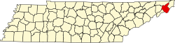 | |
| CDPs | ||
| Unincorporated communities | ||
| Footnotes | ‡This populated place also has portions in an adjacent county or counties | |