Laurel Fork, Tennessee | |
|---|---|
 Laurel Fork  Laurel Fork | |
| Coordinates: 36°12′21″N82°00′09″W / 36.20583°N 82.00250°W | |
| Country | United States |
| State | Tennessee |
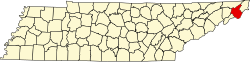
| County | Carter |
| Elevation | 3,455 ft (1,053 m) |
| Time zone | UTC-5 (Eastern (EST)) |
| • Summer (DST) | UTC-4 (EDT) |
| Area code | 423 |
| GNIS feature ID | 1315358 [1] |
Laurel Fork is an unincorporated community in Carter County, Tennessee, United States. [1] [2]