Fort Dubois

Last updated

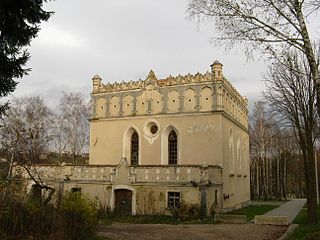
Fort Dubois is a military construction from the 19th century, [1] located in the town of Hirson in the Aisne department in Picardy in northern France. This fort was built between 1877 and 1880. It is the work of the French general and military engineer Raymond Adolphe Sere de Rivieres. It was intended to prevent the supply rail from potential invaders. In 1912, the fort was decommissioned. The fort was partially destroyed. It consisted of barracks, a bakery, powder magazines, a turret Mougin, single and double caponiers. Despite a clearance operation carried out in May 2006, many weapons remain on site and make it very dangerous. The access is logically prohibited.

Hirson Commune in Hauts-de-France, France

Hirson is a commune in the Aisne department in Hauts-de-France in northern France.

Aisne Department of France

Aisne is a French department in the Hauts-de-France region of northern France. It is named after the river Aisne.

In the administrative divisions of France, the department is one of the three levels of government below the national level, between the administrative regions and the commune. Ninety-six departments are in metropolitan France, and five are overseas departments, which are also classified as regions. Departments are further subdivided into 334 arrondissements, themselves divided into cantons; the last two have no autonomy, and are used for the organisation of police, fire departments, and sometimes, elections.

Coordinates: 49°54′52″N4°04′24″E / 49.91444°N 4.07333°E / 49.91444; 4.07333

Geographic coordinate system Coordinate system

A geographic coordinate system is a coordinate system that enables every location on Earth to be specified by a set of numbers, letters or symbols. The coordinates are often chosen such that one of the numbers represents a vertical position and two or three of the numbers represent a horizontal position; alternatively, a geographic position may be expressed in a combined three-dimensional Cartesian vector. A common choice of coordinates is latitude, longitude and elevation. To specify a location on a plane requires a map projection.

Related Research Articles

Matlacha, Florida CDP in Florida, United States

Matlacha is a census-designated place (CDP) in Lee County, Florida, United States. As of the 2000 census, the CDP had a total population of 735. It is part of the Cape Coral-Fort Myers, Florida Metropolitan Statistical Area.

Camp Dubois

Camp Dubois, near present-day Wood River, Illinois, served as the winter camp and starting point for the Lewis and Clark Expedition.

Segarcea Town in Dolj County, Romania

Segarcea is a small town in Dolj County, Romania, about 25 kilometres from Craiova, the county seat. It has 8,000 inhabitants and it is famous for its white wines.

NATO Dispersed Operating Bases Wikimedia list article

NATO Dispersed Operating Bases (DOBs) were developed to improve air power survival when NATO began planning for tactical air bases and aircraft in western Europe during the early Cold War years of the 1950s.

Fortune, Newfoundland and Labrador Town in Newfoundland and Labrador, Canada

Fortune is a Canadian town located in the province of Newfoundland and Labrador.

Hrabské municipality of Slovakia

Hrabské is a village and municipality in Bardejov District in the Prešov Region of north-east Slovakia.

The canton of Villeneuve-sur-Yonne is a canton of France, located in the Yonne département, in the Bourgogne-Franche-Comté région. It has 12 communes.

Baranowice, Milicz County Village in Lower Silesian, Poland

Baranowice is a village in the administrative district of Gmina Milicz, within Milicz County, Lower Silesian Voivodeship, in south-western Poland. Prior to 1945 it was in Germany.

The canton of Saint-Trivier-sur-Moignans is an administrative division in eastern France. It was disbanded following the French canton reorganisation which came into effect in March 2015. It consisted of 13 communes, which joined the canton of Villars-les-Dombes in 2015. It included the following communes:

Budy, Końskie County Village in Świętokrzyskie, Poland

Budy is a village in the administrative district of Gmina Fałków, within Końskie County, Świętokrzyskie Voivodeship, in south-central Poland. It lies approximately 7 kilometres (4 mi) south of Fałków, 27 km (17 mi) south-west of Końskie, and 43 km (27 mi) north-west of the regional capital Kielce.

Husiatyn Synagogue synagogue

The Husiatyn Synagogue (Festungs-Schule) is a former synagogue in Husiatyn, Galicia, Ukraine.

Barwino Village in Pomeranian, Poland

Barwino is a village in the administrative district of Gmina Kępice, within Słupsk County, Pomeranian Voivodeship, in northern Poland. It lies approximately 6 kilometres (4 mi) north of Kępice, 21 km (13 mi) south of Słupsk, and 112 km (70 mi) west of the regional capital Gdańsk.

Janówiec is a settlement in the administrative district of Gmina Bobolice, within Koszalin County, West Pomeranian Voivodeship, in north-western Poland.

ESC Lille is a French business school founded in 1892. It has two campuses, one in Lille and one in Paris. ESC Lille is EQUIS accredited by the EFMD and the Conference Of The Grandes Ecoles. In 2005, it was the first European business school to be accredited by Project Management Institute’s Global Accreditation Center for Project Management (GACPM), and is still the only PMI-accredited business school in France. In July 2009 the union of Ceram Business School and ESC Lille was announced. It will create the largest French business school in terms of student numbers. The new school, named Skema Business School, span three sites in France in Lille, Paris and Sophia Antipolis near Nice and two sites in China (Suzhou) and Morocco (Casablanca).

Louisbourg Expedition (1757)

The Louisbourg Expedition (1757) was a failed British attempt to capture the French Fortress of Louisbourg on Île Royale during the Seven Years' War.

Väike-Lähtru is a village in Lääne-Nigula Parish, Lääne County, in western Estonia.

Torgu-Mõisaküla is a village in Saaremaa Parish, Saare County in western Estonia.

Victory War Memorial

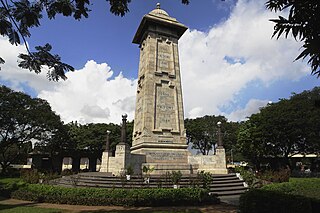
Victory War Memorial, formerly called the Cupid's bow, is a memorial in Chennai, India, originally constructed to commemorate the victory of the Allied Armies during World War I (1914–1918) and later became the victory war memorial for World War II (1939–1945), erected in the memory of those from the Madras presidency who lost their lives in the wars. Later addition includes inscriptions of 1948 Kashmir Aggression, 1962 War with China and the Indo-Pakistan War.

London Heights, Indiana Unincorporated community in Indiana, United States

London Heights is an unincorporated community in Moral Township, Shelby County, in the U.S. state of Indiana.

Ceintures de Lyon

The ceintures de Lyon were a series of fortifications built between 1830 and 1890 around the city of Lyon, France to protect the city from foreign invasion.

References