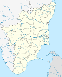
The Coromandel Coast is the southeastern coastal region of the Indian subcontinent, bounded by the Utkal Plains to the north, the Bay of Bengal to the east, the Kaveri delta to the south, and the Eastern Ghats to the west, extending over an area of about 22,800 square kilometres. Its definition can also include the northwestern coast of the island of Sri Lanka. The coast has an average elevation of 80 metres and is backed by the Eastern Ghats, a chain of low, flat-topped hills.

Colonial India was the part of the Indian subcontinent that was under the jurisdiction of European colonial powers during the Age of Discovery. European power was exerted both by conquest and trade, especially in spices. The search for the wealth and prosperity of India led to the colonisation of the Americas after their discovery by Christopher Columbus in 1492. Only a few years later, near the end of the 15th century, Portuguese sailor Vasco da Gama became the first European to re-establish direct trade links with India since Roman times by being the first to arrive by circumnavigating Africa. Having arrived in Calicut, which by then was one of the major trading ports of the eastern world, he obtained permission to trade in the city from Saamoothiri Rajah. The next to arrive were the Dutch, with their main base in Ceylon. Their expansion into India was halted, after their defeat in the Battle of Colachel by the Kingdom of Travancore, during the Travancore-Dutch War.

Pulicat or Pazhaverkadu is a historic seashore town in Thiruvallur District, of Tamil Nadu state, India. It is about 60 kilometres (37 mi) north of Chennai and 3 kilometres (1.9 mi) from Elavur, on the southern periphery of the Pulicat Lake. Pulicat lake is a shallow salt water lagoon which stretches about 60 kilometres (37 mi) along the coast. With lakeside and seashore development as well as several Special Economic Zones (SEZs) including a US$1 billion Medical SEZ, coming up in nearby Elavur, land prices in the area are rising.

Pulicat Lagoon is the second largest brackish water lagoon in India,, measuring 759 square kilometres (293 sq mi). The lagoon is one of the three important wetlands to attract northeast monsoon rain clouds during the October to December season in the Tirupati Region. The lagoon comprises the following regions, which adds up 759 square kilometres (293 sq mi) according to Andhra Pradesh Forest Department: 1) Pulicat Lake 2) Marshy/Wetland Land Region (AP) 3) Venadu Reserve Forest (AP) 4) Pernadu Reserve Forest (AP) The lagoon was cut across in the middle by the Sriharikota Link Road, which divided the water body into lagoon and marshy land. The lagoon encompasses the Pulicat Lake Bird Sanctuary. The barrier island of Sriharikota separates the lagoon from the Bay of Bengal and is home to the Satish Dhawan Space Centre. Major part of the lagoon comes under Nellore district of Andhra Pradesh.

Chennai, formerly known as Madras, is the capital of the state of Tamil Nadu and is India's fifth largest city. It is located on the Coromandel Coast of the Bay of Bengal. With an estimated population of 8.9 million (2014), the 382-year-old city is the 31st largest metropolitan area in the world.

The Dutch Gold Coast or Dutch Guinea, officially Dutch possessions on the Coast of Guinea was a portion of contemporary Ghana that was gradually colonized by the Dutch, beginning in 1612. The Dutch began trading in the area around 1598, joining the Portuguese which had a trading post there since the late 1400s. Eventually, the Dutch Gold Coast became the most important Dutch colony in West Africa after Fort Elmina was captured from the Portuguese in 1637, but fell into disarray after the abolition of the slave trade in the early 19th century. On 6 April 1872, the Dutch Gold Coast was, in accordance with the Anglo-Dutch Treaties of 1870–71, ceded to the United Kingdom.

Dutch India consisted of the settlements and trading posts of the Dutch East India Company on the Indian subcontinent. It is only used as a geographical definition, as there was never a political authority ruling all Dutch India. Instead, Dutch India was divided into the governorates Dutch Ceylon and Dutch Coromandel, the commandment Dutch Malabar, and the directorates Dutch Bengal and Dutch Suratte.

Dutch Ceylon was a governorate established in present-day Sri Lanka by the Dutch East India Company. Although the Dutch managed to capture most of the coastal areas in Sri Lanka they were never able to control the Kandyan Kingdom located in the interior of the island. Dutch Ceylon existed from 1640 until 1796.

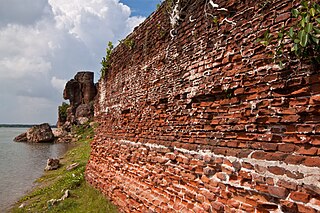
The ruins of Alamparai Fort lie near Kadappakkam, a village 50 km from Mamallapuram on the land overlooking the sea. Constructed in the late 17th century during the Mughal era, the Alamparai Fort once had a 100-metre long dockyard stretching into the sea, from which zari cloth, salt, and ghee were exported. During 1735 AD it was ruled by Nawab Doste Ali Khan. In 1750, for the services rendered by the famous French commander Dupleix to Subedar Muzaphar Jung, the fort was given to the French. When French were defeated by the British, the fort was captured and destroyed in 1760 AD. More recently the structure was damaged in the 2004 Indian Ocean earthquake.
Slavery was an established institution in ancient India by the start of the common era, or likely earlier. However, its study in ancient times is problematic and contested because it depends on the disputed translations of terms such as dasa and dasyu.
Francis Day (1605–1673) was an administrator associated with the East India Company. He served as a factor of the Company's factory at Masulipatnam from 1632 to 1639. In 1639, he negotiated the purchase of a strip of land south of the Dutch factory at Pulicat from the Raja of Chandragiri, where the town of Madras was built. He served as the second Agent of Madras from 1643 to 1644. Along with Andrew Cogan, he is regarded as the founder of Madras.

The Dutch Empire is a term comprising different territories that were controlled by Netherlands from the seventeenth to the twentieth century. They settled outside Europe, they had skills in trade and transport. In the late sixteenth century, the Netherlands took back their lead at sea, and by the second half of the seventeenth century their cultural and economy rose to dominate the sea. This hundred year period is called the Dutch Golden Age. The Dutch built their empire with corporate colonialism by conducting the East Indies and the West Indies companies, following the British Empire footsteps, which led to war between both empires. All Dutch sailors and merchants were part of the voyages that explored around the world. After the French Revolutionary Wars, Netherlands lost most of its power to the British after the French armies invaded Holland and parts of the Dutch colonies. So, the Dutch leaders had to defend their colonies and homeland.

The History of Pulicat revolves around the early role of Pulicat as a seaport in one of the few natural harbours on the Coromandel Coast of South India. Pulicat is in Tamil Nadu at the mouth of Pulicat lake. Worth a visit to AARDE Pulicat Museum located in Kottai Kuppam road at Pazhaverkadu will give the detailed account on the history of Pulicat.

Suratte or Soeratte was a directorate of the Dutch East India Company between 1616 and 1795, with its main factory in the city of Surat. Surat was an important trading city of the Mughal Empire on the river Tapti, and the Portuguese had been trading there since 1540. In the early 17th century, Portuguese traders were displaced by English and Dutch traders.

Dutch Malabar,(Dutch:Nederlandse Malabar, Malayalam:ഡച്ച് മലബാർ) also known by the name of its main settlement Cochin, was the title of a commandment of the Dutch East India Company on the Malabar Coast between 1661 and 1795, and is part of what is today collectively referred to as Dutch India. Dutch presence in the region started with the capture of Portuguese Quilon, and ended with the occupation of Malabar by the British in 1795. They possessed military outposts in 11 locations: Alleppey, Ayacotta, Chendamangalam, Pappinivattom, Ponnani, Pallipuram, Cranganore, Chetwai, Cannanore, Cochin, and Quilon.

Coromandel was a governorate of the Dutch East India Company on the Coromandel Coast between 1610 until the company's liquidation in 1798. Dutch presence in the region began with the capture of Pulicat from the Portuguese, which then became a colony of the Kingdom of the Netherlands until 1825, when it was relinquished to the British according to the Anglo-Dutch Treaty of 1824. It is part of what is today called Dutch India.

Nagapattinam Port is a port in the South Indian town of Nagapattinam in the Indian state of Tamil Nadu. It is a natural port located in the shores of Bay of Bengal. The port came to prominence during the period of Medieval Cholas and served as their important port for commerce and east bound naval expeditions. Nagapattinam was settled by the Portuguese and, later, the Dutch under whom it served as the capital of Dutch Coromandel from 1660 to 1781 CE. In November 1781, the town was conquered by the British East India Company. The port was an important port for the colonial empires until Thoothukudi port became the primary port in the Coromandel Coast.

India–Netherlands relations refer to foreign relations between India and the Netherlands. India maintains an embassy in The Hague, Netherlands and the Netherlands maintains an embassy in New Delhi and a consulate general in Mumbai. Both countries established diplomatic relations in 1947.

Fort Vijf Sinnen was a fortification made by the Dutch East India Company in Nagapattinam, then part of Dutch Coromandel (1610-1798), now Tamil Nadu. The fortification, also described as a castle, was built to protect the interests of the trading company, which shifted the capital of the Coromandel operation from Pulicat to Nagapattinam in 1690, three years after work began on the fort.
Henricus Franciscus von Söhsten, later anglicized to Henry Francis von Söhsten was the last opperhoofd of Dutch Coromandel between 1824 and 1825.


