Related Research Articles

Lagos is a city and municipality at the mouth of Bensafrim River and along the Atlantic Ocean, in the Barlavento region of the Algarve, in southern Portugal. The population of the municipality in 2011 was 31,049, in an area of 212.99 km2. The city of Lagos proper has a population of approximately 22,000. Typically, these numbers increase during the summer months, with the influx of visiting tourists and seasonal residents. While the majority of the population lives along the coast and works in tourism and services, the inland region is sparsely inhabited, with the majority of the people working in agriculture and forestry.
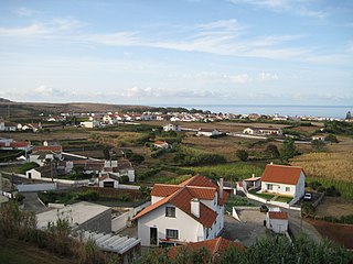
Vila do Porto is the single municipality, the name of the main town and one of the civil parishes on the island of Santa Maria, in the Portuguese archipelago of Azores. Its nearest neighbor, administratively, is the municipality of Povoação on the southern coast of São Miguel, and it is physically southwest of the islets of the Formigas. The population in 2021 was 5,408, in an area of 96.89 km2 (37.41 sq mi).

Lagoa is a city and municipality in the district of Faro, in the Portuguese region of Algarve. The population of the municipality in 2011 was 22,975, in an area of 88.25 km². Its urban population, in the city of Lagoa proper, is 6,100 inhabitants. An important travel destination, its coast has won numerous accolades. Marinha Beach was considered by the Michelin Guide as one of the 10 most beautiful beaches in Europe and as one of the 100 most beautiful beaches in the world.
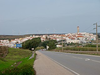
Vila do Bispo is a municipality (concelho) in the Portuguese Algarve. It has 5,717 inhabitants in an area of 179.06 km2.

Praia da Luz, officially Luz, is a civil parish of the municipality of Lagos, in Algarve region, Portugal. The population of the civil parish in 2011 was 3,545, in an area of 21.78 km2. Also known as Santorini de Portugal, Luz de Lagos or Vila da Luz, "Praia da Luz" is used to refer to both the urbanized village and the beach. The parish had its origins in a small fishing village, but was transformed by several holiday-villa complexes into a tourist area.
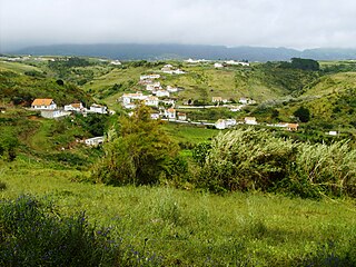
Vila do Porto is a civil parish in the municipality of Vila do Porto, located on the island of Santa Maria, in the Portuguese autonomous region of Azores. It is the southernmost and easternmost parish in the archipelago of Azores. The population in 2011 was 3,119, in an area of 25.55 km².

The Fort of São João do Arade, sometimes referred to as the Castle of Arade, is a medieval fortification situated in the civil parish of Ferragudo in the Portuguese Algarve municipality of Lagoa.

The Fort of Guincho, also known as the Fort of Velas, is located at the edge of the Praia do Abano, along the southern edge of the coast of the civil parish of Alcabideche, in Cascais Municipality, Lisbon District, Portugal.. It was classified as Property of Public Interest by the national government on 29 September 1977, but today stands in a state of decay, even after studies to remodel the location as a visitors centre for the nearby Sintra-Cascais Nature Park.

Fort of Santa Cruz, is a 16th-century fortification located in the civil parish of Angústias, municipality of Horta, on the island of Faial in the Portuguese Azores. Occasionally referred to as the Castelo de Santa Cruz by locals, it is situated in the historic centre of the city, on the edge of Horta Bay. It was constructed to work in conjunction with the Fort of Bom Jesus at the mouth of the Ribeira da Conceição and Fort of Greta along the coast of the extinct spatter cone Monte da Guia, to defend the entrance to the harbour and southern access to the Bay.
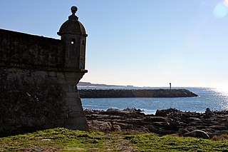
The Fort of Lagarteira is a medieval fort in the civil parish of Vila Praia de Âncora, municipality of Caminha in the Portuguese Norte, classified as a Property of Public Interest.

Carrapateira is a village on the western coast of the Algarve, Portugal. Administratively, it is part of the civil parish of Bordeira, within the municipality of Aljezur, in the Faro District. Its landmarks include an old fort and a church. The nearby beaches are a popular surfing destination.
The Fort of the Espírito Santo is the remains of a 16th-century fortification located on the extreme northern edge of the Bay of Praia da Vitória, in the Portuguese civil parish of Santa Cruz, municipality of Praia da Vitória, on the island of Terceira, in the Azores.
Iládio Amado is a teacher of music education and also an instrumentalist and composer. He lives in Vila do Bispo, Algarve, and has performed all over the country as a member of various bands. He is currently a member of Tokamaki.

The Fort of São João Baptista is the ruins of a 16th-century maritime fort situated on the western edge of Praia Formoso, in the civil parish of Almagreira, municipality of Vila do Porto, on the Portuguese island of Santa Maria.

The Fort of São Brás is a 17th-century maritime fort situated on the southern cliffs of the civil parish of Vila do Porto, municipality of the same name, on the Portuguese island of Santa Maria, in the archipelago of the Azores.
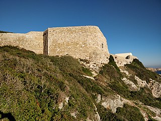
The Fort of Santo António de Belixe, which is also referred to as the Fortress of Beliche, is located on Cape St. Vincent in the parish of Sagres, municipality of Vila do Bispo, Faro District, in Portugal. The original date of construction is unknown but the fort was already in existence in the 16th Century.

The Fort of Almádena or, also known as the Fort of the River Mouth, is located between the towns of Salema and Burgau, in the Algarve region of Portugal. It was constructed in 1632. Damaged by the 1755 earthquake, it was abandoned in 1849.
References
- 1 2 "Ruínas do Forte de Vera Cruz da Figueira - Praia da Figueira, Budens". Património Militar. Câmara Municipal de Vila do Bispo. Retrieved 25 December 2021.
- 1 2 3 4 5 6 7 8 9 10 GORDALINA, Rosário (2011). "Forte de Vera Cruz / Forte de Vera Cruz da Figueira / Forte da Figueira". Sistema de Informação para o Património Arquitectónico. Direcção-Geral do Património Cultural. Retrieved 20 December 2021.
- ↑ "Praia da Figueira (Budens) - Canhão". Portal do Arqueólogo. Direcção-Geral do Património Cultural. Retrieved 20 December 2021.
- ↑ "Canhão do Forte da Figueira (Budens)". Portal do Arqueólogo. Direcção-Geral do Património Cultural. Retrieved 20 December 2021.
