Freshwater, Virginia

Last updated

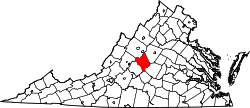
Freshwater is an unincorporated community in Nelson County, Virginia, United States.

Nelson County, Virginia County in the United States

Nelson County is a county located in the Commonwealth of Virginia. As of the 2010 census, the population was 15,020. Its county seat is Lovingston.

Virginia State of the United States of America

Virginia, officially the Commonwealth of Virginia, is a state in the Southeastern and Mid-Atlantic regions of the United States located between the Atlantic Coast and the Appalachian Mountains. Virginia is nicknamed the "Old Dominion" due to its status as the first English colonial possession established in mainland North America and "Mother of Presidents" because eight U.S. presidents were born there, more than any other state. The geography and climate of the Commonwealth are shaped by the Blue Ridge Mountains and the Chesapeake Bay, which provide habitat for much of its flora and fauna. The capital of the Commonwealth is Richmond; Virginia Beach is the most populous city, and Fairfax County is the most populous political subdivision. The Commonwealth's estimated population as of 2018 is over 8.5 million.

United States Federal republic in North America

The United States of America (USA), commonly known as the United States or America, is a country composed of 50 states, a federal district, five major self-governing territories, and various possessions. At 3.8 million square miles, the United States is the world's third or fourth largest country by total area and is slightly smaller than the entire continent of Europe's 3.9 million square miles. With a population of over 327 million people, the U.S. is the third most populous country. The capital is Washington, D.C., and the largest city by population is New York City. Forty-eight states and the capital's federal district are contiguous in North America between Canada and Mexico. The State of Alaska is in the northwest corner of North America, bordered by Canada to the east and across the Bering Strait from Russia to the west. The State of Hawaii is an archipelago in the mid-Pacific Ocean. The U.S. territories are scattered about the Pacific Ocean and the Caribbean Sea, stretching across nine official time zones. The extremely diverse geography, climate, and wildlife of the United States make it one of the world's 17 megadiverse countries.

Related Research Articles

West Wareham, Massachusetts Census-designated place in Massachusetts, United States

West Wareham is a census-designated place (CDP) in the town of Wareham in Plymouth County, Massachusetts, United States. The population was 2,064 at the 2010 census.

East Carroll Township, Cambria County, Pennsylvania Township in Pennsylvania, United States

East Carroll Township is a township in Cambria County, Pennsylvania, United States. The population was 1,654 at the 2010 census. It is part of the Johnstown, Pennsylvania Metropolitan Statistical Area.

La Villa, Texas City in Texas

La Villa is a city in Hidalgo County, Texas. The population was 1,957 at the 2010 United States Census. It is part of the McAllen–Edinburg–Mission and Reynosa–McAllen metropolitan areas.

Fort Koshkonong

Fort Koshkonong was a military fort located near the present-day city of Fort Atkinson, Wisconsin. Intended to control the confluence of the Bark and Rock rivers, it was used as a station for local militia units and the U.S. regulars in the region to scout the British Band, a group of Native Americans who fought against government units during the 1832 Black Hawk War. General Henry Atkinson was the commander of the fort during the war. Black Hawk was in the same general area, but evaded capture and started to flee towards the Wisconsin River. The original fort was abandoned by the Army following the conflict. Local settlers dismantled it for the wood as the town developed.

Tuscarora Creek (Opequon Creek) river in United States of America

Tuscarora Creek in Berkeley County, West Virginia is an 11.4-mile-long (18.3 km) tributary of Opequon Creek, which drains into the Potomac River in the Chesapeake Bay watershed.

The Rural Municipality of McKillop No. 220, Saskatchewan was originally called Strassburg and is now named McKillop No. 220 as of July 15, 1919. Strassburg R.M. No. 220 was originally formed December 13, 1909.

Magic Roundabout (High Wycombe) ring junction in High Wycombe, Buckinghamshire, England,

The Magic Roundabout in High Wycombe, Buckinghamshire, England, is similar to the roundabouts with the same name in Swindon and other places. It is located on the junction of the A40 and A404. The junction is the second meeting point of the two roads, they interchange at the start of the A404 in Marylebone, London, with the A40 forming the Westway. The two roads follow different routes to reach Wycombe, the A40 coming via Beaconsfield and the A404 via North London and Amersham. From the roundabout, the A40 continues towards Oxford, Cheltenham, Gloucester and South Wales, whilst the A404 goes south to Marlow and Maidenhead.

Copper Cove Subdivision, California Unincorporated community in California, United States

Copper Cove Subdivision is an unincorporated community in Calaveras County, California. It lies at an elevation of 1070 feet.

Nameless is a populated place in Travis County, Texas.

Wawken No. 93 is a rural municipality in south-east Saskatchewan, Canada encompassing 836.39 square kilometers in area. The rural municipality maintains offices in the community of Wawota, Saskatchewan. The rural municipality in conjunction with the provincial government is in charge of maintenance of highways in its area. As well, the municipality provides policing, fire protection and municipal governance for the rural district, with a reeve as its administrator. Agriculture plays an important role in the rural municipality. The rural municipality includes Kenosee Lake and the Kenosee Superslides. The municipality also includes the ghost town of Cannington Lake.

Mičivode Village in Republika Srpska, Bosnia and Herzegovina

Mičivode is a village in the municipality of Sokolac, Bosnia and Herzegovina.

Cloverdale, Fluvanna County is an unincorporated community in Fluvanna County, in the U.S. state of Virginia. Cloverdale has historically been an African American community.

The Battle of Bowmanville was a 1942 revolt in the Bowmanville prisoner of war camp, Ontario, Canada. The prisoners, most of whom were higher-ranking German officers, objected to the intended shackling of 100 prisoners. The battle lasted for three days.

Corn Creek Wash is a stream located in Coconino County, Arizona, southeast of the census-designated place of Leupp. The name was collected by the United States Geological Survey between 1976 and 1980, and entered into the Geographic Names Information System on February 8, 1980.

Monadh Mòr Scottish mountain

Monadh Mòr is a mountain in the Cairngorms region of the Highlands of Scotland.

Hardingrove, Indiana Unincorporated community in Indiana, United States

Hardingrove is an unincorporated community in Tobin Township, Perry County, in the U.S. state of Indiana.

White Oak Valley is an unincorporated community in Brown County, in the U.S. state of Ohio.

Saltair is an unincorporated community in Clermont County, in the U.S. state of Ohio.

Chanos is a municipality located in the province of Zamora, Castile and León, Spain. According to the 2015 census (INE), the municipality has a population of 55 inhabitants.

La Chuparosa is a census-designated place (CDP) in Starr County, Texas, United States. It is a new CDP formed from part of the La Rosita CDP prior to the 2010 census with a population of 49.

References

Coordinates: 37°45′02″N78°55′37″W / 37.75056°N 78.92694°W / 37.75056; -78.92694

Geographic coordinate system Coordinate system

A geographic coordinate system is a coordinate system that enables every location on Earth to be specified by a set of numbers, letters or symbols. The coordinates are often chosen such that one of the numbers represents a vertical position and two or three of the numbers represent a horizontal position; alternatively, a geographic position may be expressed in a combined three-dimensional Cartesian vector. A common choice of coordinates is latitude, longitude and elevation. To specify a location on a plane requires a map projection.