Freyung, Bavaria

Last updated
Freyung
Freyung.jpg
Freyung
Wappen von Freyung.svg
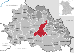
Location of Freyung within Freyung-Grafenau district
Freyung in FRG.svgWaldhäuserwaldSchönbrunner WaldSchlichtenberger WaldSankt Oswald (unincorporated area)Pleckensteiner WaldPhilippsreuter WaldMauther ForstGraineter WaldAnnathaler WaldSchönbergGrafenauFreyungLeopoldsreuter WaldFrauenberger und Duschlberger Wald
Germany adm location map.svg
Red pog.svg
Freyung
Bavaria location map.svg
Red pog.svg
Freyung
Coordinates: 48°48′N13°33′E / 48.800°N 13.550°E / 48.800; 13.550
Country Germany
State Bavaria
Admin. region Niederbayern
District Freyung-Grafenau
Subdivisions3 Stadtteile
Government
   Mayor (202026) Dr. Olaf Heinrich [1] (CSU)
Area
  Total
48.64 km2 (18.78 sq mi)
Elevation
655 m (2,149 ft)
Population
 (2023-12-31) [2]
  Total
7,263
  Density150/km2 (390/sq mi)
Time zone UTC+01:00 (CET)
  Summer (DST) UTC+02:00 (CEST)
Postal codes
94078
Dialling codes 08551, 08558
Vehicle registration FRG
Website www.freyung.de

Freyung is a town in Bavaria and capital of the Freyung-Grafenau district. It is situated in the Bavarian Forest mountain range, near the border with Austria and the Czech Republic.

Contents

Geography

The town is situated on the southeastern rim of the Bavarian Forest National Park near the confluence of the Saußbach and Reschbach creeks. The town centre is located about 33 km (21 mi) north of Passau and just 18 km (11 mi) west of the border to Czechia. Freyung is divided into 27 different settlements. [3]

History

Wolfstein Castle Schloss Wolfstein.JPG
Wolfstein Castle

First start

The first known settlements in the area of ​​today's town of Freyung are from the 13th century. The inhabitants settled in a clearing village near the old Wolfstein Castle, which Bishop Wolfger von Erla had built around 1200. Before that, Emperor Henry VI had ceded the land to some of the bishops of Passau in 1193. At that time, Freyung was not yet a place name, but referred to an area. The later name Freiung denoted the fact that the first settlers were exempt from taxes (cf. Freihaus ). In 1301, this place was first mentioned in documents as Purchstol zu Wolferstein, with a forest attached to it. As early as 1354, the neighboring town of Kreuzberg, which had been founded at the beginning of the 14th century, was granted market rights, which were transferred to Freyung in 1523.

19th century

When the Prince-Bishopric of Passau was dissolved in 1803 with the Imperial Deputation Act, Freyung first fell to the Austrian Duchy of Salzburg and two years the Kingdom of Bavaria with the Peace of Pressburg. 535 people were living in the town in 1811, however, in a devastating town fire in 1872, 39 of the approximately 70 houses were destroyed. A settlement was laid out beneath the castle which in 1301 was mentioned as Purchstol zu Wolferstein.

20th century and after

On December 3, 1953, Freyung was elevated to town status. After the incorporation of Ort, Freyung was part of the Wolfstein district from April 1, 1954, to June 30, 1972. After the district was merged with the Grafenau district, it became the district town of the Freyung-Grafenau district. Freyung had received the oppurtunity to host the yearly Bavarian Regional Garden Show in 2022, however had to move it to 2023 because of Covid. [4] The event was also visited by Markus Söder. [5]

Population

Year1961197019871991199520052010201520172023
Population6862728271247458740972356923719471877263

Politics

City council

PartyPercentage of votes
Christian Social Union (CSU) 48,15 %
Citizens' Community City and Country (BGStuL)20,57 %
Ecological Democratic Party (ödp) 10,81 %
Non-partisan Voters Freyung-Kreuzberg (ÜWFK)9,96 %
Young Voters Union (JWU)10,52 %

Mayors

Infrastructure

The district court "Landratsamt" Freyung, FRG - Grafenauer Str Nr 44 LRA v SW.JPG
The district court "Landratsamt"

Public facilities

Technology Campus Freyung, FRG - Grafenauer Str Nr 22 Technologie Campus v SW.JPG
Technology Campus

Education and science

Twin towns

Freyung is twinned with

Notable people

Related Research Articles

Passau is a Landkreis (district) in the southeast of Bavaria, Germany. It encloses the city of Passau geographically from two sides. Neighboring districts are Rottal-Inn, Deggendorf, Freyung-Grafenau. To the south it borders Austria.

<span class="mw-page-title-main">Bavarian Forest National Park</span> National Park in Bavaria, Germany

The Bavarian Forest National Park is a national park in the Eastern Bavarian Forest immediately on Germany's border with the Czech Republic. It was founded on 7 October 1970 as the first national park in Germany. Since its expansion on 1 August 1997 it has covered an area of 24,250 hectares. Together with the neighbouring Czech Bohemian Forest the Bavarian Forest forms the largest contiguous area of forest in Central Europe.

Deggendorf is a Landkreis (district) in Bavaria, Germany. It is bordered by the districts of Regen, Freyung-Grafenau, Passau, Rottal-Inn, Dingolfing-Landau and Straubing-Bogen.

Freyung-Grafenau is a Landkreis (district) in Bavaria, Germany. It is bounded by the districts of Passau, Deggendorf and Regen, the Czech Republic and by Austria.

Regen is a Landkreis (district) in Bavaria, Germany. It is bounded by the districts of Freyung-Grafenau, Deggendorf, Straubing-Bogen and Cham, and by the Czech Republic.

<span class="mw-page-title-main">Zwiesel</span> Town in Bavaria, Germany

Zwiesel is a town in the lower-Bavarian district of Regen, and since 1972 is a Luftkurort with particularly good air. The name of the town was derived from the Bavarian word stem zwisl which refers to the form of a fork. The fork of the rivers Großer Regen and Kleiner Regen and the land that lies between these two rivers were called Zwiesel.

<span class="mw-page-title-main">Waldkirchen</span> Town in Bavaria, Germany

Waldkirchen is the biggest town in the district of Freyung-Grafenau in Germany.

<span class="mw-page-title-main">Hauzenberg</span> Town in Bavaria, Germany

Hauzenberg is a municipality in the district of Passau, in Bavaria, Germany. It is situated 15 kilometres northeast of Passau.
<span class="mw-page-title-main">Grafenau, Bavaria</span> Town in Bavaria, Germany

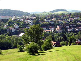
Grafenau is a town in the Freyung-Grafenau district, in Bavaria, Germany. 32 km north of Passau, the town is situated in the Bavarian Forest and is the base of the Bavarian Forest National Park Authority. Grafenau is a holiday destination with a variety of kinds of accommodation from self-catering apartments to a "holiday village".

<span class="mw-page-title-main">Haidmühle</span> Municipality in Bavaria, Germany

Haidmühle is a municipality in the district of Freyung-Grafenau in Bavaria in Germany.
<span class="mw-page-title-main">Innernzell</span> Municipality in Bavaria, Germany

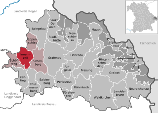
Innernzell is a municipality in the district of Freyung-Grafenau in Bavaria in Germany.

<span class="mw-page-title-main">Philippsreut</span> Municipality in Bavaria, Germany

Philippsreut is a municipality in the district of Freyung-Grafenau in Bavaria, Germany. It lies on the border with the Czech Republic.

<span class="mw-page-title-main">Schönberg, Lower Bavaria</span> Municipality in Bavaria, Germany

Schönberg is a municipality in the district of Freyung-Grafenau in Bavaria in Germany.
<span class="mw-page-title-main">Spiegelau</span> Municipality in Bavaria, Germany

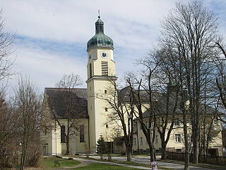
Spiegelau is a municipality in the district of Freyung-Grafenau in Bavaria in Germany. It lies in the heart of the Bavarian Forest.

<span class="mw-page-title-main">Zenting</span> Municipality in Bavaria, Germany

Zenting is a municipality in the district of Freyung-Grafenau in Bavaria in Germany.

<span class="mw-page-title-main">Bad Griesbach</span> Town in Bavaria, Germany

Bad Griesbach im Rottal, or just Bad Griesbach, is a town in the district of Passau in Bavaria in Germany.

<span class="mw-page-title-main">Lindberg</span> Municipality in Bavaria, Germany

Lindberg is a municipality in the district of Regen in Bavaria in Germany in the immediate neighbourhood of the larger town Zwiesel.

<span class="mw-page-title-main">Obernzell</span> Municipality in Bavaria, Germany

Obernzell is a municipality in the district of Passau in Bavaria in Germany.

<span class="mw-page-title-main">Buchberger Leite</span>

The Buchberger Leite is a gorge near Hohenau in the Lower Bavarian county of Freyung-Grafenau in Bavaria.
<span class="mw-page-title-main">Wolfstein Castle</span>

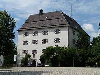
Wolfstein Castle or Schloss Wolfstein is a schloss and former castle in Freyung in Lower Bavaria. It gave its name to the county of Wolfstein which was dissolved in 1972.

References

  1. Liste der ersten Bürgermeister/Oberbürgermeister in kreisangehörigen Gemeinden, Bayerisches Landesamt für Statistik, 15 July 2021.
  2. Genesis Online-Datenbank des Bayerischen Landesamtes für Statistik Tabelle 12411-003r Fortschreibung des Bevölkerungsstandes: Gemeinden, Stichtag (Einwohnerzahlen auf Grundlage des Zensus 2011).
  3. Gemeinde Freyung in the location database of the Bavarian State Library Online . Bavarian State Library
  4. https://www.br.de/nachrichten/bayern/wegen-corona-landesgartenschau-freyung-findet-erst-2023-statt,S23gaWn
  5. "Landesgartenschau Freyung 2023 ☀️ Bayerischer Wald 2024 / 2025". www.bayrischer-wald.de. Retrieved 2024-11-25.