Frome Clay

Last updated

Frome Clay
Stratigraphic range: Bathonian
~168–166  Ma
O
S
D
C
P
T
J
K
Pg
N
Langton Herring Praeexogyra hebridica var elongata Frome Clay Bathonian.jpg
Fossils from the Frome Clay
Type Formation
Unit of Great Oolite Group
Underlies Forest Marble Formation
Overlies Fuller's Earth Formation
Thickness20–50 m (66–164 ft) in Wiltshire and Somerset
45–70 m (148–230 ft) in Dorset
Lithology
Primary Mudstone
Other Limestone
Location
Coordinates 51°12′N2°18′W / 51.2°N 2.3°W / 51.2; -2.3
Approximate paleocoordinates 41°24′N10°06′E / 41.4°N 10.1°E / 41.4; 10.1
Region England
CountryFlag of the United Kingdom.svg  United Kingdom
United Kingdom relief location map.jpg
Blue pog.svg
Frome Clay (the United Kingdom)
England relief location map.jpg
Blue pog.svg
Frome Clay (England)

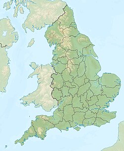
The Frome Clay is a geological formation in England. It preserves fossils dating back to the Bathonian stage of the Middle Jurassic period. [1]

See also

Related Research Articles

<span class="mw-page-title-main">River Frome, Dorset</span> River in Dorset, England

The River Frome is a river in Dorset in the south of England. At 30 miles (48 km) long it is the major chalkstream in southwest England. It is navigable upstream from Poole Harbour as far as the town of Wareham.

<span class="mw-page-title-main">Isle of Purbeck</span> Peninsula in Dorset, England

The Isle of Purbeck is a peninsula in Dorset, England. It is bordered by water on three sides: the English Channel to the south and east, where steep cliffs fall to the sea; and by the marshy lands of the River Frome and Poole Harbour to the north. Its western boundary is less well defined, with some medieval sources placing it at Flower's Barrow above Worbarrow Bay. John Hutchins, author of The History and Antiquities of the County of Dorset, defined Purbeck's western boundary as the Luckford Lake steam, which runs south from the Frome. According to writer and broadcaster Ralph Wightman, Purbeck "is only an island if you accept the barren heaths between Arish Mell and Wareham as cutting off this corner of Dorset as effectively as the sea." The most southerly point is St Alban's Head.

<span class="mw-page-title-main">Weald Clay</span> Geological formation in England

Weald Clay or the Weald Clay Formation is a Lower Cretaceous sedimentary rock unit underlying areas of South East England, between the North and South Downs, in an area called the Weald Basin. It is the uppermost unit of the Wealden Group of rocks within the Weald Basin, and the upper portion of the unit is equivalent in age to the exposed portion of the Wessex Formation on the Isle of Wight. It predominantly consists of thinly bedded mudstone. The un-weathered form is blue/grey, and the yellow/orange is the weathered form, it is used in brickmaking.

<span class="mw-page-title-main">River Frome, Herefordshire</span> River in Herefordshire, England

The River Frome is a river in Herefordshire, England. It flows through Bromyard, and Bishops Frome. Immediately below the depopulated village of Stretton Grandison its tributary, the river or brook named the Lodon, joins it. It then flows west, past Yarkhill and the farmstead or locality of Prior's Frome before its confluence with the Lugg at Hampton Bishop about 2 miles (3.2 km) before the latter joins the Wye.

<span class="mw-page-title-main">Kimmeridge Clay</span> Geological formation

The Kimmeridge Clay is a sedimentary deposit of fossiliferous marine clay which is of Late Jurassic to lowermost Cretaceous age and occurs in southern and eastern England and in the North Sea. This rock formation is the major source rock for North Sea oil. The fossil fauna of the Kimmeridge Clay includes turtles, crocodiles, sauropods, plesiosaurs, pliosaurs and ichthyosaurs, as well as a number of invertebrate species.

<span class="mw-page-title-main">Wealden Group</span>

The Wealden Group, occasionally also referred to as the Wealden Supergroup, is a group in the lithostratigraphy of southern England. The Wealden group consists of paralic to continental (freshwater) facies sedimentary rocks of Berriasian to Aptian age and thus forms part of the English Lower Cretaceous. It is composed of alternating sands and clays. The sandy units were deposited in a flood plain of braided rivers, the clays mostly in a lagoonal coastal plain.

The Kellaways Formation is a geological formation of the Callovian Series from the Jurassic. It is found in the British Isles, immediately above the Great Oolite Series: below the Oxford Clay Formation and above the Cornbrash. It consists of two layers, the Kellaways Sand, a light green-grey clayish silt and sand with layers of sand concretions, overlying the Kellaways Clay, a dark grey plastic fissile clay.

The Reading Formation is a geologic formation in southern England. It dates to the Paleocene period, and is part of the Lambeth Group. It overlies the London Basin and is below the Harwich Formation. The formation is composed of "a series of lenticular mottled clays and sands, here and there with pebbly beds and masses of fine sand converted into quartzite. These beds are generally unfossiliferous."

<span class="mw-page-title-main">Hampshire Basin</span>

The Hampshire Basin is a geological basin of Palaeogene age in southern England, underlying parts of Hampshire, the Isle of Wight, Dorset, and Sussex. Like the London Basin to the northeast, it is filled with sands and clays of Paleocene and younger ages and it is surrounded by a broken rim of chalk hills of Cretaceous age.

<span class="mw-page-title-main">Pottsville Formation</span>

The Pennsylvanian Pottsville Formation is a mapped bedrock unit in Pennsylvania, western Maryland, West Virginia, Ohio, and Alabama. It is a major ridge-former in the Ridge-and-Valley Appalachians of the eastern United States. The Pottsville Formation is conspicuous at many sites along the Allegheny Front, the eastern escarpment of the Allegheny or Appalachian Plateau.

The Lias Group or Lias is a lithostratigraphic unit found in a large area of western Europe, including the British Isles, the North Sea, the Low Countries and the north of Germany. It consists of marine limestones, shales, marls and clays.

<span class="mw-page-title-main">Lower Greensand Group</span> Geological unit

The Lower Greensand Group is a geological unit present across large areas of Southern England. It was deposited during the Aptian and Albian stages of the Early Cretaceous. It predominantly consists of sandstone and unconsolidated sand that were deposited in shallow marine conditions.

The Bishop's Frome Limestone is a rock unit within the Raglan Mudstone Formation of the Old Red Sandstone occurring in the border region between England and South Wales. This limestone is a calcrete, that is to say it originated as a soil during a break in deposition rather than being an original marine deposit. It is perhaps the most significant of all of the calcretes which occur within the uppermost Silurian and lower Devonian sequence of rocks which constitute the Old Red Sandstone of the Anglo-Welsh Basin. It defines the boundary within the basin between the Silurian and the Devonian periods. The rock was formerly known as the Psammosteus Limestone after a characteristic fossil fish recorded from it; Psammosteus anglicus. The fossil remains were subsequently shown to have been wrongly identified and belong in fact to Traquairaspis symondsi. Its modern name derives from the Herefordshire village of Bishop's Frome. Its thickness is variable ranging from 2m up to 8m.

<span class="mw-page-title-main">Tunbridge Wells Sand Formation</span>

The Tunbridge Wells Sand Formation is a geological unit which forms part of the Wealden Group and the uppermost and youngest part of the unofficial Hastings Beds. These geological units make up the core of the geology of the Weald in the English counties of West Sussex, East Sussex and Kent.

<span class="mw-page-title-main">Atherfield Clay Formation</span> Geological formation in southern England

The Atherfield Clay Formation is a Geological formation in Southern England. Part of the Lower Greensand Group it dates to the Aptian age of the Early Cretaceous. The deposit is of marine origin largely consisting of massive yellowish brown to pale grey mudstones. The pterosaur Vectidraco is known from the formation. As is the Sandownid turtle Sandownia.

<span class="mw-page-title-main">Wadhurst Clay Formation</span>

The Wadhurst Clay Formation is a geological unit which forms part of the Wealden Group and the middle part of the now unofficial Hastings Beds. These geological units make up the core of the geology of the High Weald in the English counties of West Sussex, East Sussex and Kent.

<span class="mw-page-title-main">Geography of Dorset</span>

Dorset is a county located in the middle of the south coast of England. It lies between the latitudes 50.512°N and 51.081°N and the longitudes 1.682°W and 2.958°W, and occupies an area of 2,653 km2. It spans 90 kilometres (56 mi) from east to west and 63 kilometres (39 mi) from north to south.

<span class="mw-page-title-main">Lulworth Formation</span>

The Lulworth Formation is a geologic formation in England. It dates from the late Tithonian to the mid Berriasian. It is a subunit of the Purbeck Group. In Dorset, it consists of three members, which are in ascending order, the Mupe Member, the Ridgway Member, and the Warbarrow Tout Member. The Mupe Member is typically 11 to 16 m thick and largely consists of marls and micrites with interbeds of calcareous mudstone. The Ridgeway Member is about 3 to 7 m thick and consists of in its western portion carbonaceous muds, marls and micrites, in the east the muds are replaced by micritic limestone. The Warbarrow Tout Member is 17 to 39 m thick and consists of limestone at the base and micrite and mudstone for the rest of the sequence, this member is the primary source of the vertebrate fossils within the formation. Elsewhere the unit is undifferentiated.

The geology of West Sussex in southeast England comprises a succession of sedimentary rocks of Cretaceous age overlain in the south by sediments of Palaeogene age. The sequence of strata from both periods consists of a variety of sandstones, mudstones, siltstones and limestones. These sediments were deposited within the Hampshire and Weald basins. Erosion subsequent to large scale but gentle folding associated with the Alpine Orogeny has resulted in the present outcrop pattern across the county, dominated by the north facing chalk scarp of the South Downs. The bedrock is overlain by a suite of Quaternary deposits of varied origin. Parts of both the bedrock and these superficial deposits have been worked for a variety of minerals for use in construction, industry and agriculture.

This article describes the geology of the New Forest, a national park in Hampshire, in Southern England.

References

  1. British Geological Survey. "Frome Clay Formation". BGS Lexicon of Named Rock Units. Retrieved 31 December 2022.