Kraków Voivodeship, refers to several historical Voivodeships of Poland in the surrounding regions, with the city of Kraków as its capital.

New Silesia was a small province of the Kingdom of Prussia from 1795 to 1807, created after the Third Partition of Poland. It was located northwest of Kraków and southeast of Częstochowa, in the lands that had been part of the Duchy of Siewierz and the adjacent Polish historical province of Lesser Poland, including the towns of Żarki, Pilica, Będzin, and Sławków.

The Archdiocese of Kraków is an archdiocese located in the city of Kraków in Poland. As of 2013 weekly mass attendance was 51.3% of the population.
Kraków Governorate was an administrative unit of the Congress Poland.

Chwałów is a village in the administrative district of Gmina Mietków, within Wrocław County, Lower Silesian Voivodeship, in south-western Poland.
Stary Śleszów is a village in the administrative district of Gmina Żórawina, within Wrocław County, Lower Silesian Voivodeship, in south-western Poland. Prior to 1945 it was in Germany. It lies approximately 6 kilometres (4 mi) south of Żórawina and 22 km (14 mi) south of the regional capital Wrocław.
Żołoćki is a village in the administrative district of Gmina Boćki, within Bielsk County, Podlaskie Voivodeship, in north-eastern Poland.
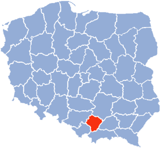
Czechy is a village in the administrative district of Gmina Słomniki, within Kraków County, Lesser Poland Voivodeship, in southern Poland. It lies approximately 6 kilometres (4 mi) south-east of Słomniki and 25 km (16 mi) north-east of the regional capital Kraków.
Słupia Nadbrzeżna-Kolonia is a village in the administrative district of Gmina Tarłów, within Opatów County, Świętokrzyskie Voivodeship, in south-central Poland. It lies approximately 10 kilometres (6 mi) south-east of Tarłów, 31 km (19 mi) north-east of Opatów, and 84 km (52 mi) east of the regional capital Kielce.
Brzezie is a village in the administrative district of Gmina Pawłów, within Starachowice County, Świętokrzyskie Voivodeship, in south-central Poland. It lies approximately 6 kilometres (4 mi) south-west of Pawłów, 13 km (8 mi) south of Starachowice, and 32 km (20 mi) east of the regional capital Kielce.

Borki is a village in the administrative district of Gmina Góra Kalwaria, within Piaseczno County, Masovian Voivodeship, in east-central Poland. It lies approximately 5 kilometres (3 mi) south-east of Góra Kalwaria, 22 km (14 mi) south-east of Piaseczno, and 36 km (22 mi) south-east of Warsaw.
Żbiki-Starki is a village in the administrative district of Gmina Krasne, within Przasnysz County, Masovian Voivodeship, in east-central Poland. It lies approximately 9 kilometres (6 mi) south of Przasnysz and 81 km (50 mi) north of Warsaw.
Kozłowo is a village in the administrative district of Gmina Gzy, within Pułtusk County, Masovian Voivodeship, in east-central Poland.
Szczodrochowo is a village in the administrative district of Gmina Gostyń, within Gostyń County, Greater Poland Voivodeship, in west-central Poland. It lies approximately 7 kilometres (4 mi) north of Gostyń and 52 km (32 mi) south of the regional capital Poznań.
Lipe Trzecie is a village in the administrative district of Gmina Blizanów, within Kalisz County, Greater Poland Voivodeship, in west-central Poland. It lies approximately 5 kilometres (3 mi) north of Blizanów, 21 km (13 mi) north of Kalisz, and 92 km (57 mi) south-east of the regional capital Poznań.
Lisice is a village in the administrative district of Gmina Dąbie, within Koło County, Greater Poland Voivodeship, in west-central Poland.

Wilczyn is a village in Konin County, Greater Poland Voivodeship, in west-central Poland. It is the seat of the gmina called Gmina Wilczyn. It lies approximately 31 kilometres (19 mi) north of Konin and 86 km (53 mi) east of the regional capital Poznań.
Zawada is a village in the administrative district of Gmina Kłomnice, within Częstochowa County, Silesian Voivodeship, in southern Poland. It lies approximately 6 kilometres (4 mi) east of Kłomnice, 27 km (17 mi) north-east of Częstochowa, and 82 km (51 mi) north of the regional capital Katowice.
Karwacja is a settlement in the administrative district of Gmina Sierakowice, within Kartuzy County, Pomeranian Voivodeship, in northern Poland. It lies approximately 3 kilometres (2 mi) east of Sierakowice, 18 km (11 mi) west of Kartuzy, and 46 km (29 mi) west of the regional capital Gdańsk.
Podleśne is a village in the administrative district of Gmina Braniewo, within Braniewo County, Warmian-Masurian Voivodeship, in northern Poland, close to the border with the Kaliningrad Oblast of Russia. It lies approximately 8 kilometres (5 mi) north-east of Braniewo and 79 km (49 mi) north-west of the regional capital Olsztyn.


