Kraków Voivodeship, refers to several historical Voivodeships of Poland in the surrounding regions, with the city of Kraków as its capital.

New Silesia was a small province of the Kingdom of Prussia from 1795 to 1807, created after the Third Partition of Poland. It was located northwest of Kraków and southeast of Częstochowa, in the lands that had been part of the Duchy of Siewierz and the adjacent Polish historical province of Lesser Poland, including the towns of Żarki, Pilica, Będzin, and Sławków.

The Archdiocese of Kraków is an archdiocese located in the city of Kraków in Poland. As of 2013 weekly mass attendance was 51.3% of the population.

Bukowno is a town in Olkusz County, Lesser Poland Voivodeship, Poland, with 10,564 inhabitants (2008). Until 1975 it belonged to the Kraków Voivodeship and in 1975 - 1998 to the Katowice Voivodeship. Bukowno is located in western part of Lesser Poland Voivodeship, between Katowice and Kraków about 40 km (24.85 mi) away from both towns. On December 31, 2008 the town had 10 574 inhabitants.
Kraków Governorate was an administrative unit of the Congress Poland.
Bierzyce is a village in the administrative district of Gmina Długołęka, within Wrocław County, Lower Silesian Voivodeship, in south-western Poland. Prior to 1945 it was in Germany.
Opalanki is a village in the administrative district of Gmina Ozorków, within Zgierz County, Łódź Voivodeship, and in central Poland. It lies approximately 3 kilometres (2 mi) east of Ozorków, 16 km (10 mi) north-west of Zgierz, and 24 km (15 mi) north-west of the regional capital Łódź.

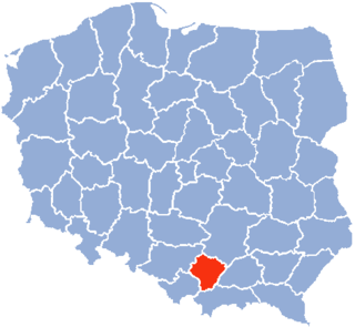
Balice is a village in the administrative district of Gmina Zabierzów, within Kraków County, Lesser Poland Voivodeship, in southern Poland. It lies approximately 4 kilometres (2 mi) south of Zabierzów and 11 km (7 mi) west of the city centre of Kraków.
Sulmierzyce is a village in Pajęczno County, Łódź Voivodeship, in central Poland. It is the seat of the gmina called Gmina Sulmierzyce. It lies approximately 14 kilometres (9 mi) east of Pajęczno and 70 km (43 mi) south of the regional capital Łódź.
Łowisko is a village in the administrative district of Gmina Kamień, within Rzeszów County, Subcarpathian Voivodeship, in south-eastern Poland. It lies approximately 33 km (21 mi) north-east of the regional capital Rzeszów.
Karniszyn is a village in the administrative district of Gmina Bieżuń, within Żuromin County, Masovian Voivodeship, in east-central Poland. It lies approximately 4 kilometres (2 mi) north-east of Bieżuń, 11 km (7 mi) south of Żuromin, and 113 km (70 mi) north-west of Warsaw.
Kuszkowo is a village in the administrative district of Gmina Krzywiń, within Kościan County, Greater Poland Voivodeship, in west-central Poland.
Koziegłówki is a village in the administrative district of Gmina Koziegłowy, within Myszków County, Silesian Voivodeship, in southern Poland. It lies approximately 3 kilometres (2 mi) south-east of Koziegłowy, 10 km (6 mi) west of Myszków, and 40 km (25 mi) north of the regional capital Katowice.
Wołcza Mała is a village in Gmina Miastko, Bytów County, Pomeranian Voivodeship, in northern Poland. It lies approximately 25 kilometres (16 mi) south-west of Bytów and 73 km (45 mi) south-west of Gdańsk.
Ogardzki Młyn is a settlement in the administrative district of Gmina Strzelce Krajeńskie, within Strzelce-Drezdenko County, Lubusz Voivodeship, in western Poland. It lies approximately 13 kilometres (8 mi) north-east of Strzelce Krajeńskie and 37 km (23 mi) north-east of Gorzów Wielkopolski.
Łówcz Górny is a village in the administrative district of Gmina Łęczyce, within Wejherowo County, Pomeranian Voivodeship, in northern Poland. It lies approximately 12 kilometres (7 mi) south-east of Łęczyce, 21 km (13 mi) south-west of Wejherowo, and 46 km (29 mi) west of the regional capital Gdańsk.
Chełmsko is a settlement in the administrative district of Gmina Myślibórz, within Myślibórz County, West Pomeranian Voivodeship, in north-western Poland.
Rzyszczewko is a settlement in the administrative district of Gmina Biały Bór, within Szczecinek County, West Pomeranian Voivodeship, in north-western Poland. It lies approximately 9 kilometres (6 mi) north of Biały Bór, 31 km (19 mi) north of Szczecinek, and 163 km (101 mi) north-east of the regional capital Szczecin.

The Kraków Museum of Insurance is a former museum in Kraków, Poland which was dedicated to insurances. It was established in 1987. It was the only such museum in existence devoted to all aspects of the history of insurance in Poland and in formerly Polish lands. The director of the museum was Marianna Halota. The collections of the museum encompassed two centuries of rare artifacts and memorabilia including over 35,000 historic documents and certificates from 28 countries.

Kraków is a Polish parliamentary constituency that is coterminous with the Lesser Poland Voivodeship. It elects fourteen members of the Sejm.


