Kraków Voivodeship, refers to several historical Voivodeships of Poland in the surrounding regions, with the city of Kraków as its capital.

New Silesia was a small province of the Kingdom of Prussia from 1795 to 1807, created after the Third Partition of Poland. It was located northwest of Kraków and southeast of Częstochowa, in the lands that had been part of the Duchy of Siewierz and the adjacent Polish historical province of Lesser Poland, including the towns of Żarki, Pilica, Będzin, and Sławków.

The Archdiocese of Kraków is an archdiocese located in the city of Kraków in Poland. As of 2013 weekly mass attendance was 51.3% of the population.

Tadeusz Kościuszko University of Technology is a public university located in central Kraków, Poland, established in 1946 and, as an institution of higher learning granted full autonomy in 1954.
Kraków Governorate was an administrative unit of the Congress Poland.

Raduszyn is a village in the administrative district of Gmina Murowana Goślina, within Poznań County, Greater Poland Voivodeship, in west-central Poland. It lies immediately to the west of the town of Murowana Goślina, approximately 3 kilometres (2 mi) west of the town centre, and 21 km (13 mi) north of the regional capital Poznań. In 2006 the village had a population of 280.
Krosno-Bugaj is a settlement in the administrative district of Gmina Gorzkowice, within Piotrków County, Łódź Voivodeship, in central Poland.
Wymysłów is a village in the administrative district of Gmina Kobiele Wielkie, within Radomsko County, Łódź Voivodeship, in central Poland. It lies approximately 6 kilometres (4 mi) south-east of Kobiele Wielkie, 18 km (11 mi) south-east of Radomsko, and 90 km (56 mi) south of the regional capital Łódź.
Dębniak is a village in the administrative district of Gmina Józefów nad Wisłą, within Opole Lubelskie County, Lublin Voivodeship, in eastern Poland. It lies approximately 20 kilometres (12 mi) south of Opole Lubelskie and 57 km (35 mi) south-west of the regional capital Lublin.
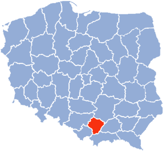
Bobin is a village in the administrative district of Gmina Proszowice, within Proszowice County, Lesser Poland Voivodeship, in southern Poland.

Żołynia is a village in Łańcut County, Subcarpathian Voivodeship, in south-eastern Poland. It is the seat of the gmina called Gmina Żołynia. It lies approximately 15 kilometres (9 mi) north-east of Łańcut and 28 km (17 mi) north-east of the regional capital Rzeszów.
Podole is a village in the administrative district of Gmina Przecław, within Mielec County, Subcarpathian Voivodeship, in south-eastern Poland. It lies approximately 2 kilometres (1 mi) south of Przecław, 12 km (7 mi) south of Mielec, and 42 km (26 mi) north-west of the regional capital Rzeszów.
Maksymilianów is a village in the administrative district of Gmina Bałtów, within Ostrowiec County, Świętokrzyskie Voivodeship, in south-central Poland. It lies approximately 5 kilometres (3 mi) south-west of Bałtów, 10 km (6 mi) north-east of Ostrowiec Świętokrzyski, and 64 km (40 mi) east of the regional capital Kielce.
Jabłonna is a village in the administrative district of Gmina Brody, within Starachowice County, Świętokrzyskie Voivodeship, in south-central Poland. It lies approximately 7 kilometres (4 mi) south-west of Brody, 9 km (6 mi) south-east of Starachowice, and 40 km (25 mi) east of the regional capital Kielce.
Wola-Józefowo is a village in the administrative district of Gmina Krasnosielc, within Maków County, Masovian Voivodeship, in east-central Poland.
Zdunówek is a village in the administrative district of Gmina Raciąż, within Płońsk County, Masovian Voivodeship, in east-central Poland.
Romany-Sędzięta is a village in the administrative district of Gmina Krzynowłoga Mała, within Przasnysz County, Masovian Voivodeship, in east-central Poland.
Janków Trzeci is a village in the administrative district of Gmina Blizanów, within Kalisz County, Greater Poland Voivodeship, in west-central Poland. It lies approximately 2 kilometres (1 mi) west of Blizanów, 18 km (11 mi) north of Kalisz, and 92 km (57 mi) south-east of the regional capital Poznań.
Niezdara is a village in the administrative district of Gmina Ożarowice, within Tarnowskie Góry County, Silesian Voivodeship, in southern Poland. It lies approximately 5 kilometres (3 mi) south-west of Ożarowice, 9 km (6 mi) east of Tarnowskie Góry, and 23 km (14 mi) north of the regional capital Katowice.
Wężownica is a village in the administrative district of Gmina Nowy Dwór Gdański, within Nowy Dwór Gdański County, Pomeranian Voivodeship, in northern Poland. It lies approximately 7 kilometres (4 mi) south-east of Nowy Dwór Gdański and 43 km (27 mi) south-east of the regional capital Gdańsk.


