Puthunagaram is a village and gram panchayat in the Palakkad district, state of Kerala, India.

Bhandardaha is a census town in Domjur CD Block of Howrah Sadar subdivision in Howrah district in the state of West Bengal, India. It is a part of Kolkata Urban Agglomeration.

Chettiarpatti is a panchayat town in Virudhunagar district in the state of Tamil Nadu, India.

Chikkanayakana Halli is a town in Tumkur district, in the state of Karnataka, India. It is 67 km away from Tumkur and 132 km from Bangalore.

Dakshin Jhapardaha is a census town in Domjur CD Block of Howrah Sadar subdivision in Howrah district in the state of West Bengal, India. It is a part of Kolkata Urban Agglomeration.

Dhampur is a city and a municipal board in Bijnor district in the state of Uttar Pradesh, India. It is located at 29.30°N 78.50°E, and lies in Northern India.

Ezhudesam is a town panchayat in Kanniyakumari district in the state of Tamil Nadu, India.

Kappiyarai is a panchayat town in Kanniyakumari district in the Indian state of Tamil Nadu.

Karuppur is a panchayat town in Salem District in the Indian state of Tamil Nadu. It is located on the National Highway 7 between Salem and Bangalore. The Periyar University, with which many Salem colleges are affiliated, is located here. Government College of Engineering, referred as GCE-Salem is also located here. It is a railway station on the Chennai-Shoranur railway line.

Kilpennathur is a Panchayat Town in Tiruvanamalai district in the Indian state of Tamil Nadu. Kilpennathur is one of the taluks of Tiruvannamalai district and an assembly constituency of Tamil Nadu.The MLA of Kilpennathur assembly constituency is DMK party Mr. K. Pichandi.

Nallur (Nalloor) is a panchayat town in Kanniyakumari district in the Indian state of Tamil Nadu.

Naravarikuppam is a town in Thiruvallur district in the Indian state of Tamil Nadu.also called redhills

Pappakurichi is a census town in Tiruchirappalli district in the Indian state of Tamil Nadu.

Peerkankaranai is a town in Southern part of the metropolitan city of Chennai in the Indian state of Tamil Nadu.

Pratitnagar is a census town in Dehradun district in the Indian state of Uttarakhand.

Thevaram is a Town Panchayat in Theni district in the Indian state of Tamil Nadu. Thevaram is located in Tamil Nadu near on border of Kerala at the Eastern side foot-hill of Western Ghats. The State Highway SH-100 passes through this town.

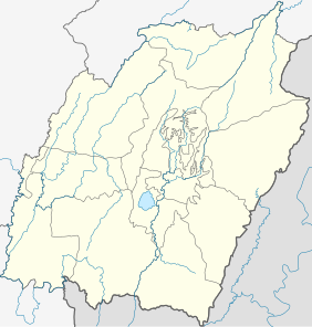
Wangoi is a town and a Municipal Council in Imphal West district in the Indian state of Manipur.

Yadadri Bhuvanagiri district
Ponmanai is a panchayat town in Kanniyakumari district in the Indian state of Tamil Nadu.

Kerur is a City in Bagalkot district in Karnataka, which located on NH 218. It has an average elevation of 617 meters (2024 feet). It's a birthplace of Jagadish Shettar, a former Chief Minister of Karnataka. Kerur is a Town Panchayat city in district of Bagalkot, Karnataka. The Kerur city is divided into 16 wards for which elections are held every five years. The Kerur Town Panchayat has population of 19,731 of which 9,929 are males while 9,802 are females as per report released by Census India 2011.


