Galbally, County Limerick

Last updated

Galbally
An Gallbhaile (Irish)
Village
Galballysquare.jpg
View looking south from the village square
Ireland adm location map.svg
Red pog.svg
Galbally
Location in Ireland
Coordinates: 52°24′04″N8°17′46″W / 52.401°N 8.296°W / 52.401; -8.296
Country Ireland
Province Munster
County County Limerick
Elevation
112 m (367 ft)
Population
 (2016) [1]
251
Irish Grid Reference R798278

Galbally (Irish : An Gallbhaile, meaning 'town of the stranger or the foreigner') [2] is a village in southeast County Limerick, Ireland, on the border with County Tipperary. It is located at the foot of the Galtee Mountains and at the western approach to the Glen of Aherlow. The Aherlow River, flowing down from the Galtee mountains, runs by the village, to meet the Suir at Kilmoyler a short distance north of Cahir. Galbally is in a valley overlooked by the Galtee Mountains. The village is in a townland and civil parish of the same name. [2]

Contents

History

Megalithic passage tomb at Duntryleague near Galbally Megalithic Tomb, Duntryleague (geograph 2544297).jpg
Megalithic passage tomb at Duntryleague near Galbally
Moor Abbey ruins, Galbally Moor Abbey, Galbally, County Limerick.jpg
Moor Abbey ruins, Galbally

A number of archaeological sites and buildings in the Galbally area are included in the Record of Protected Structures. [3] Among these is "Darby's Bed", a passage tomb which sits on a nearby hill in the townland of Duntryleague. [4] It is cited in Irish legend as one of the places where Diarmuid and Grainne spent a night during their flight from the angry Fionn MacCumhaill. [5]

Also located just outside the village is Moor Abbey. This Franciscan friary was founded in the thirteenth century by Donach Cairbreach Ua'Briain. [6] The only standing building from site is the friary's church, which was built in 1471. [7] The site had a tumultuous history, matching the ebbs and flows of Irish politics and religious freedoms, and was inhabited until 1748, though with periods of desertion. Present in the church is the remains of a tomb, which is perhaps that of the founder.[ citation needed ]

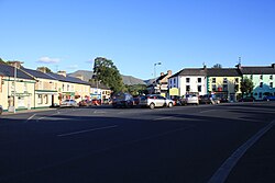
In the centre of Galbally's village square is a statue of a soldier, erected in memory of named local volunteers who lost their lives during the War of Independence in 1921. [8] The south side of the square was the site of a poor house during famine times. Charles Bianconi's carriages used to drive through the village, and the stables they used still stand on the north side of the village square. [9]

The Barons Massy of Duntryleague had their original seat in the area and their Charnel house (burial place) is still extant. The Massy's, an English family of Norman descent, received land in county Limerick in the Cromwellian plantation, and settled in Duntryleague, in the parish of Galbally. The family played a prominent role in the Anglo-Irish ascendancy class up to the 20th century. Their Summer house, Massy Lodge, stands near the neighbouring village of Anglesborough.

Also located at Duntryleague are the remains of a Protestant church tower and a graveyard. A number of the graves are occupied by the Bennett family, who had owned nearby Gleneffy House Estate (also known as Castle Creagh) [10] from the 1680s until the 1920s. William H Massy Bennett, a Justice of the Peace, was the last Bennett to live there. He died in 1920 and it was sold by his son George Latham Massy Bennett in an auction in July 1920.[ citation needed ] In 1826 the Rev P Fitzgerald referred to Castle Creagh as "a very handsome seat of the Bennet family, now in ruins" in his History of Limerick. [10] The current Gleneffy House was built for William's father, George Latham Bennett by the architect Charles Frederick Anderson in the 1850s, it stands on the site of the older castle, mentioned by the Rev Fitzgerald, and is located on the hillside of the Glen of Aherlow to the north of Galbally. It is now a private residence.[ citation needed ]

Amenities

Galbally hosts amenities and services include a number of pubs, a carpenters, undertakers, shops, a chipper, a number of B&Bs, a village museum/gallery, and an equestrian centre. The village's sporting facilities include: pitches for field sports, a community field, and "all weather" astro-turf facilities.[ citation needed ]

The village's Catholic church, the Church of Christ the King, is within the ecclesiastical parish of Galbally & Lisvernane which straddles the Limerick-Tipperary border. [11] Its 'sister' village within this parish is the village of Lisvernane, which lies in the Glen of Aherlow in County Tipperary. [11]

Community and clubs

Although the Gaelic Athletic Association usually has one club in each parish, there are two in this parish: Galbally, on the Limerick side, and Aherlow, across the border in Tipperary. While each club plays hurling to some extent, gaelic football is the primary sport, and both clubs have won their respective county senior football championships, Aherlow winning the Tipperary title for the first time in 2006. Galbally were first-time winners of the Limerick Senior Football Championship in 1994 and repeated the feat in 1997. Galbally also won the 1995 County Junior B Hurling title, captained by John Kiely, [12] who went on to manage the Limerick county hurling team to victory in the 2018 All-Ireland Senior Hurling Championship Final.[ citation needed ]

Galbally Camogie Club fields teams from under 12 to Senior. Galbally is also home to the Mooreabbey Milers AC running club.[ citation needed ]

In 1994, Galbally was selected as the 'prettiest town in Ireland' in the annual Irish Tidy Towns Competition, [13] and has won the Limerick competition nine times.

A folk ballad, The Galbally Farmer, tells of the trials suffered by a hired labourer working for the miserly farmer of the title, Darby O'Leary. [14]

In 2024, it was reported that some ancestors of the US TV host Conan O'Brien came from Galbally. [15]

See also

Related Research Articles

<span class="mw-page-title-main">County Tipperary</span> County in Ireland

County Tipperary is a county in Ireland. It is in the province of Munster and the Southern Region. The county is named after the town of Tipperary, and was established in the early 13th century, shortly after the Norman invasion of Ireland. It is Ireland's largest inland county and shares a border with eight counties, more than any other. The population of the county was 167,895 at the 2022 census. The largest towns are Clonmel, Nenagh and Thurles.

<span class="mw-page-title-main">Cahir</span> Town in County Tipperary, Ireland

Cahir is a town in County Tipperary in Ireland. It is also a civil parish in the barony of Iffa and Offa West.

<span class="mw-page-title-main">Galtymore</span> Mountain in Tipperary/Limerick, Ireland

Galtymore or Galteemore is a mountain in the province of Munster, Ireland. At 917.9 metres, it is one of Ireland's highest mountains, being the 12th-highest on the Arderin list, and 14th-highest on the Vandeleur-Lynam list. Galtymore has the 4th-highest topographic prominence of any peak in Ireland, which classifies Galtymore as a P600, or "major mountain". It is one of the 13 Irish Munros.

<span class="mw-page-title-main">Golden Vale</span>

The Golden Vale is the historic name given to an area of rolling pastureland in the province of Munster in southwestern Ireland. The area covers parts of three counties: Cork, Limerick and Tipperary. Considered the best land in Ireland for dairy farming, the region has been described as the "heart of the Munster dairying country".

Kilmoyler is a townland in the civil parish of Killardry in the barony of Clanwilliam, County Tipperary in Ireland. The townland is in the parish of 'Bansha and Kilmoyler' in the Roman Catholic Archdiocese of Cashel and Emly.

<span class="mw-page-title-main">Bansha</span> Village in Munster, Ireland

Bansha is a village in County Tipperary in Ireland. The village is part of the parish of "Bansha and Kilmoyler" in the Roman Catholic Archdiocese of Cashel and Emly. It is in the historical barony of Clanwilliam. Bansha is co-extensive with the pre-Reformation parish of Templeneiry of which the townland name of Templenahurney is thought to be a corruption. While the village is the focal point of the area, there is also an outlying hamlet in the parish, located at Rossadrehid where a rural creamery once serviced the dairy industry.

<span class="mw-page-title-main">Galtee Rovers GAA</span>

Galtee Rovers GAA, also called Galtee Rovers—St. Pecaun's is a Gaelic Athletic Association club located in the village of Bansha on the National Primary Route N24 in the shadow of the Galtee Mountains in west County Tipperary, Ireland. The club, founded in 1885, represents the parish of Bansha & Kilmoyler and enters gaelic football and hurling teams in the West Tipperary and Tipperary championships. The club grounds – Canon Hayes Park – are named in honour of the founder of Muntir na Tíre, Very Rev. John Canon Hayes, Parish Priest of Bansha & Kilmoyler (1946–57), who was patron of the club during his pastorship. The club pavilion is named 'The McGrath Centre' in honour of two club members, the late John & Geraldine McGrath who died on New Year's Day, 1 January 2000. John Moloney, referee of six All-Ireland Senior Finals, was President of the Galtee Rovers Club at the time of his death on 6 October 2006. In addition to his work at national level in the Gaelic Athletic Association, at club level he coached and organised the juvenile and under-age players for nearly 50 years.

<span class="mw-page-title-main">Mooncoin</span> Town in County Kilkenny, Ireland

Mooncoin is an urban area in County Kilkenny, in Ireland. The population was 1,175 in 2016. Historically part of the Gaelic kingdom of Osraige, today it is in the far south of the county of Kilkenny, located in the valley of the River Suir. It is surrounded by the uplands of the Slievenamon and Comeragh Mountains, just 10 kilometres (6.2 mi) north of Waterford City along the N24 national primary road, and it is 48 kilometres (30 mi) south of Kilkenny.

The Tipperary Senior Football Championship is an annual Gaelic Athletic Association club competition between the top Gaelic football clubs in Tipperary. The winners of the Tipperary Championship qualify to represent their county in the Munster Senior Club Football Championship, the winners of which advance to the All-Ireland Senior Club Football Championship.

The Glen of Aherlow is a valley located between Slievenamuck and the Galtee Mountains in the western part of County Tipperary in Ireland. The principal village is Lisvarrinane. There is also a hamlet at Rossadrehid, where Aherlow creamery was located before its closure in the late 20th century. Other adjacent centres of population are the villages of Galbally, Kilross and Bansha. Across the northern flank of Slievenamuck lies Tipperary Town.

Rossmore is a small village and townland in County Tipperary in Ireland. It is in the civil parish of Clonoulty, barony of Kilnamanagh Lower. It is located in the electoral division (ED) of Clonoulty West. It is also half of the Clonoulty and Rossmore parish in the Roman Catholic Archdiocese of Cashel and Emly.

<span class="mw-page-title-main">Aherlow GAA</span> Gaelic games club in County Tipperary, Ireland

Aherlow GAA is a Gaelic Athletic Association club located in County Tipperary in Ireland, established in 1885, within a year of the GAA's foundation. The club plays Gaelic football at senior, under-21, junior, minor and underage levels in the West Tipperary Division and all-county competitions of Tipperary GAA. The club also fields hurling teams, and plays Ladies' Gaelic football. The club is centred on the village of Lisvernane and surrounding Glen of Aherlow, approximately eight miles east of Tipperary town. Club players, who have played for the Tipperary senior football team, have included Ciarán McDonald and Barry Grogan. The club has joined forces with the intermediate football team Lattin-Cullen GAA for the senior football championship. This combination team, known as Aherlow Gaels, won the 2016 West Tipperary divisional title by defeating Galtee Rovers.

The Ballyhoura Way is a long-distance trail in Ireland. The trail is 89 kilometres long; it begins at St John's Bridge, near Kanturk, County Cork and ends at Limerick Junction, County Tipperary, and is typically completed in four days. It is designated as a National Waymarked Trail by the National Trails Office of the Irish Sports Council and is managed by Ballyhoura Fáilte. The trail was opened in April 1994 by President Mary Robinson.

Garryspillane GAA club is a Gaelic Athletic Association club located in the parish of Knocklong/Glenbrohane, County Limerick, Ireland. The club was founded in 1952 and is almost exclusively concerned with hurling with footballers catered for by neighbouring Galbally.

Emly GAA is a Gaelic Athletic Association club in Emly, County Tipperary, Republic of Ireland. Both hurling and Gaelic football are played at the club.

Ballylanders GAA is a Gaelic Athletic Association (GAA) located in the parish of Ballylanders/Knockadea in County Limerick. The club was founded in 1888 and is solely a Gaelic football club as hurlers from the parish play with neighbouring Glenroe. They won the County Senior Football Championship on four occasions in 1917, 1999, 2007 and 2014.

The Aherlow River is a river in County Limerick and County Tipperary, Ireland.

<span class="mw-page-title-main">Moor Abbey</span> Franciscan friary in County Tipperary

Moor Abbey is a ruined medieval Franciscan friary in Galbally, County Tipperary, Ireland, on the banks of the River Aherlow. Originally founded in the 13th century, the surviving ruins date from the late 15th century. The abbey was burnt down by British forces in 1569.

Barry O'Connell is an Irish hurler who plays for Limerick Premier Championship club Kildimo-Pallaskenry. He usually lines out as a right wing-forward. O'Connell is a former member of the Limerick senior hurling team.

Stagdale Lodge was an ancestral home, on the border of the counties of Limerick and Tipperary, Ireland in the Glen of Aherlow. It was located in the Townland of Lissanarroor, Civil Parish of Galbally, County Limerick.

References

  1. "Census 2016 Sapmap Area - Settlements - Galbally". Census 2016. Central Statistics Office Ireland. 2016. Retrieved 31 October 2018.
  2. 1 2 "An Gallbhaile / Galbally". logainm.ie. Irish Placenames Commission. Retrieved 31 October 2018.
  3. "Limerick County Development Plan - Volume 3 - Record of Protected Structures" (PDF). limerick.ie. Limerick City & County Council. 2010. Retrieved 31 October 2018.
  4. "Duntryleague, Passage Tomb, Co. Limerick". thestandingstone.ie. The Standing Stone. 2010. Retrieved 31 October 2018.
  5. "Ever heard of Darby's Bed? Diarmuid and Gráinne slept here..." thejournal.ie. The Journal. 7 February 2015. Retrieved 31 October 2018.
  6. Fitzgerald Rev P. & McGregor J.J. (1826). The History, Topography and Antiquities of the County and City of Limerick. Dublin. p. 573. Another monastery of the Dominican Order was founded at Galbally in county Limerick by Donogh Carbrac O'Brien in 1240
  7. "Monument of the Month - Moor Abbey, Co. Tipperary". archaeology.ie. National Monuments Service. Retrieved 31 October 2018.
  8. "The Square, Galbally, County Limerick". buildingsofireland.ie. National Inventory of Architectural Heritage. Retrieved 31 October 2018.
  9. "Go Walk: Galbally, Co Limerick". irishtimes.com. Irish Times. 19 September 2014. Retrieved 31 October 2018.
  10. 1 2 "Gleneffy estate entry in Landed Estates Database". landedestates.nuigalway.ie. Landed Estates Database. Retrieved 31 October 2018.
  11. 1 2 "Parish of Galbally & Lisvernane". cashel-emly.ie. Archdiocese of Cashel & Emly.
  12. "1995 County Junior B Hurling Final - John Kiely Victory Speech". YouTube. 1995.
  13. "The Tidy Towns of Ireland "Celebrating 50 years"" (PDF). tidytowns.ie. Tidy Towns. Archived from the original (PDF) on 19 April 2016.
  14. "Ballads - The Garbally Farmer - Darby Ryan" (PDF). limerickcity.ie. Limerick City and County Council. Retrieved 31 October 2018.
  15. "Famous TV host traces roots in County Limerick". www.live95fm.ie. Live 95 FM. Retrieved 11 January 2024.