Geiselwind

Last updated
Geiselwind
Geiselwind - Ort von Norden.JPG
Geiselwind seen from the north
DEU Geiselwind COA.svg
Location of Geiselwind within Kitzingen district
Geiselwind in KT.svgCastell
Germany adm location map.svg
Red pog.svg
Geiselwind
Bavaria location map.svg
Red pog.svg
Geiselwind
Coordinates: 49°46′N10°28′E / 49.767°N 10.467°E / 49.767; 10.467
Country Germany
State Bavaria
Admin. region Unterfranken
District Kitzingen
Government
   Mayor (202026) Ernst Nickel [1] (FW)
Area
  Total48.77 km2 (18.83 sq mi)
Highest elevation
442 m (1,450 ft)
Lowest elevation
345 m (1,132 ft)
Population
 (2022-12-31) [2]
  Total2,647
  Density54/km2 (140/sq mi)
Time zone UTC+01:00 (CET)
  Summer (DST) UTC+02:00 (CEST)
Postal codes
96160
Dialling codes 09556 /09555
Vehicle registration KT
Website www.geiselwind.de

Geiselwind is a market town in Lower Franconia (Bavaria) in the district of Kitzingen in Germany. It has a population of around 2,300.

Contents

Geography

Location

Geiselwind is today in the region of Lower Franconia (Würzburg). Until administrative reform Geiselwind belonged to the region of Middle Franconia. On the edge of the municipal area is the Dreifrankenstein ("Three Franconia Stone"), where the regions of Lower Franconia and Middle Franconia and Upper Franconia meet.

Subdivision

Geiselwind has the following Ortsteile : Burggrub, Dürrnbuch, Ebersbrunn, Füttersee, Geiselwind, Gräfenneuses, Holzberndorf, Ilmenau, Langenberg, Rehweiler, Wasserberndorf and Freihaslach.

History

The name Geiselwind can be dated to the 8th century AD. At this time by decree of the German emperor, Wends were settled in the Frankish area.

Geiselwind market in today's Lower Franconia belonged to the sovereign Grafschaft von Schwarzenberg. With the Rheinbundakte in 1806 the place came to Bavaria. In the course of the administrative reforms of Bavaria, today's municipality was created with the municipality edict of 1818.

Demographics

In the area of the municipality, in 1970 2,125, in 1987 2,016 and in 2000 2,323, inhabitants were counted.

Governance

The mayor is Ernst Nickel (free voter/land community). In 2002 he succeeded Gottfried Schaller (free voter/land community).

Economy

The local rate incomes amounted in the year 1999 to 997000 euro, of which the trade tax incomes (net) amounted to 303000 euros.

In 1998 the number of employees on the social welfare contribution rolls was:

In the processing trade there were 6 enterprises, in the building main trade 8 enterprises.

In 1999 there were 109 agricultural enterprises with a farmed area of 21.07 square kilometres, of which 12.92 km² were arable and 8.09 km² of continuously grass. The largest employers are:

Education

In the year 1999 the following schools existed:

Related Research Articles

<span class="mw-page-title-main">Heinrichsthal</span> German community

Heinrichsthal is a community in the Aschaffenburg district in the Regierungsbezirk of Lower Franconia (Unterfranken) in Bavaria, Germany. It is part of the Verwaltungsgemeinschaft of Heigenbrücken.

<span class="mw-page-title-main">Gundelsheim, Bavaria</span> Municipality in Bavaria, Germany

Gundelsheim is a community in the Upper Franconian district of Bamberg.

<span class="mw-page-title-main">Kemmern</span> Municipality in Bavaria, Germany

Kemmern is a community in the Upper Franconian district of Bamberg in Bavaria, southern Germany.

<span class="mw-page-title-main">Lauter, Bavaria</span> Municipality in Bavaria, Germany

Lauter is a community in the Upper Franconian district of Bamberg and a member of the administrative community (Verwaltungsgemeinschaft) of Baunach.

<span class="mw-page-title-main">Priesendorf</span> Municipality in Bavaria, Germany

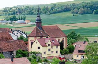
Priesendorf is a community in the Upper Franconian district of Bamberg and a member of the administrative community (Verwaltungsgemeinschaft) of Lisberg.

<span class="mw-page-title-main">Rattelsdorf</span> Municipality in Bavaria, Germany

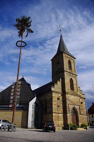
Rattelsdorf is a municipality with market rights in the Upper Franconian district of Bamberg.

<span class="mw-page-title-main">Schönbrunn im Steigerwald</span> Municipality in Bavaria, Germany

Schönbrunn im Steigerwald is a community in the Upper Franconian district of Bamberg and a member of the administrative community (Verwaltungsgemeinschaft) of Burgebrach.

<span class="mw-page-title-main">Röthenbach (Allgäu)</span> Municipality in Bavaria, Germany

Röthenbach (Allgäu) is a municipality in the administrative region of Swabia Lindau district and seat of the municipal association Röthenbach.

<span class="mw-page-title-main">Grünenbach</span> Municipality in Bavaria, Germany

Grünenbach is a municipality in the district of Lindau in Bavaria in Germany.

<span class="mw-page-title-main">Birkenfeld, Bavaria</span> Municipality in Bavaria, Germany

Birkenfeld is a community in the Main-Spessart district in the Regierungsbezirk of Lower Franconia (Unterfranken) in Bavaria, Germany and a member of the Verwaltungsgemeinschaft of Marktheidenfeld.

<span class="mw-page-title-main">Bischbrunn</span> Municipality in Bavaria, Germany

Bischbrunn is a community with around 1,800 (2013) inhabitants in the Main-Spessart district in the Regierungsbezirk of Lower Franconia (Unterfranken) in Bavaria, Germany and a member of the Verwaltungsgemeinschaft of Marktheidenfeld.

<span class="mw-page-title-main">Gräfendorf</span> Municipality in Bavaria, Germany

Gräfendorf is a community in the Main-Spessart district in the Regierungsbezirk of Lower Franconia (Unterfranken) in Bavaria, Germany and a member of the Verwaltungsgemeinschaft of Gemünden am Main.

<span class="mw-page-title-main">Hasloch</span> Municipality in Bavaria, Germany

Hasloch is a community in the Main-Spessart district in the Regierungsbezirk of Lower Franconia (Unterfranken) in Bavaria, Germany and a member of the Verwaltungsgemeinschaft of Kreuzwertheim. Hasloch has a population close to 1,400.

<span class="mw-page-title-main">Karbach, Bavaria</span> Municipality in Bavaria, Germany

Karbach is a market community in the Main-Spessart district in the Regierungsbezirk of Lower Franconia (Unterfranken) in Bavaria, Germany and a member of the Verwaltungsgemeinschaft of Marktheidenfeld.

<span class="mw-page-title-main">Karsbach</span> Municipality in Bavaria, Germany

Karsbach is a municipality in the Main-Spessart district in the Regierungsbezirk of Lower Franconia (Unterfranken) in Bavaria, Germany and a member of the Verwaltungsgemeinschaft of Gemünden am Main.

<span class="mw-page-title-main">Mittelsinn</span> Municipality in Bavaria, Germany

Mittelsinn is a municipality in the Main-Spessart district in the Regierungsbezirk of Lower Franconia (Unterfranken) in Bavaria, Germany and a member of the Verwaltungsgemeinschaft of Burgsinn.

<span class="mw-page-title-main">Neuhütten</span> Municipality in Bavaria, Germany

Neuhütten is a community in the Main-Spessart district in the Regierungsbezirk of Lower Franconia (Unterfranken) in Bavaria, Germany and a member of the Verwaltungsgemeinschaft of Partenstein. It has a population of around 1,100.

<span class="mw-page-title-main">Urspringen</span> Municipality in Bavaria, Germany

Urspringen is a community in the Main-Spessart district in the Regierungsbezirk of Lower Franconia (Unterfranken) in Bavaria, Germany and a member of the Verwaltungsgemeinschaft of Marktheidenfeld.

<span class="mw-page-title-main">Schneeberg, Bavaria</span> Municipality in Bavaria, Germany

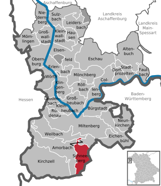
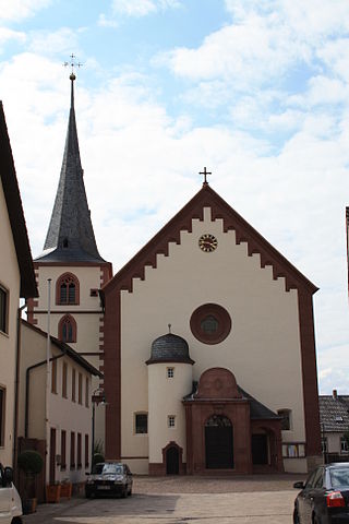
Schneeberg is a market municipality in the Miltenberg district in the Regierungsbezirk of Lower Franconia (Unterfranken) in Bavaria, Germany.

<span class="mw-page-title-main">Frankenwinheim</span> Municipality in Bavaria, Germany

Frankenwinheim is a village in the district of Schweinfurt in Bavaria, Germany and part of Verwaltungsgemeinschaft Gerolzhofen.

References