Wiesentheid

Last updated
Wiesentheid
Wiesentheid BW 2013-03-27 09-28-20.jpg
Church of Saint Maurice and the rectory
DEU Wiesentheid COA.svg
Coat of arms
Location of Wiesentheid within Kitzingen district
Wiesentheid in KT.svg
Germany adm location map.svg
Red pog.svg
Wiesentheid
Bavaria location map.svg
Red pog.svg
Wiesentheid
Coordinates: 49°48′N10°21′E / 49.800°N 10.350°E / 49.800; 10.350 Coordinates: 49°48′N10°21′E / 49.800°N 10.350°E / 49.800; 10.350
Country Germany
State Bavaria
Admin. region Unterfranken
District Kitzingen
Government
   Mayor Werner Knaier (CSU)
Area
  Total33.33 km2 (12.87 sq mi)
Elevation
249 m (817 ft)
Population
 (2020-12-31) [1]
  Total4,918
  Density150/km2 (380/sq mi)
Time zone UTC+01:00 (CET)
  Summer (DST) UTC+02:00 (CEST)
Postal codes
97353
Dialling codes 09383
Vehicle registration KT
Website www.wiesentheid.de

Wiesentheid is a municipality in the district of Kitzingen in Bavaria in Germany.

Contents

History

It was first mentioned in 918 as "Wisenheida". Mediatization in 1806 brought the former county of Schönborn into the Grand Duchy of Würzburg, along with which it became part of the Kingdom of Bavaria in 1814. The Bavarian Municipal Edict of 17 May 1818 ( Gemeindeedikt (de)) formed today's Wiesentheid. [2]

Main sights

Sister city

Personalities

Related Research Articles

Vilsbiburg Place in Bavaria, Germany

Vilsbiburg is a town on the river Große Vils, 18 km southeast of Landshut, in the district of Landshut, in Bavaria, Germany. The city owes its name to the river Große Vils which runs through Vilsbiburg. As of 2019 Vilsbiburg has 12,203 inhabitants.

Schmidmühlen Place in Bavaria, Germany

Schmidmühlen is a municipality in the district of Amberg-Sulzbach in Bavaria in Germany. It is situated at the junction of the Vils and Lauterach rivers.

Wiesen, Bavaria Place in Bavaria, Germany

Wiesen is a community in the Aschaffenburg district in the Regierungsbezirk of Lower Franconia (Unterfranken) in Bavaria, Germany and a member of the Verwaltungsgemeinschaft of Schöllkrippen. It has around 1,000 inhabitants.

Lauter, Bavaria Place in Bavaria, Germany

Lauter is a community in the Upper Franconian district of Bamberg and a member of the administrative community (Verwaltungsgemeinschaft) of Baunach.

Pommersfelden Place in Bavaria, Germany

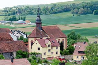
Pommersfelden is a community in the Upper Franconian district of Bamberg in Germany.
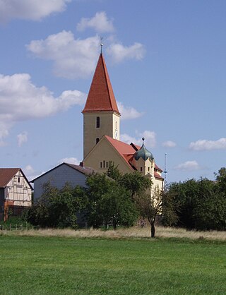
Pollenfeld Place in Bavaria, Germany

Pollenfeld is a municipality in the district of Eichstätt in Bavaria in Germany.

Weiler-Simmerberg Place in Bavaria, Germany

Weiler-Simmerberg is a market town in the Swabian Lindau district.

Castell, Bavaria Place in Bavaria, Germany

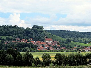
Castell is a municipality in the district of Kitzingen in Bavaria in Germany. It was the seat of the Counts of Castell. Today it is part of the municipal association Wiesentheid. It has around 800 inhabitants.

Eching am Ammersee Place in Bavaria, Germany

Eching am Ammersee is a municipality in the district of Landsberg in Bavaria in Germany. It has a size of 6.15km2.

Igling Place in Bavaria, Germany

Igling is a municipality in the district of Landsberg in Bavaria in Germany.

Bodolz Place in Bavaria, Germany

Bodolz is a municipality in the district of Lindau in Bavaria in Germany.

Grünenbach Place in Bavaria, Germany

Grünenbach is a municipality in the district of Lindau in Bavaria in Germany.

Maierhöfen Place in Bavaria, Germany

Maierhöfen is a municipality in the district of Lindau in Bavaria in Germany.

Opfenbach Place in Bavaria, Germany

Opfenbach is a municipality in the district of Lindau in Bavaria in Germany.

Aura im Sinngrund Place in Bavaria, Germany

Aura im Sinngrund is a community in the Main-Spessart district in the Regierungsbezirk of Lower Franconia (Unterfranken) in Bavaria, Germany and a member of the Verwaltungsgemeinschaft of Burgsinn.

Eußenheim Place in Bavaria, Germany

Eußenheim is a community in the Main-Spessart district in the Regierungsbezirk of Lower Franconia (Unterfranken) in Bavaria, Germany.

Fellen Place in Bavaria, Germany

Fellen is a community in the Main-Spessart district in the Regierungsbezirk of Lower Franconia (Unterfranken) in Bavaria, Germany and a member of the Verwaltungsgemeinschaft of Burgsinn.

Karsbach Place in Bavaria, Germany

Karsbach is a municipality in the Main-Spessart district in the Regierungsbezirk of Lower Franconia (Unterfranken) in Bavaria, Germany and a member of the Verwaltungsgemeinschaft of Gemünden am Main.

Mittelsinn Place in Bavaria, Germany

Mittelsinn is a community in the Main-Spessart district in the Regierungsbezirk of Lower Franconia (Unterfranken) in Bavaria, Germany and a member of the Verwaltungsgemeinschaft of Burgsinn.

Urspringen Place in Bavaria, Germany

Urspringen is a community in the Main-Spessart district in the Regierungsbezirk of Lower Franconia (Unterfranken) in Bavaria, Germany and a member of the Verwaltungsgemeinschaft of Marktheidenfeld.

References

  1. "Tabellenblatt "Daten 2", Statistischer Bericht A1200C 202041 Einwohnerzahlen der Gemeinden, Kreise und Regierungsbezirke". Bayerisches Landesamt für Statistik und Datenverarbeitung (in German). June 2021.
  2. H. Clément: Das bayerische Gemeindeedikt vom 17. Mai 1818. Ein Beitrag zur Entstehungsgeschichte der kommunalen Selbstverwaltung in Deutschland. Diss. Freiburg i. B., 1934.
Wiesentheid Castle of the Counts of Schonborn, built from 1701 for Rudolf Franz Erwein von Schonborn Wiesentheid BW 2013-03-27 09-20-55 stitch.jpg
Wiesentheid Castle of the Counts of Schönborn, built from 1701 for Rudolf Franz Erwein von Schönborn
Portal of castle Wiesentheid BW 2013-03-27 09-22-17.JPG
Portal of castle