Geology of the Waikato-King Country Region

Last updated

The Waikato and King Country regions of New Zealand are built upon a basement of greywacke rocks, which form many of the hills. Much of the land to the west of the Waikato River and in the King Country to the south has been covered by limestone and sandstone, forming bluffs and a karst landscape. The volcanic cones of Karioi and Pirongia dominate the landscape near Raglan and Kawhia Harbours. To the east, the land has been covered with ignimbrite deposits from the Taupō Volcanic Zone. Large amounts of pumice from the Taupō Volcanic Zone have been deposited in the Waikato Basin and Hauraki Plains.

Contents

Basement rocks

As with most of New Zealand, the basement rocks of the Waikato Region and King Country are composed of greywacke (indurated sandstone, siltstone and mudstone).

Geology of the Waikato-King Country Region
Inactive Tihiroa, Waipa and Aria fault lines in the Waikato/King Country (black proven, grey is inferred) that are also the line of a junction magnetic anomaly (click on map to enable mouse over)


The Waipa Fault passes north–south through the Waikato-King Country region, from Taupiri, along the Waipā River, and south to near Ōhura. It represents a major dividing line between different terranes.

Murihiku Terrane greywacke lies beneath the Waikato-King Country region on the western side, and outcrops to the west of the Waipa Fault, from south of Waikato Heads to Awakino. The Murihiku Terrane is considered to be an accretionary wedge of mainly volcanogenic forearc sediments. It was formed in Late Triassic to Late Jurassic times (220-145 Ma).

A line of Dun Mountain-Maitai Terrane rocks are assumed to pass north–south along the Waipa Fault, [1] through the centre of the Waikato-King Country region, separating the Murihiku Terrane and Waipapa Composite Terrane, and produce a detectable Junction Magnetic Anomaly, but only outcrops at one place, at Wairere. Some Murihiku rocks occur to the east of the Junction Magnetic Anomaly, forming the Taupiri and Hakarimata Ranges, but it is assumed that these rocks have been shifted to their present position.

The Waipapa Morrinsville Terrane greywacke lies beneath the Waikato-King Country region on the eastern side, south of the Hunua Ranges, and east of the Waipa Fault. It was formed in Late Jurassic to Early Cretaceous times (160-120 Ma).

Te Kuiti Group coal and limestone

The Te Kuiti Group rocks overlie the basement rocks, and are present in Northland, Auckland, the Waikato, and King Country, although they have often been eroded or covered. Rocks containing coal were formed from swampland in Late Eocene times (37-34 Ma). The land sunk and the sea transgressed, and calcareous sandstone, mudstone, and limestone were deposited in Oligocene times (34-24 Ma).

The coal deposits outcrop near Huntly and Maramarua, where they are mined.

Limestone exists in the area south and west of the Waikato River, down to Piopio and Te Kūiti, producing impressive bluffs around Port Waikato, Raglan Harbour, Kawhia Harbour, Otorohanga, Waitomo, Te Kūiti, etc. The Karst landscape around Waitomo contains many cave systems, including the Waitomo Glowworm Cave.

Miocene sediment

In early Miocene times (24 Ma), plate convergence caused regional compression. The land eroded, and was deposited throughout the Miocene (24-5 Ma) in rapidly subsiding basins. These soft sandstones and mudstones remain to the southwest of Te Kūiti.

Mohakatino Volcanic Arc

Geology of the Waikato-King Country Region
Map of selected surface volcanic features of the Waikato-King Country Region. Clicking on the map enlarges it, and enables panning and mouseover of volcano name/wikilink and ages before present. Key for the volcanics that are shown with panning is: '"`UNIQ--templatestyles-00000000-QINU`"'   basalt (shades of brown/orange), '"`UNIQ--templatestyles-00000001-QINU`"'   monogenetic basalts, '"`UNIQ--templatestyles-00000002-QINU`"'
  undifferentiated basalts of the Tangihua Complex in Northland Allochthon,
'"`UNIQ--templatestyles-00000003-QINU`"'  arc basalts,'"`UNIQ--templatestyles-00000004-QINU`"'  arc ring basalts, '"`UNIQ--templatestyles-00000005-QINU`"'
   dacite,
'"`UNIQ--templatestyles-00000006-QINU`"'   andesite (shades of red), '"`UNIQ--templatestyles-00000007-QINU`"'  basaltic andesite, '"`UNIQ--templatestyles-00000008-QINU`"'
   rhyolite, (ignimbrite is lighter shades of violet),
and '"`UNIQ--templatestyles-00000009-QINU`"'  plutonic. White shading is selected caldera features.

The volcanic arc that developed to the west of Northland and Auckland extended further south towards Taranaki. These andesitic and basaltic volcanoes were mostly active in middle Miocene times (14-11 Ma), and contributed volcanics that are found interleaved in the sandstone and mudstone deposits that formed around that time.

Recent volcanic activity

Mount Karioi and Mount Pirongia, near Raglan and Kawhia Harbours, are large stratovolcanoes composed of andesite and basalt, that erupted about 2.5 Ma ago. Other volcanoes in this group include Kakepuku, Te Kawa, and Tokanui.

Maungatautari, west of Te Awamutu, is a volcano, composed of andesite and dacite, that erupted about 1.8 Ma.

Ignimbrite and pumice deposits

Over the last 2 million years, pyroclastic flows from the Taupō Volcanic Zone have deposited ignimbrites over the area east of Te Kūiti. Some of the largest deposits are from the Whakamaru eruption, north of Taupō, around 330,000 years ago. The ignimbrite deposits from the Oruanui eruption 26,500 years ago, and the Taupō eruption, 1800 years ago are also major deposits. They form impressive cliffs in many areas.

The Hauraki Plains and Hauraki Gulf represent a rift valley. The rift valley is assumed to have developed about 2 Ma ago, due to the clockwise rotation of the Eastern North Island, that stretched the land between Auckland and East Cape. This rotation may also have been associated with rifting that created the Hamilton Basin to their south west. [2]

The Waikato River used to flow from Lake Karapiro, through the Hinuera Gap, and Hauraki Plains, to come out on the east coast in the Hauraki Gulf. The sediment from the 26.5 ka Oruanui eruption of Lake Taupō caused the river to change direction, and come out to the west. [3] In fact, the Waikato River changes its route quite regularly, as eruptions occur in the Taupō Volcanic Zone, and the river channel becomes blocked. Many lakes and swamps in the Waikato Basin represent old routes.

Pumice from the Taupō Volcanic Zone has been deposited throughout the Waipa and Waikato Basins, and the Hauraki Plains, forming excellent soils and swampland.

Tauranga Group

Tauranga Group describes sediments of the last 5 million years, mainly of volcanic pumice, initially Pliocene deposits (Walton Subgroup) from Coromandel and latterly Holocene from Taupō (Piako Subgroup). They underlie the Hamilton lowlands and extend into the Waipa basin, but elsewhere are mainly alluvial deposits in valleys. As well as pumice gravels and sands, they include silts, muds and peat. [1]

Coastal dunes

Substantial sand dunes with high iron content have formed around the Kawhia and Aotea Harbours.

David Kear's 'Geology of Ironsand Resources of New Zealand' (NZ Dept of Scientific & Industrial Research 1979) says, "The ironsand deposits extend from south Kaipara and Muriwai, north of Auckland, for over 300 miles southwards to the Whangaehu River, south of Wanganui". Soluble iron in concentrates exceeds 50% in most locations. It is currently mined at Taharoa and Waikato North Head.

Geological sites worth visiting

Maps

Geological maps of New Zealand are now freely accessible on line from the New Zealand Institute of Geological and Nuclear Science (GNS Science), a New Zealand Government Research Institute. [1]

See also

Related Research Articles

<span class="mw-page-title-main">Waikato</span> Region of New Zealand

Waikato is a region of the upper North Island of New Zealand. It covers the Waikato District, Waipa District, Matamata-Piako District, South Waikato District and Hamilton City, as well as Hauraki, Coromandel Peninsula, the northern King Country, much of the Taupō District, and parts of the Rotorua Lakes District. It is governed by the Waikato Regional Council.

<span class="mw-page-title-main">Waipā River</span> River in New Zealand

The Waipā River is in the Waikato region of the North Island of New Zealand. The headwaters are in the Rangitoto Range east of Te Kūiti. It flows north for 115 kilometres (71 mi), passing through Ōtorohanga and Pirongia, before flowing into the Waikato River at Ngāruawāhia. It is the Waikato's largest tributary. The Waipā's main tributary is the Puniu River.

<span class="mw-page-title-main">Mount Pirongia</span> Extinct volcano in Waikato district of New Zealand

Mount Pirongia is an extinct stratovolcano located in the Waikato region of New Zealand's North Island. It rises to 959 m (3,146 ft) and is the highest peak in the Waikato region. Pirongia's many peaks are basaltic cones created by successive volcanic eruptions between the late Pliocene and early Pleistocene, about 2.5 million years ago. In the adjacent picture, the characteristic profile of the mountain can be seen, along with a prominent accessory cone to the right.

<span class="mw-page-title-main">Waikato Plains</span>

The Waikato Plains form a large area of low-lying land in the northwest of the North Island of New Zealand. They are the alluvial plains of the Waikato River, the country's longest river with a length of 425 km (264 mi).

<span class="mw-page-title-main">Volcanism of New Zealand</span> Volcanic activity of New Zealand

The volcanism of New Zealand has been responsible for many of the country's geographical features, especially in the North Island and the country's outlying islands.

<span class="mw-page-title-main">Geology of New Zealand</span> Overview of the geology of New Zealand

The geology of New Zealand is noted for its volcanic activity, earthquakes and geothermal areas because of its position on the boundary of the Australian Plate and Pacific Plates. New Zealand is part of Zealandia, a microcontinent nearly half the size of Australia that broke away from the Gondwanan supercontinent about 83 million years ago. New Zealand's early separation from other landmasses and subsequent evolution have created a unique fossil record and modern ecology.

<span class="mw-page-title-main">Opotoru River</span> River in New Zealand

The Opotoru River is a river of the Waikato Region of New Zealand's North Island. It flows north, reaching the Raglan Harbour southwest of the town of Raglan. There is no regular monitoring of pollution, but 38 kilometres (24 mi) (31.2%) of the river has been fenced to protect it from farm stock.

<span class="mw-page-title-main">Puniu River</span> River in New Zealand

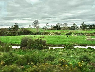
The Puniu River is a river of the Waikato region of New Zealand's North Island. As a tributary of the Waipā River, and at a length of 57 kilometres (35 mi), it is one of the longest secondary tributaries in New Zealand.

<span class="mw-page-title-main">Geology of the Auckland Region</span>

The Auckland Region of New Zealand is built on a basement of greywacke rocks that form many of the islands in the Hauraki Gulf, the Hunua Ranges, and land south of Port Waikato. The Waitākere Ranges in the west are the remains of a large andesitic volcano, and Great Barrier Island was formed by the northern end of the Coromandel Volcanic Zone. The Auckland isthmus and North Shore are composed of Waitemata sandstone and mudstone, and portions of the Northland Allochthon extend as far south as Albany. Little Barrier Island was formed by a relatively isolated andesitic volcano, active around 1 to 3 million years ago.

<span class="mw-page-title-main">Taupō Volcano</span> Lake Taupo Volcanic crater lake in New Zealand

Lake Taupō, in the centre of New Zealand's North Island, fills the caldera of the Taupō Volcano, a large rhyolitic supervolcano. This huge volcano has produced two of the world's most powerful eruptions in geologically recent times.

The Taranaki Region of New Zealand is built upon the Median Batholith in the West, and Greywacke Rocks in the East. However, no rocks older than Miocene times are visible at the surface. The dominant feature of the Taranaki Region is the andesitic stratovolcano of Mount Taranaki, which is only about 130,000 years old. The dissected hill country to the East of the Taranaki Peninsula, and West of the Central Volcanic Plateau is composed of soft Miocene to Pleistocene sandstone and mudstone. The coastal lowlands around Wanganui to the South have well-developed Quaternary marine terraces, and coastal sand dunes.

The Raukumara Region of New Zealand corresponds to the East Cape of the North Island, and associated mountain ranges.

<span class="mw-page-title-main">Geology of the Canterbury Region</span> Overview of the geology of Canterbury, New Zealand

Canterbury in New Zealand is the portion of the South Island to the east of the Southern Alps / Kā Tiritiri o te Moana, from the Waiau Uwha River in the north, to the Waitaki River in the south.

<span class="mw-page-title-main">Geology of the Northland Region</span>

New Zealand's Northland Region is built upon a basement consisting mainly of greywacke rocks, which are exposed on the eastern side of the peninsula. In-place Eocene coal measures crop out at Kamo, near Whangarei, and Oligocene limestone crops out at Hikurangi, near Whangarei.

<span class="mw-page-title-main">Geology of the Tasman District</span>

The Tasman Region, and the small adjoining Nelson Region, form one of the more geologically interesting regions of New Zealand. It contains the oldest rocks of anywhere on New Zealand's main islands. It contains all the main terranes that make up New Zealand's basement. These basement rocks include Ultramafic rocks, such as Serpentine and Dunite, and valuable minerals, such as Gold. The Nelson Region is bordered to the south by the Alpine Fault, the main fault forming the boundary between the Pacific Plate and the Indo-Australian Plate, that generated the Southern Alps.

Karioi or Mount Karioi is a 2.4 million year old extinct stratovolcano 8 km (5.0 mi) SW of Raglan in the Waikato region of New Zealand's North Island. It was the earliest of the line of 6 calcalkalic volcanoes, the largest of which is Mount Pirongia. Karioi forms a background to many parts of Raglan.

<span class="mw-page-title-main">Marokopa</span> Village in Waikato region, New Zealand

Marokopa is a rural community in Waitomo District and Waikato region of New Zealand. It is located close to the coast between Awakino and Kawhia Harbour. The meshblock includes the coastal township of Marokopa, at the mouth of the Marokopa River, and the south side of the small village of Awamarino, about 10 km (6.2 mi) upstream.

<span class="mw-page-title-main">Waitemata Group</span>

The Waitemata Group is an Early Miocene geologic group that is exposed in and around the Auckland Region of New Zealand, between the Whangarei Harbour in the North and the Raglan Harbour in the South. The Group is predominantly composed of deep water sandstone and mudstone (flysch). The sandstone dominated units form the cliffs around the Waitemata Harbour and rare more resistant conglomerates underlie some of Auckland's prominent ridges.

The Auckland regional geologic faults have low seismic activity, compared to much of New Zealand, but do result in an earthquake risk to the Auckland metropolitan area, New Zealand's largest city. There is also evidence of past tectonic, volcanic associations in a city located within what is, at best, a very recently dormant Auckland volcanic field.

The Alexandra Volcanic Group is a chain of extinct calc-alkalic basaltic stratovolcanoes that were most active between 2.74 and 1.60 million years ago but is now known to have had more recent activity between 1.6 and 0.9 million years ago. They extend inland from Mount Karioi near Raglan with Mount Pirongia being the largest, with Pukehoua on the eastern slopes of Pirongia, Kakepuku, Te Kawa, and Tokanui completing the definitive lineament. The associated, but usually separated geologically basaltic monogenetic Okete volcanic field, lies mainly between Karioi and Pirongia but extends to the east and is quite scattered.

References

  1. 1 2 3 Geological Maps of New Zealand from Institute of Geological and Nuclear Sciences (GNS Science) - a New Zealand government Crown Research Institute.
  2. Pittari, Adrian; Prentice, Marlena L.; McLeod, Oliver E.; Zadeh, Elham Yousef; Kamp, Peter J. J.; Danišík, Martin; Vincent, Kirsty A. (2021). "Inception of the modern North Island (New Zealand) volcanic setting: spatio-temporal patterns of volcanism between 3.0 and 0.9 Ma" (PDF). New Zealand Journal of Geology and Geophysics. 64 (2–3): 250–272. doi:10.1080/00288306.2021.1915343.
  3. "A river used to run through it". New Zealand Geographic. Retrieved 2018-11-16.

Further reading