Geopotential

Last updated

Geopotential is the potential of the Earth's gravity field. For convenience it is often defined as the negative of the potential energy per unit mass, so that the gravity vector is obtained as the gradient of the geopotential, without the negation. In addition to the actual potential (the geopotential), a hypothetical normal potential and their difference, the disturbing potential, can also be defined.

Contents

Concepts

For geophysical applications, gravity is distinguished from gravitation. Gravity is defined as the resultant force of gravitation and the centrifugal force caused by the Earth's rotation. Likewise, the respective scalar potentials can be added to form an effective potential called the geopotential, . The surfaces of constant geopotential or isosurfaces of the geopotential are called equigeopotential surfaces (sometimes abbreviated as geop), [1] also known as geopotential level surfaces, equipotential surfaces, or simply level surfaces. [2]

Global mean sea surface is close to one equigeopotential called the geoid . [3] How the gravitational force and the centrifugal force add up to a force orthogonal to the geoid is illustrated in the figure (not to scale). At latitude 50 deg the off-set between the gravitational force (red line in the figure) and the local vertical (green line in the figure) is in fact 0.098 deg. For a mass point (atmosphere) in motion the centrifugal force no more matches the gravitational and the vector sum is not exactly orthogonal to the Earth surface. This is the cause of the coriolis effect for atmospheric motion.

Balance between gravitational and centrifugal force on the Earth surface The shape of the rotating Earth.svg
Balance between gravitational and centrifugal force on the Earth surface

The geoid is a gently undulating surface due to the irregular mass distribution inside the Earth; it may be approximated however by an ellipsoid of revolution called the reference ellipsoid. The currently most widely used reference ellipsoid, that of the Geodetic Reference System 1980 (GRS80), approximates the geoid to within a little over ±100 m. One can construct a simple model geopotential that has as one of its equipotential surfaces this reference ellipsoid, with the same model potential as the true potential of the geoid; this model is called a normal potential . The difference is called the disturbing potential. Many observable quantities of the gravity field, such as gravity anomalies and deflections of the plumbline, can be expressed in this disturbing potential.

Formulation

The Earth's gravity field can be derived from a gravity potential (geopotential) field as follows:

which expresses the gravity acceleration vector as the gradient of , the potential of gravity. The vector triad is the orthonormal set of base vectors in space, pointing along the coordinate axes.

Note that both gravity and its potential contain a contribution from the centrifugal pseudo-force due to the Earth's rotation. We can write

where is the potential of the gravitational field, that of the gravity field, and that of the centrifugal force field.

The centrifugal force—per unit of mass, i.e., acceleration—is given by

where

is the vector pointing to the point considered straight from the Earth's rotational axis. It can be shown that this pseudo-force field, in a reference frame co-rotating with the Earth, has a potential associated with it that looks like this:

This can be verified by taking the gradient () operator of this expression.

Here, , and are geocentric coordinates.

Normal potential

To a rough approximation, the Earth is a sphere, or to a much better approximation, an ellipsoid. We can similarly approximate the gravity field of the Earth by a spherically symmetric field:

of which the equipotential surfaces—the surfaces of constant potential value—are concentric spheres.

It is more accurate to approximate the geopotential by a field that has the Earth reference ellipsoid as one of its equipotential surfaces, however. The most recent Earth reference ellipsoid is GRS80, or Geodetic Reference System 1980, which the Global Positioning system uses as its reference. Its geometric parameters are: semi-major axis a = 6378137.0 m, and flattening f = 1/298.257222101.

A geopotential field is constructed, being the sum of a gravitational potential and the known centrifugal potential , that has the GRS80 reference ellipsoid as one of its equipotential surfaces. If we also require that the enclosed mass is equal to the known mass of the Earth (including atmosphere) GM = 3986005 × 108 m3·s−2, we obtain for the potential at the reference ellipsoid:

Obviously, this value depends on the assumption that the potential goes asymptotically to zero at infinity (), as is common in physics. For practical purposes it makes more sense to choose the zero point of normal gravity to be that of the reference ellipsoid, and refer the potentials of other points to this.

Disturbing potential

Once a clean, smooth geopotential field has been constructed matching the known GRS80 reference ellipsoid with an equipotential surface (we call such a field a normal potential) we can subtract it from the true (measured) potential of the real Earth. The result is defined as T, the disturbing potential:

The disturbing potential T is numerically a great deal smaller than U or W, and captures the detailed, complex variations of the true gravity field of the actually existing Earth from point-to-point, as distinguished from the overall global trend captured by the smooth mathematical ellipsoid of the normal potential.

Geopotential number

In practical terrestrial work, e.g., levelling, an alternative version of the geopotential is used called geopotential number, which are reckoned from the geoid upward:

where is the geopotential of the geoid.

Simple case: sphere

For the purpose of satellite orbital mechanics, the geopotential is typically described by a series expansion into spherical harmonics (spectral representation). In this context the geopotential is taken as the potential of the gravitational field of the Earth, that is, leaving out the centrifugal potential.

Solving for geopotential (Φ) in the simple case of a sphere: [4]

Integrate to get

where:
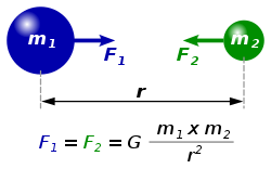
See also

Related Research Articles

<span class="mw-page-title-main">Latitude</span> Geographic coordinate specifying north–south position

In geography, latitude is a coordinate that specifies the north–south position of a point on the surface of the Earth or another celestial body. Latitude is given as an angle that ranges from –90° at the south pole to 90° at the north pole, with 0° at the Equator. Lines of constant latitude, or parallels, run east–west as circles parallel to the equator. Latitude and longitude are used together as a coordinate pair to specify a location on the surface of the Earth.

<span class="mw-page-title-main">Lorentz force</span> Force acting on charged particles in electric and magnetic fields

In physics, the Lorentz force is the combination of electric and magnetic force on a point charge due to electromagnetic fields. A particle of charge q moving with a velocity v in an electric field E and a magnetic field B experiences a force of

<span class="mw-page-title-main">Potential energy</span> Energy held by an object because of its position relative to other objects

In physics, potential energy is the energy held by an object because of its position relative to other objects, stresses within itself, its electric charge, or other factors. The term potential energy was introduced by the 19th-century Scottish engineer and physicist William Rankine, although it has links to the ancient Greek philosopher Aristotle's concept of potentiality.

<span class="mw-page-title-main">Stress–energy tensor</span> Tensor describing energy momentum density in spacetime

The stress–energy tensor, sometimes called the stress–energy–momentum tensor or the energy–momentum tensor, is a tensor physical quantity that describes the density and flux of energy and momentum in spacetime, generalizing the stress tensor of Newtonian physics. It is an attribute of matter, radiation, and non-gravitational force fields. This density and flux of energy and momentum are the sources of the gravitational field in the Einstein field equations of general relativity, just as mass density is the source of such a field in Newtonian gravity.

Geopotential height or geopotential altitude is a vertical coordinate referenced to Earth's mean sea level that represents the work done by lifting one unit mass one unit distance through a region in which the acceleration of gravity is uniformly 9.80665 m/s2. Geopotential height (altitude) differs from geometric (tapeline) height but remains a historical convention in aeronautics as the altitude used for calibration of aircraft barometric altimeters.

<span class="mw-page-title-main">Geoid</span> Ocean shape without winds and tides

The geoid is the shape that the ocean surface would take under the influence of the gravity of Earth, including gravitational attraction and Earth's rotation, if other influences such as winds and tides were absent. This surface is extended through the continents. According to Gauss, who first described it, it is the "mathematical figure of the Earth", a smooth but irregular surface whose shape results from the uneven distribution of mass within and on the surface of Earth. It can be known only through extensive gravitational measurements and calculations. Despite being an important concept for almost 200 years in the history of geodesy and geophysics, it has been defined to high precision only since advances in satellite geodesy in the late 20th century.

<span class="mw-page-title-main">Physical geodesy</span> Study of the physical properties of the Earths gravity field

Physical geodesy is the study of the physical properties of Earth's gravity and its potential field, with a view to their application in geodesy.

<span class="mw-page-title-main">Poisson's equation</span> Expression frequently encountered in mathematical physics, generalization of Laplaces equation.

Poisson's equation is an elliptic partial differential equation of broad utility in theoretical physics. For example, the solution to Poisson's equation is the potential field caused by a given electric charge or mass density distribution; with the potential field known, one can then calculate electrostatic or gravitational (force) field. It is a generalization of Laplace's equation, which is also frequently seen in physics. The equation is named after French mathematician and physicist Siméon Denis Poisson.

<span class="mw-page-title-main">Figure of the Earth</span> Size and shape used to model the Earth for geodesy

In geodesy, the figure of the Earth is the size and shape used to model planet Earth. The kind of figure depends on application, including the precision needed for the model. A spherical Earth is a well-known historical approximation that is satisfactory for geography, astronomy and many other purposes. Several models with greater accuracy have been developed so that coordinate systems can serve the precise needs of navigation, surveying, cadastre, land use, and various other concerns.

The primitive equations are a set of nonlinear partial differential equations that are used to approximate global atmospheric flow and are used in most atmospheric models. They consist of three main sets of balance equations:

  1. A continuity equation: Representing the conservation of mass.
  2. Conservation of momentum: Consisting of a form of the Navier–Stokes equations that describe hydrodynamical flow on the surface of a sphere under the assumption that vertical motion is much smaller than horizontal motion (hydrostasis) and that the fluid layer depth is small compared to the radius of the sphere
  3. A thermal energy equation: Relating the overall temperature of the system to heat sources and sinks

In vector calculus, a conservative vector field is a vector field that is the gradient of some function. A conservative vector field has the property that its line integral is path independent; the choice of any path between two points does not change the value of the line integral. Path independence of the line integral is equivalent to the vector field under the line integral being conservative. A conservative vector field is also irrotational; in three dimensions, this means that it has vanishing curl. An irrotational vector field is necessarily conservative provided that the domain is simply connected.

<span class="mw-page-title-main">Scalar potential</span> When potential energy difference depends only on displacement

In mathematical physics, scalar potential, simply stated, describes the situation where the difference in the potential energies of an object in two different positions depends only on the positions, not upon the path taken by the object in traveling from one position to the other. It is a scalar field in three-space: a directionless value (scalar) that depends only on its location. A familiar example is potential energy due to gravity.

In atmospheric science, geostrophic flow is the theoretical wind that would result from an exact balance between the Coriolis force and the pressure gradient force. This condition is called geostrophic equilibrium or geostrophic balance. The geostrophic wind is directed parallel to isobars. This balance seldom holds exactly in nature. The true wind almost always differs from the geostrophic wind due to other forces such as friction from the ground. Thus, the actual wind would equal the geostrophic wind only if there were no friction and the isobars were perfectly straight. Despite this, much of the atmosphere outside the tropics is close to geostrophic flow much of the time and it is a valuable first approximation. Geostrophic flow in air or water is a zero-frequency inertial wave.

<span class="mw-page-title-main">Gravitational potential</span> Fundamental study of potential theory

In classical mechanics, the gravitational potential is a scalar field associating with each point in space the work per unit mass that would be needed to move an object to that point from a fixed reference point. It is analogous to the electric potential with mass playing the role of charge. The reference point, where the potential is zero, is by convention infinitely far away from any mass, resulting in a negative potential at any finite distance.

A classical field theory is a physical theory that predicts how one or more physical fields interact with matter through field equations, without considering effects of quantization; theories that incorporate quantum mechanics are called quantum field theories. In most contexts, 'classical field theory' is specifically intended to describe electromagnetism and gravitation, two of the fundamental forces of nature.

<span class="mw-page-title-main">Gravity of Earth</span>

The gravity of Earth, denoted by g, is the net acceleration that is imparted to objects due to the combined effect of gravitation and the centrifugal force . It is a vector quantity, whose direction coincides with a plumb bob and strength or magnitude is given by the norm .

In physics, Gauss's law for gravity, also known as Gauss's flux theorem for gravity, is a law of physics that is equivalent to Newton's law of universal gravitation. It is named after Carl Friedrich Gauss. It states that the flux of the gravitational field over any closed surface is proportional to the mass enclosed. Gauss's law for gravity is often more convenient to work from than Newton's law.

In geophysics and physical geodesy, a geopotential model is the theoretical analysis of measuring and calculating the effects of Earth's gravitational field.

In geodesy and geophysics, theoretical gravity or normal gravity is an approximation of the true gravity on Earth's surface by means of a mathematical model representing Earth. The most common model of a smoothed Earth is a rotating Earth ellipsoid of revolution.

Lagrangian field theory is a formalism in classical field theory. It is the field-theoretic analogue of Lagrangian mechanics. Lagrangian mechanics is used to analyze the motion of a system of discrete particles each with a finite number of degrees of freedom. Lagrangian field theory applies to continua and fields, which have an infinite number of degrees of freedom.

References

  1. Hooijberg, M. (2007). Geometrical Geodesy: Using Information and Computer Technology. Springer Berlin Heidelberg. p. 9. ISBN   978-3-540-68225-7 . Retrieved 2023-09-11.
  2. "Geopotential". ametsoc.com. Retrieved 14 April 2023.
  3. Heiskanen, Weikko Aleksanteri; Moritz, Helmut (1967). Physical Geodesy. W.H. Freeman. ISBN   0-7167-0233-9.
  4. Holton, James R. (2004). An Introduction to Dynamic Meteorology (4th ed.). Burlington: Elsevier. ISBN   0-12-354015-1.