Related Research Articles

Hiawatha National Forest is a 894,836-acre (362,127 ha) National Forest in the Upper Peninsula of the state of Michigan in the United States. Commercial logging is conducted in some areas. The United States Forest Service administers this National Forest; it is physically divided into two subunits, commonly called the Eastside 46°14′N84°50′W and Westside 46°08′N86°40′W.
Bar Rock is a small barren rock within Rhode Island Sound, in Westport, Massachusetts, USA. The rock is off the connector of Horseneck and Gooseberry Neck at the Horseneck Beach State Reservation. It's just north of the state reservation's campground.

Patience Island lies off the northwest coast of Prudence Island in the town of Portsmouth, Rhode Island. It has a land area of 0.33 sq mi, making it the fourth-largest island in Narragansett Bay.

Hog Island is an island in Narragansett Bay in Rhode Island. It lies at the entrance to the harbor of Bristol and is part of the town of Portsmouth. The 60 ft (18 m) tall Hog Island Shoal Lighthouse stands off the south end, warning ships of the dangerous shoals around the island. It has a land area of approximately 0.3 sq mi, making it the fifth-largest island in Narragansett Bay. It is home to a small summer vacation colony, with no regular year-round residents, and there are approximately 100 homes on it.

Whale Rock or Submarine Rock is the smallest island in Narragansett Bay in Rhode Island. It is located in the West Passage of the bay in Narragansett, Washington County, Rhode Island, west of the Beavertail area on Conanicut Island. The island received its names because it is shaped like a whale's back or a submarine's bow. It was responsible for numerous shipwrecks prior to the construction of a lighthouse. Whale Rock Light was built on the rock in 1882; it was destroyed by the 1938 New England hurricane, which also claimed the life of keeper Walter Eberle. Part of the lighthouse's foundation can still be seen.
Coasters Harbor Island is a 92-acre (370,000 m2) island in Narragansett Bay, Newport, Rhode Island. The island is home to the Naval War College (NWC), an education and research institution of the United States Navy that specializes in developing ideas for naval warfare and passing them along to officers of the Navy.
Greene Island is a small island in Narragansett Bay, Warwick, Rhode Island. The island was named after Captain John Greene who purchased the island in 1642 from Native Americans as part of a larger purchase of 660 acres around Occupaspatuxet Cove. Occupaspatuxet means where “meadows cut through by a river,” and the area was also known as Greene's Hold. Chief Miantonomi was one of the Indian witnesses on the deed to Greene, which referenced the "little island." The Greenes were followers of Samuel Gorton, a radical Christian philosopher and theologian, who sought refuge in the Warwick area. Greene Island features shallow tidal flats and marsh grasses.

Rose Island is an 18.5-acre (7.5 ha) island in Narragansett Bay off Newport, Rhode Island, United States. It is allegedly named "Rose Island" because at low tide the island appears to be shaped like a rose. The Island is only accessible by boat. The island and its lighthouse are run by the private, non-profit Rose Island Lighthouse Foundation.

Black Farm, also known as the Isaac Collins Farm, is a historic farm in Hopkinton, Rhode Island bounded by Woodville Alton Road and Wood Road. The 264-acre (107 ha) was first developed by John Collins beginning in 1710, and saw agricultural use for over 200 years. The main house dates to the late 18th century, and is a 1-1/2 story gambrel-roofed post-and-beam structure. Other outbuildings include 19th century barns, a corn crib, and a guest cottage added in the 1930s. Set some distance off from this complex of buildings is the foundational remnant of what was probably an ice house: it consists of granite blocks and is eight feet in height.
Burlingame State Park and Campground is a public recreation area located in the town of Charlestown, Rhode Island. The state park's 3,100 acres (1,300 ha) offer camping, hiking, and water activities on Watchaug Pond.

Maschaug Pond is a coastal lagoon in Westerly, Washington County, Rhode Island, United States. Located at 41°19′07″N71°49′51″W, it is one of nine such lagoons in southern Rhode Island. A "small, brackish pond", it is not permanently connected to the Block Island Sound, and is largely bordered by the Misquamicut Club golf course. Nests of the piping plover, which has been federally designated as a threatened species, have been documented within the watershed.

Ninigret is a coastal lagoon in Charlestown, Rhode Island, in the United States, located at 41°22′45″N71°38′43″W. It is the largest of the nine lagoons, or "salt ponds", in southern Rhode Island. It is utilized for recreational activities, as well as oyster and quahog harvesting. Found along its shores are "extensive" archaeological remains. Ninigret Pond, like others in the region, was "formed after the recession of the glaciers 12,000 years ago". The pond is situated on low-lying ground, and as such, it is considered particularly vulnerable to storm surge flooding. It is connected to Green Hill Pond via a small channel.

Washington County, known locally as South County, is a county located in the U.S. state of Rhode Island. As of the 2010 census, the population was 126,979. Rhode Island counties have no governmental functions other than as court administrative and sheriff corrections boundaries, which are part of the state government.
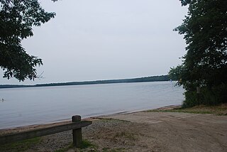
George Washington State Campground is an overnight camping facility in Chepachet, a village in the town of Glocester, Rhode Island. The campground is managed by the Rhode Island Department of Parks and Recreation, and is located on Putnam Pike.
The Arcadia Management Area is a protected area in Richmond, Exeter, Hopkinton, and West Greenwich, Rhode Island. With an area of 14,000 acres, it is the state's largest recreational area. During the winter some of the roads going through the forest close and are only accessible by foot traffic. In 2011, part of the film Moonrise Kingdom was filmed at the park. The former Pine Top Ski Area on Escoheag Hill is located within Arcadia.
Sandy Point Island is a 35-acre island in Little Narragansett Bay, lying mostly in Westerly, Rhode Island and partly in Stonington, Connecticut. Once an extension of Napatree Point, Sandy Point is now a mile-long island that serves as an important nature preserve and recreation site. Sandy Point is the westernmost piece of land in the state of Rhode Island.
Centerville and Moscow are two rural adjacent villages in the town of Hopkinton, Rhode Island. Located just outside the village of Hope Valley, the two villages are very small and are only separated by Moscow Pond, a small pond in the Rockville Management Area in the northern section of town. Sometimes referred to as "Centerville-Moscow", the area is located on and around Rhode Island Route 138, known as Spring Street, between the villages of Hope Valley and Rockville.

Pulaski State Park is a 100-acre state park near the village of Chepachet in Glocester, Rhode Island. It was founded in 1939 and contains a day use facility inside the George Washington Management Area with a beach and covered picnic areas. The Civilian Conservation Corps built a road to the park when "[i]n 1940, the state acquired a lease from the federal government for what is now the Casimir Pulaski State Park and Peck Pond in what is now the Glocester-Burrillville line. "

Wickaboxet State Forest is a 678 acre state forest on Plain Meeting House Road in West Greenwich, Rhode Island. It was founded in 1932.

The Blackstone Park Conservation District is a public, 45-acre woodland conservation area on the East Side of Providence, Rhode Island. It is run by the non-profit Blackstone Parks Conservancy in partnership with the Providence Parks Department. The park is situated on the west bank of the tidal Seekonk River, within the watershed and wildlife corridor of the Blackstone River Valley. Unlike many city parks, it is actively managed for the purpose of providing habitats for wildlife and supporting a healthy ecosystem for native flora and fauna.
References
- ↑ "George Washington State Campground and Management Area". Rhode Island Department of Environmental Management Division of Parks & Recreation. Retrieved 24 October 2018.