
The Northwest Territories is a federal territory of Canada. At a land area of approximately 1,127,711.92 km2 (435,412.01 sq mi) and a 2021 census population of 41,070, it is the second-largest and the most populous of the three territories in Northern Canada. Its estimated population as of the second quarter of 2024 is 44,936. Yellowknife is the capital, most populous community, and the only city in the territory; its population was 20,340 as of the 2021 census. It became the territorial capital in 1967, following recommendations by the Carrothers Commission.
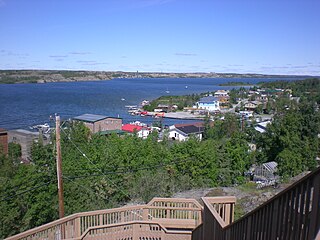
Yellowknife is the capital, largest community, and the only city in the Northwest Territories, Canada. It is on the northern shore of Great Slave Lake, about 400 km (250 mi) south of the Arctic Circle, on the west side of Yellowknife Bay near the outlet of the Yellowknife River.
The Tłı̨chǫ people, sometimes spelled Tlicho and also known as the Dogrib, are a Dene First Nations people of the Athabaskan-speaking ethnolinguistic group living in the Northwest Territories of Canada.
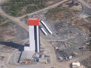
The Con Mine (1938–2003) was the first gold mine developed in the Northwest Territories, Canada, just south of Yellowknife. The property was staked by Consolidated Mining and Smelting Company of Canada (Cominco) in September 1935 in response to the discovery of visible gold nearby; the name "Con" is an abbreviation of "Consolidated". The advent of winter prevented any prospecting from being conducted, but work in the summer of 1936 led to the discovery of numerous gold veins. The Con Mine entered production in 1938 and ceased operations in 2003. It has produced over 5,000,000 ozt (160,000 kg) of gold from 12,195,585 tons of ore processed. The mine was over 6,000 ft (1,800 m) deep.
Royal Oak Mines Incorporated was a gold mining company, founded in 1990 by Margaret "Peggy" Witte in Kirkland, Washington.
The Colomac Mine was a privately owned and operated open pit gold mine located 200 km northwest of Yellowknife in the Northwest Territories in Canada. It operated between 1990–1992, and 1994–1997. It was operated by Neptune Resources Limited, which had little success in making a profit during its operation. In 1994, the mine had reopened under Royal Oak Mines Inc. Both Neptune Resources and Royal Oak Mines where both owned and operated by Peggy Witte. Due to low gold prices and high cost of mining, Royal Oak Mines was forced into bankruptcy. The Federal Government of Canada became owners of the mine, along with the related environmental issues. A major cleanup effort was completed to prevent the mine from polluting the environment. On January 26, 2012, Nighthawk Gold Corporation completed an agreement to acquire 100% of the mineral claims and leases of the former producing Colomac Gold Mine and surrounding mineral leases, from then Aboriginal Affairs and Northern Development Canada (AANDC) now Crown Indigenous Relations and Northern Affairs Canada (CIRNAC). The Colomac Property lies within the central portion of Nighthawk Gold’s 930 square kilometre property. Nighthawk Gold has since been responsibly exploring and advancing the Colomac Gold Project with the goal to restart gold mining operations in the future, assuming positive economics and the receipt of operating permits.
The Rayrock Mine was a uranium producing venture in the Northwest Territories, Canada. It is located on the south side of Maryleer Lake and the north shore of Fault Lake, 169 kilometers northwest of Yellowknife and 74 kilometres northwest of Rae. Radioactive deposits were originally staked in 1948 and then restaked in 1950. American Yellowknife Mines Limited explored the site with detailed Geiger surveys and extensive trenching in the early 1950s. In 1954 exploration work included over 10,000 feet (3,000 m) of surface diamond drilling, and the company was reorganized as Rayrock Mines Limited.
The Burwash Mine was a small gold property discovered in the fall of 1934 by Johnny Baker and Hugh Muir at Yellowknife Bay, Northwest Territories. The town of Yellowknife did not exist yet at that point, but the discovery of gold at Burwash was the catalyst that brought more gold prospectors into the region in 1935 and 1936. A short shaft was sunk in 1935–1936 at Burwash, and in the summer of 1935 a 16-ton bulk sample of ore was shipped to Trail, British Columbia for processing, yielding 200 troy ounces (6.2 kg) of gold. The mine did not become a substantial producer and it is believed the gold vein was mined out.
The Salmita Mine was a gold producer in the Northwest Territories, Canada during 1983 to 1987. The deposit was first discovered in 1945 and underground exploration was carried out in 1951–1952. It was reactivated for exploration by Giant Yellowknife Mines Limited in 1975 and entered production in 1983. They used the old camp and milling plant of the abandoned Tundra Mine, located a few kilometres to the south. The mine produced 179,906 troy ounces (5,595.7 kg) of gold from the milling of 238,177 tons of ore. The area is now owned by Seabridge Gold.
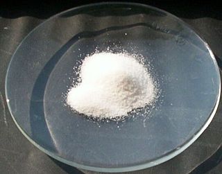
Arsenic trioxide is an inorganic compound with the formula As
2O
3. As an industrial chemical, its major uses include the manufacture of wood preservatives, pesticides, and glass. It is sold under the brand name Trisenox among others when used as a medication to treat a type of cancer known as acute promyelocytic leukemia. For this use it is given by injection into a vein.

Dettah, sometimes spelled incorrectly as Detah, is a First Nations community in the North Slave Region of the Northwest Territories, Canada. Located just southeast of the capital of Yellowknife, it is a 6.5 km (4.0 mi) drive from that city by ice road across the north arm of Great Slave Lake in winter or a 27 km (17 mi) drive via the Ingraham Trail, year-round. The name T'é?ehdaá means 'Burnt Point' in the Wíílíídeh dialect and was simplified to Dettah when non-indigenous people couldnʼt pronounce it. The place was a common fishing spot for the Tetsǫ́tʼine (Yellowknives) people and is home to nearly 200 indigenous people.
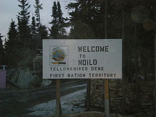
Ndilǫ is a First Nations community in the North Slave Region of the Northwest Territories, Canada. The small Dene community is on the edge of Yellowknife on the tip of Latham Island. It had a population of approximately 321 people in 2016. Ndilǫ and Dettah are the communities of the Yellowknives. Ndilǫ is represented by the Yellowknives Dene First Nation (Ndilǫ) and are part of the Akaitcho Territory Government. The Ndilǫ traditionally speak the Dene dialects Wíílíídeh and Chipewyan (Denesuline).
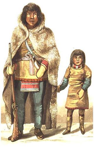
The Yellowknives, Yellow Knives, Copper Indians, Red Knives or T'atsaot'ine are indigenous peoples of Canada, one of the five main groups of the First Nations Dene who live in the Northwest Territories. The name, which is also the source for the later community of Yellowknife, derives from the colour of the tools made from copper deposits.

Behchokǫ̀, officially the Tłı̨chǫ Community Government of Behchokǫ̀, is a community in the North Slave Region of the Northwest Territories, Canada. Behchokǫ̀ is located on the Yellowknife Highway, on the northwest tip of Great Slave Lake, approximately 110 km (68 mi) northwest of Yellowknife.

The history of the Northwest Territories covers the period from thousands of years ago to the present day. Prior to European colonization, the lands that encompass present-day Northwest Territories were inhabited for millennia by several First Nations. European explorers and fur traders began to explore the region since the late-16th century. By the 17th century, the British laid claim to both the North-Western Territory and Rupert's Land; and granted the Hudson's Bay Company a commercial fur trade monopoly over the latter region.

Tibbitt to Contwoyto Winter Road is an annual ice road first built in 1982 to service mines and exploration activities in the Northwest Territories and Nunavut in Northern Canada. Between 400 and 600 km long, the road is said to be the world's longest heavy haul ice road and operates for eight to ten weeks starting in the last week of January. Most of the road (85%–87%) is built over frozen lakes, 495 km (308 mi), with the remaining 73 km (45 mi) built on over 64 land portages between lakes.

The Charter Community of Délı̨nę is located in the Sahtu Region of the Northwest Territories, Canada, on the western shore of Great Bear Lake and is 544 km (338 mi) northwest of Yellowknife. Délı̨nę means "where the waters flow", a reference to the headwaters of the Great Bear River, Sahtúdé. It is the only settlement on the shores of Great Bear Lake as Fort Confidence was last used in the 1800s and Port Radium closed in 1982.
This timeline of Yellowknife history summarises key events in the history of Yellowknife, a city in the Northwest Territories, Canada.

The Yellowknives Dene First Nation is a band government in the Northwest Territories. It represents the Yellowknives people, the namesake of the territorial capital Yellowknife. Its membership primarily resides in two communities: Ndilǫ, bordering the City of Yellowknife at the tip of Latham Island, and Dettah, separated from the city by Yellowknife Bay. The Yellowknives Dene traditionally speak the local Wíílíídeh dialect, which falls under the dene language.
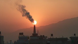
Legacy pollution or legacy pollutants are persistent materials in the environment that were created through a polluting industry or process that have polluting effects after the process has finished. Frequently these include persistent organic pollutants, heavy metals or other chemicals residual in the environment long after the industrial or extraction processes that produced them. Often these are chemicals produced by industry and polluted before there was widespread awareness of the toxic effects of the pollutants, and subsequently regulated or banned. Notable legacy pollutants include mercury, PCBs, Dioxins and other chemicals that are widespread health and environmental effects. Sites for legacy pollutants include mining sites, industrial parks, waterways contaminated by industry, and other dump sites.

