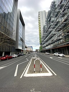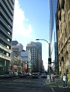
Rundle Mall is a pedestrian street mall located in Adelaide, South Australia. It was opened as a pedestrian mall in September 1976 by closing the section of Rundle Street between King William Street and Pulteney Street, to vehicular traffic. The street continues as Rundle Street to the east and Hindley Street to the west.

King William Street is the part of a major arterial road that traverses the CBD and centre of Adelaide, continuing as King William Road to the north of North Terrace and south of South Terrace. At approximately 40 metres (130 ft) wide, King William Street is the widest main street of all the Australian State capital cities. Named after King William IV in 1837, it is historically considered one of Adelaide's high streets, for its focal point of businesses, shops and other prominent establishments. The Glenelg tram line runs along the middle of the street through the city centre.

Brisbane City is the central suburb and central business district of Brisbane, the state capital of Queensland, Australia. It is colloquially referred to as the "Brisbane CBD" or "the city". It is located on a point on the northern bank of the Brisbane River, historically known as Meanjin, Mianjin or Meeanjin in the local Aboriginal Australian dialect. The triangular shaped area is bounded by the median of the Brisbane River to the east, south and west. The point, known at its tip as Gardens Point, slopes upward to the north-west where the city is bounded by parkland and the inner city suburb of Spring Hill to the north. The CBD is bounded to the north-east by the suburb of Fortitude Valley. To the west the CBD is bounded by Petrie Terrace, which in 2010 was reinstated as a suburb.
Fullarton Road is a main road in the South Australian capital city of Adelaide.

Glen Osmond Road is a major section of the Princes Highway and state Highway 1 in the city of Adelaide, South Australia. Connecting the Adelaide city centre with the Adelaide Hills via the South Eastern Freeway; Glen Osmond Road carries half of Adelaide's freight traffic and is the major commuter route from the southern Adelaide Hills. It has intersections at Greenhill Road, Fullarton Road, Cross Road and Portrush Road.

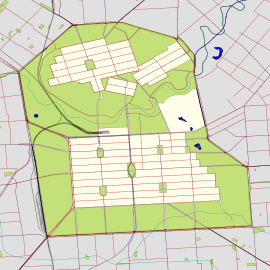
Adelaide city centre is the inner city locality of Greater Adelaide, the capital city of South Australia. It is known by locals simply as "the City" or "Town" to distinguish it from Greater Adelaide and from the City of Adelaide local government area. The population was 15,115 in the 2016 census.

Whitmore Square, also known as Iparrityi, is one of five public squares in the Adelaide city centre, South Australia. Occupying 2.4ha, it is located at the junction of Sturt and Morphett Streets in the south-western quarter of the Adelaide city grid.

Gouger Street is a major street in the centre of Adelaide, South Australia. It was named after Robert Gouger, first Colonial Secretary of South Australia. Gouger Street is known for its high-end international restaurants and cafes. Cuisines found along Gouger Street include Italian, French, Argentinian, Malaysian, Vietnamese, Chinese and Thai. Many of the restaurants on Gouger Street have won awards; some of the better known ones are Star of Siam, La Porchetta (Italian) and Chi on Gouger.

Halifax Street is a street in the south-eastern sector of the centre of Adelaide, South Australia. It runs east–west between East Terrace and King William Street, crossing Hutt Street and Pulteney Street and passing through Hurtle Square. It was named after Sir Charles Wood, British Member of Parliament for Halifax.

Gilles Street is a street in the south-eastern sector of the centre of Adelaide, South Australia. It runs east–west between East Terrace and King William Street, crossing Hutt Street and Pulteney Street. It was named after Osmond Gilles, an early treasurer of the colony of South Australia on 23 May 1837.

Creek Street is a major street in the central business district of Brisbane, Queensland, Australia. The street follows a one-way south–north direction, starting at the beginning of Charlotte Street and cutting through Elizabeth Street, Queen Street, Adelaide Street, and Ann Street before coming to an end at Turbot Street in the northern end of the CBD. Creek Street was named for the filled-in creek over which it was constructed, and is an exception to the convention of parallel streets in the CBD being named after male royals.

Grote Street is a major street in the CBD of the centre of Adelaide, South Australia. It runs in an east–west direction, as a continuation of Wakefield Street where it crosses Victoria Square. It concludes at West Terrace; the road which continues is Sir Donald Bradman Drive. The Grote Street–Sir Donald Bradman Drive route is the most direct method of travelling from the CBD to the Adelaide Airport.

Angas Street is a main street in the CBD of the centre of Adelaide, South Australia. The rear of St Aloysius College faces the street, and various law courts are on the street, including the Dame Roma Mitchell Building. The South Australia Police headquarters and South Australian Metropolitan Fire Service Adelaide station are further down the street.

Wright Street is an east–west street in the centre of Adelaide, South Australia. Among the buildings on Wright Street is the Juvenile Court.

Franklin Street is a main street in the centre of Adelaide, South Australia.

Waymouth Street, often spelt as Weymouth Street in the early days, is an east–west street running between King William Street and West Terrace in the Adelaide city centre in South Australia. The street is named after Henry Waymouth, a founding director of the South Australian Company, whose name was also sometimes spelt as Weymouth.

Flinders Street is a main street in the city centre of Adelaide, South Australia. It was the location of Flinders St School of Music, a campus of TAFE. Pilgrim Uniting Church and Flinders Street Baptist Church are city churches located in the street.
Crime in South Australia is prevented by the South Australia Police (SAPOL), various state and federal courts in the criminal justice system and the state Department for Correctional Services, which administers the prisons and remand centre.


