West Terrace, Adelaide

Last updated

West Terrace

West Terrace Cemetery aerial.jpg
South-facing aerial view of West Terrace Cemetery, westerly adjacent to West Terrace and northerly adjacent to Anzac Highway
Australia South Australia City of Adelaide location map.svg
Red pog.svg
North end
Red pog.svg
South end
Coordinates
General information
TypeStreet
Location Adelaide city centre
Length1.6 km (1.0 mi) [1]
Opened1837
Former
route number
AUS Alphanumeric Route A21.svg A21 (1998–2017)
Major junctions
North end North Terrace
Port Road
Adelaide
 
South end South Terrace
Goodwood Road
Anzac Highway
Adelaide
Location(s)
LGA(s) City of Adelaide

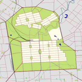
West Terrace is a street in Adelaide, South Australia. It is the westernmost street of the Adelaide city centre. It ends at North Terrace and South Terrace, and connects to Port Road and Anzac Highway.

The southern end of West Terrace, where it connects to Goodwood Road and Anzac Highway, is home to a Rydges Hotel and the West Terrace Cemetery. The northern reaches are occupied by several car dealerships, and hq, Adelaide's largest nightclub. The remainder of West Terrace is occupied by fast food outlets and smaller shops.

The Royal Adelaide Hospital is also located near West Terrace, having moved from premises at the eastern end of North Terrace in 2018.

West Terrace is also the location of Adelaide High School, South Australia's oldest government high school.

Traffic on West Terrace can be very heavy, as it is a major route in and out of the city, and some areas are designated traffic black spots.

There is a tram stop at the junction of West and North Terraces near the Royal Adelaide Hospital.
Related Research Articles

<span class="mw-page-title-main">North Terrace, Adelaide</span> Street in Adelaide, South Australia

North Terrace is one of the four terraces that bound the central business and residential district of Adelaide, the capital city of South Australia. It runs east–west, along the northern edge of "the square mile". The western end continues on to Port Road, and the eastern end continues across the Adelaide Parklands as Botanic Road.

Greenhill Road is a major road in Adelaide, South Australia, that provides a connection to the eastern and hills suburbs. Its western section, running along the south side of Adelaide Parklands, forms part of Adelaide's City Ring Route.

South Road and its southern section as Main South Road outside of Adelaide is a major north–south conduit connecting Adelaide and the Fleurieu Peninsula, in South Australia. It is one of Adelaide's most important arterial and bypass roads. As South Road, it is designated part of route A2 within suburban Adelaide. As Main South Road, it is designated part of routes A13 and B23.

<span class="mw-page-title-main">Goodwood Road, Adelaide</span>

Goodwood Road is a major north–south arterial road, approximately 10 kilometres long, in Adelaide, South Australia. It runs between the Adelaide city centre and Adelaide's southern suburbs of Pasadena and Panorama.

<span class="mw-page-title-main">Transport in Adelaide</span> Transportation network of Adelaide, Australia

The metropolitan area of Adelaide, South Australia is served by a wide variety of transport. Being centrally located on the Australian mainland, it forms a hub for east–west and north–south routes. The road network includes major expressways such as the Southern Expressway, the South Eastern Freeway, the Port River Expressway, the Northern Expressway and the South Road Superway. The city also has a public transport system managed by Adelaide Metro, consisting of a contracted bus system including the O-Bahn Busway, six metropolitan railway lines, and the Glenelg-Adelaide-Hindmarsh Tram. According to a study conducted by the Australian Bureau of Statistics, Adelaide has the highest passenger vehicle travel to work (84%) and the second lowest proportion of people walking to work (2.9%)–something that is being combated by the South Australian government in an effort to increase citizen ridership and use of public transport.

<span class="mw-page-title-main">Cross Road, Adelaide</span>

Cross Road is a major arterial road that travels east–west through the inner southern suburbs of the Australian city of Adelaide. It is designated route A3.

<span class="mw-page-title-main">Anzac Highway</span> Highway in Adelaide

Anzac Highway is an 8.7-kilometre-long (5.4 mi) main arterial road heading southwest from the city of Adelaide, the capital of South Australia, to the beachside suburb of Glenelg.

Port River Expressway is a 5.7-kilometre (3.5 mi) freeway-grade road. The expressway links Port Adelaide and the LeFevre Peninsula across the north-western suburbs of Adelaide to major interstate routes via North-South Motorway.

<span class="mw-page-title-main">Port Road, Adelaide</span>

Port Road is a major road in Adelaide, South Australia connecting the Adelaide city centre with Port Adelaide. It is 12 km (7.5 mi) long, and is designated part of route R1 within central Adelaide, and beyond as route A7.

<span class="mw-page-title-main">Western Distributor (Sydney)</span>

Western Distributor is a 4.3-kilometre-long (2.7 mi) grade-separated motorway that is primarily elevated for the majority of its route on the western fringe of the Sydney central business district in New South Wales, Australia. It links the southern end of Bradfield Highway at the Sydney Harbour Bridge to Victoria Road in Rozelle, at its western terminus near White Bay. It is a constituent part of the A4 route.

Morphett Street is a main street in the west of the city centre of Adelaide, South Australia, parallel to King William Street and numbered from north to south. At its northern end it is part of the West End of Adelaide, a thriving cultural and entertainment precinct, with the Lion Arts Centre on the south-western corner of its junction with North Terrace.

<span class="mw-page-title-main">Tapleys Hill Road</span>

Tapleys Hill Road is a north–south arterial road which runs parallel to the coast through western Adelaide, Australia. This name covers many consecutive streets and is not widely known to most drivers except for the northernmost section, as the entire allocation is still best known as by the names of its constituent parts: Tapleys Hill Road proper, Brighton Road, Ocean Boulevard, Lonsdale Road, Dyson Road, Murray Road, and Gawler Street. This article will deal with the entire length of the corridor for sake of completion, as well to avoid confusion between declarations.

Adelaide has two city ring routes, that loop around the Adelaide city centre and North Adelaide, known as the Inner and Outer Ring Routes.

<span class="mw-page-title-main">Frome Road</span> Road in Adelaide, South Australia

Frome Road is a connecting road in the South Australian capital city of Adelaide. It starts from North Terrace in the Adelaide city centre, running in a northerly direction past the University of South Australia, the site of the old Royal Adelaide Hospital, now known as Lot Fourteen, the Institute of Medical and Veterinary Science and the University of Adelaide, and then through the Adelaide Parklands to the Adelaide Zoo where it turns northeasterly, crosses the River Torrens via Albert Bridge, and continues through the parklands to the intersection with Melbourne Street and Brougham Place in North Adelaide. It is one of the three roads connecting the city centre to North Adelaide, the others being King William Road and Montefiore Road.

<span class="mw-page-title-main">East Terrace</span> Street in Adelaide, South Australia

East Terrace marks the eastern edge of the Adelaide city centre. It is one of the main north–south thoroughfares through the east side of the city. Although the terrace essentially runs north–south between North Terrace and South Terrace, unlike Adelaide's other three terraces, its path is far from a straight line; travelling the entire length of East Terrace requires turning at right angles at most intersections from Pirie Street onwards. These days however, the traffic flow, after a swerve to the east between Grenfell and Pirie Streets, continues southwards over the Pirie intersection into Hutt Street and on down to South Terrace.

<span class="mw-page-title-main">Sturt Street, Adelaide</span> Street in Adelaide, South Australia

Sturt Street is a street in the south-western sector of the centre of Adelaide, South Australia. It runs east-west between West Terrace to King William Street, passing through Whitmore Square. After crossing King William Street, it continues as Halifax Street.

<span class="mw-page-title-main">North–South Motorway</span> Motorway in Adelaide, South Australia

The North–South Motorway is a partially complete motorway traversing the inner western suburbs of Adelaide, from Waterloo Corner in the north to Bedford Park in the south. Progressively constructed in stages since 2010, once complete it will replace the adjacent South Road as Adelaide's main north–south roadway. It will form the central section of the North–South Corridor, being flanked north and south by the Northern Expressway and Southern Expressway, respectively. It is designated part of route M2.

<span class="mw-page-title-main">South Terrace, Adelaide</span> Road in Adelaide, South Australia

South Terrace is one of the four terraces which bound the city centre of Adelaide, the capital of South Australia.

<span class="mw-page-title-main">Currie Street</span> Street in Adelaide, South Australia

Currie Street is a main street in the Adelaide city centre, South Australia. It runs east–to–west from King William Street, through Light Square, to West Terrace on the western edge of the city centre.

<span class="mw-page-title-main">Frome Street</span> Street in Adelaide, South Australia

Frome Street is a street in the East End of the Adelaide city centre, South Australia. It runs from North Terrace in the north to Angas Street, and then as Regent Street North to Carrington Street in the south. North of North Terrace, Frome Street continues towards North Adelaide as Frome Road.

References

  1. Google (30 May 2022). "West Terrace" (Map). Google Maps . Google. Retrieved 30 May 2022.

See also

Australia road sign W5-29.svg   Australian roadsportal