Quorn is a small town and railhead in the Flinders Ranges in the north of South Australia, 39 kilometres (24 mi) northeast of Port Augusta. At the 2016 census, the locality had a population of 1,230, of which 1,131 lived in its town centre.

Southern Expressway is an 18.5 km (11.5 mi) freeway through the southern suburbs of Adelaide, South Australia. It is the southern part of the North–South Corridor which extends the full length of Adelaide and is being built to urban freeway standard. It is designated part of route M2.

Alpha is a rural town and a locality in the Barcaldine Region, Queensland, Australia. At the 2021 census, the locality had a population of 559 people.

Main North Road is the major north-south arterial route through the suburbs north of the Adelaide City Centre in the city of Adelaide, South Australia. It continues north through the settled areas of South Australia and is a total of 307 kilometres (191 mi) long, from North Adelaide to 21 kilometres (13 mi) out of Port Augusta. It follows the route established in the early years of the colony by explorer John Horrocks and was a major route for farmers and graziers to reach the capital, passing through rich farmland and the Clare Valley wine region. In 2011, the section of road between Gawler to Wilmington was renamed Horrocks Highway.

Flinders Medical Centre (FMC) is a major public tertiary hospital and teaching school, co-located with Flinders University and the 130 bed Flinders Private Hospital located at Bedford Park, South Australia. It opened in 1976. It serves as the trauma centre for the southern suburbs, and parts of the Adelaide Hills. An around-the-clock emergency retrieval service brings patients to FMC by road or helicopter.

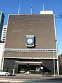
Adelaide city centre is the inner city locality of Greater Adelaide, the capital city of South Australia. It is known by locals simply as "the City" or "Town" to distinguish it from Greater Adelaide and from the City of Adelaide local government area. The population was 15,115 in the 2016 census.
Carrington Street is a street in the south-eastern sector of the centre of Adelaide, South Australia. It runs east–west, from East Terrace to King William Street, blocked at Hutt Street and crossing Pulteney Street at Hurtle Square. It is one of the narrow streets of the Adelaide grid, at 1 chain wide.

Grenfell Street is a major street in the north-east quarter of the Adelaide city centre, South Australia. The street runs west-east from King William Street to East Terrace. On the other side of King William Street, it continues as Currie Street. Its intersection with Pulteney Street is encircled by Hindmarsh Square.

Sturt Street is a street in the south-western sector of the centre of Adelaide, South Australia. It runs east-west between West Terrace to King William Street, passing through Whitmore Square. After crossing King William Street, it continues as Halifax Street.

Grote Street is a major street running east to west in the western half of Adelaide city centre, in Adelaide, South Australia. It is on the northern border of Chinatown and the Adelaide Central Market, and is a lively centre for shopping and restaurants. The historic Her Majesty's Theatre is located here.

Eynesbury Senior College is an independent co-educational senior high school on Franklin Street in the city centre of Adelaide, the capital of South Australia. The college comprises a modern, five-storey, multi-function complex and caters for Year 10, 11 and 12 students.

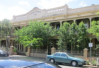
Flinders Street is a main street in the city centre of Adelaide, South Australia. It runs from the northern end of Victoria Square to East Terrace, Adelaide. It is one of the intermediate-width streets of the Adelaide grid, at 1+1⁄2 chains wide.

Harrisville is a rural town and locality in the Scenic Rim Region, Queensland, Australia. In the 2016 census, the locality of Harrisville had a population of 613 people.

Scots Church is a stone Uniting Church building on the southwest corner of North Terrace and Pulteney Street in Adelaide, the capital city of South Australia. It was one of the early churches built in the new city in 1850. It was built as the "Chalmers Free Church of Scotland".

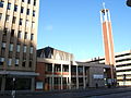
Pilgrim Uniting Church is a church in the heart of the City on Flinders Street, Adelaide in South Australia. It is a church of the Uniting Church in Australia.
Rev. James Maughan was a Methodist minister in Adelaide, South Australia. His name was commemorated in the Maughan Church, Franklin Street, which has since been demolished.
Nora Burden was a South Australian stained glass artist.

Gawler Place is a single-lane road in the city centre of Adelaide, the capital of South Australia. It runs north to south from North Terrace to Wakefield Street, parallel to and approximately midway between King William and Pulteney Streets.

Adelaide Central bus station is Adelaide's main terminus for long distance coach services. It is located on Franklin Street.
Flinders Street Baptist Church is a church in Flinders Street, South Australia.