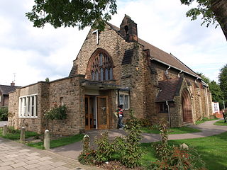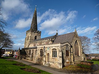
Beeston is a town in the Borough of Broxtowe, Nottinghamshire, England, it is 3 miles south-west of Nottingham. To its north-east is the University of Nottingham's main campus, University Park. The headquarters of pharmaceutical and retail chemist group Boots are 0.6 miles (1 km) east of the centre of Beeston, on the border with Broxtowe and the City of Nottingham. To the south lie the River Trent and the village of Attenborough, with extensive wetlands.

Eastwood is a former coal mining town and civil parish in the Broxtowe district of Nottinghamshire, England, 8 miles (13 km) northwest of Nottingham. Mentioned in Domesday Book, it expanded rapidly during the Industrial Revolution. The Midland Railway was formed here and it is the birthplace of D. H. Lawrence.

Kimberley is a market town and civil parish in the Borough of Broxtowe in Nottinghamshire, England, lying 6 miles northwest of Nottingham along the A610. The town grew as a centre for coal mining, brewing and hosiery manufacturing. At the 2011 census the town had a population of 6,053, and this fell to 6,033 at the 2021 census.

Broxtowe is a local government district with borough status in Nottinghamshire, England. It lies immediately west of the city of Nottingham, and most of the built-up areas of the borough form part of the Nottingham Urban Area. The council is based in Beeston and the borough also includes the towns of Eastwood, Kimberley and Stapleford and surrounding villages and rural areas.

Calcot, or Calcot Row, is a village in West Berkshire, England. Calcot is within the built-up area of Reading, located about 3 miles (4.8 km) out of the town centre, and straddles the historic A4 Bath Road. It sits between the hamlet of Horncastle and Junction 12 of the M4 motorway.

Chilwell is a suburban area in the borough of Broxtowe in Nottinghamshire, England. It lies on the west side of the town of Beeston and is 4 miles (6.4 km) south-west of the centre of Nottingham.

Ashfield is a constituency represented in the House of Commons of the UK Parliament. It is in the English county of Nottinghamshire, East Midlands, to the north-west of the city of Nottingham, in the Erewash Valley along the border with neighbouring county Derbyshire.

Broxtowe is a parliamentary constituency in Nottinghamshire, England, represented in the House of Commons of the UK Parliament since 2024 by Juliet Campbell, from the Labour Party.

Clifton is a suburb and historic manor in the city of Nottingham, in Nottinghamshire, England. As of the 2021 census, it had a population of 22,936.

Stapleford is a town and civil parish in the Borough of Broxtowe, Nottinghamshire, England, 6 miles (9.7 km) west of Nottingham. The population of the civil parish at the 2001 census was 14,991, at the 2011 census it was 15,241, and 15,453 at the 2021 census.

Attenborough is a village in the Borough of Broxtowe in Nottinghamshire, England. It forms part of the Greater Nottingham area and is 4+1⁄2 miles (7.2 km) to the south-west of the city of Nottingham, between Long Eaton and Beeston. It adjoins the suburbs of Toton to the west and Chilwell to the north. The population of the ward, as at the 2011 Census, was 2,328.

Trowell is a village and civil parish in Nottinghamshire, England. It lies a few miles west of Nottingham, in the borough of Broxtowe on the border with Derbyshire. According to the 2001 census it had a population of 2,568, falling to 2,378 at the 2011 census, and 2,287 at the 2021 census.
Broxtowe Borough Council elections are held every four years. Broxtowe Borough Council is the local authority for the non-metropolitan district of Borough of Broxtowe in Nottinghamshire, England. Since the full review of boundaries in 2015, 44 councillors are elected from 20 wards.

Aspley is a council estate and a ward of the city of Nottingham, Nottinghamshire, England. It is located within the boundaries of Nottingham City Council. The ward is located 3 miles (4.8 km) west of Nottingham City Centre and is located only 1.6 miles south-east of Junction 26 of the M1. It lies south of Bulwell, west of Basford and is north of Bilborough. The principal road in the ward is the A610. At the 2001 Census the ward had a population of 15,689, increasing to 17,622 at the 2011 census.

Greasley is a civil parish north west of Nottingham in Nottinghamshire, England. Although it is thought there was once a village called Greasley, there is no settlement of that name today as it was destroyed by the Earl of Rutland. The built up areas in the parish are Beauvale, Giltbrook, Moorgreen, Newthorpe, Watnall and parts of Eastwood, Kimberley and Nuthall. There is also a small hamlet known as Bog-End. The parish is one of the largest in Nottinghamshire at 7.63 square miles (19.8 km2), the 2001 UK Census reporting it had a total population of 10,467, increasing to 11,014 in 2011, and 11,241 at the 2021 census.

The A610 is an A-road in England, which runs from Nottingham to Ambergate, where it joins the A6.

Goldington is part of Bedford, Bedfordshire, England. It encompasses much of the historic village and parish of Goldington that was merged with Bedford in 1934, although some parts of the old village are within the neighbouring Newnham ward. It also includes two modern estates that are part of Renhold parish.
Blue Monkey Brewery is a 20 barrel microbrewery located on the border of Nottinghamshire and Derbyshire. Founded in Ilkeston in 2008, the company doubled its capacity and moved to Giltbrook in 2010. It produces beers, including Ape Ale and Guerrilla Porter. It currently has four outlets; The Organ Grinder Nottingham, The Organ Grinder Loughborough, The Organ Grinder Newark and The Coffee Grinder Arnold

The lead belt is a name given to part of the English East Midlands, including Nottingham, because of the number of wargames manufacturers based there. A key factor is the location of Games Workshop, the biggest wargames miniature manufacturer in the world. Games Workshop was brought to Nottingham by Bryan Ansell in the early 1980s. Ansell had previously founded Citadel Miniatures at Newark, Nottinghamshire in 1979. Many former Games Workshop staff have gone on to found other manufacturers in the area and the 8—10 companies in the lead belt account for 90% of the British wargames miniature market. Because of the concentration of wargaming businesses the lead belt is the subject of organised tours for wargamers from North America.


