
Glenfield is a suburb, part of the contiguous Auckland metropolitan area. It is located in the North Shore, north of the Waitemata Harbour, and Auckland is located in New Zealand.

Torbay is a northern suburb of Auckland, New Zealand. It is located on the city's North Shore, and is governed by Auckland Council. The name Torbay comes from the area of the same name in the south east of Devon, England, and from the Tor, a presque-isle at the north end of Waiake Beach that becomes an island at high tide.
Hillcrest is a suburb of the contiguous Auckland metropolitan area located in New Zealand. Since 2010, it has been under the jurisdiction of the Auckland Council, and is located in the North Shore, surrounded by Glenfield, Wairau Valley, Northcote and Birkenhead. The Auckland Northern Motorway passes to the east.

Bayswater is a suburb located on the North Shore of Auckland, New Zealand. It lies on a peninsula which juts into the Waitemata Harbour. The suburb is in the North Shore ward, one of the thirteen administrative divisions of Auckland Council.

Westmere is a residential suburb of Auckland, New Zealand. Westmere is under the local governance of the Auckland Council. The suburb was originally a working-class area, containing some state houses; mostly private housing originating from housing development in the 1920s. It is known for its Californian style bungalow architecture. It is now a highly sought-after residential location with extensive redevelopment.

Lincoln is a suburb in west Auckland, New Zealand. It is also the filming location of Shortland Street.
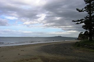
Rothesay Bay is a small suburb in Auckland's East Coast Bays region. The suburb is roughly the same size as Murrays Bay, the suburb to the immediate south.
Rapaura is a village northwest of Blenheim, New Zealand. The Wairau River flows past to the north. Spring Creek lies to the east.
Sunnynook is a suburb on the North Shore in the Auckland metropolitan area in New Zealand. It is currently under the governance of Auckland Council.
Westlake is a suburb of the North Shore in New Zealand's Auckland urban area. It lies eight kilometres to the northwest of the Auckland CBD between the major suburbs of Milford and Glenfield. The name arises from its position on the western shoreline of Lake Pupuke.
Kaiwaka "the little town of lights" is a settlement in Northland, New Zealand. The Kaiwaka River runs from the east through the area and joins with the Wairau River to form the Otamatea River, which drains into the Kaipara Harbour. State Highway 1 passes through Kaiwaka. Wellsford is 20 km south, Brynderwyn is 8 km north and Whangarei the closest city, being 60 km north. The Mangawhai Heads are 18 km north east.

Wairau Valley is the valley of the Wairau River in Marlborough, New Zealand and also the name of the main settlement in the upper valley. State Highway 63 runs through the valley. The valley opens onto the Wairau Plain, where Renwick and Blenheim are sited. The Alpine–Wairau Fault runs along the length of the valley.

Tuamarina is a small town in Marlborough, New Zealand. State Highway 1 runs through the area. The Tuamarina River joins the Wairau River just south of the settlement. Picton is about 18 km to the north, and Blenheim is about 10 km to the south.

Spring Creek is a small town in Marlborough, New Zealand. State Highway 1 runs past the settlement to the west, and the Wairau River flows past to the east. Picton is 22 km to the north, and Blenheim is 6 km to the south.
Campbells Bay is a suburb of the North Shore located in Auckland, New Zealand.
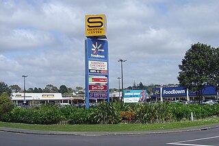
Wairau Valley is a suburb of Auckland, New Zealand. The area is predominantly light industrial/commercial. The Northern Motorway passes to the east, and the Wairau Park shopping complex extends to the north. The valley is drained by the Wairau Creek, which flows on through Milford and discharges into the Hauraki Gulf from an estuary at the northern end of Milford Beach.

Swanson is an outlying suburb of Auckland, New Zealand and is located west of Henderson, surrounded by the Waitākere Ranges.

The Kaipātiki Local Board is one of the 21 local boards of Auckland Council, and is one of the two boards overseen by the council's North Shore Ward councillors. It covers Glenfield south to Northcote Point. Its eastern border is the Northern Motorway and its western border is the Waitematā Harbour. The board sits at the Citizen's Advice Bureau in Bentley Ave, Glenfield. AUT's Akoranga Campus is the only tertiary institution in the North Shore ward, and it is in the Kaipātiki board area.
Fairview Heights is a suburb located on the North Shore of Auckland, New Zealand. It is under local governance of Auckland Council. The area is defined by Lonely Track Road on the north, East Coast Road on the east, Oteha Valley Road on the south, and the Auckland Northern Motorway on the west. Until the end of the 20th century, the area was rural.

Schnapper Rock is a western suburb on the North Shore of Auckland. The suburb is currently under local governance of Auckland Council.
