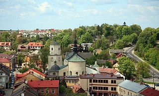
Sucha County is a unit of territorial administration and local government (powiat) in Lesser Poland Voivodeship, southern Poland, on the Slovak border. Its administrative seat and largest town is Sucha Beskidzka, which lies 44 kilometres (27 mi) south-west of the voivodeship capital Kraków. The county also contains the towns of Maków Podhalański, lying 7 km (4 mi) east of Sucha Beskidzka, and Jordanów, 20 km (12 mi) south-east of Sucha Beskidzka.

Radom County is a unit of territorial administration and local government (powiat) in Masovian Voivodeship, east-central Poland. It came into being on January 1, 1999, as a result of the Polish local government reforms passed in 1998. Its administrative seat is the city of Radom, although the city is not part of the county. The county contains three towns: Pionki, 22 km (14 mi) north-east of Radom, Iłża, 27 km (17 mi) south of Radom, and Skaryszew, 12 km (7 mi) south-east of Radom.

Maków County is a unit of territorial administration and local government (powiat) in Masovian Voivodeship, east-central Poland. It came into being on January 1, 1999, as a result of the Polish local government reforms passed in 1998. Its administrative seat and largest town is Maków Mazowiecki, which lies 73 kilometres (45 mi) north of Warsaw. The only other town in the county is Różan, lying 20 km (12 mi) east of Maków Mazowiecki.

Pułtusk County is a unit of territorial administration and local government (powiat) in Masovian Voivodeship, east-central Poland. It came into being on 1 January 1999 as a result of the Polish local government reforms passed in 1998. Its administrative seat and only town is Pułtusk, which lies 54 kilometres (34 mi) north of Warsaw.

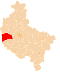
Nowy Tomyśl County is a unit of territorial administration and local government (powiat) in Greater Poland Voivodeship, west-central Poland. It came into being on January 1, 1999, as a result of the Polish local government reforms passed in 1998. Its administrative seat and largest town is Nowy Tomyśl, which lies 55 kilometres (34 mi) west of the regional capital Poznań. The county contains three other towns: Opalenica, 20 km (12 mi) east of Nowy Tomyśl, Zbąszyń, 17 km (11 mi) south-west of Nowy Tomyśl, and Lwówek, 16 km (10 mi) north of Nowy Tomyśl.
Gmina Maków Podhalański is an urban-rural gmina in Sucha County, Lesser Poland Voivodeship, in southern Poland. Its seat is the town of Maków Podhalański, which lies approximately 7 kilometres (4 mi) east of Sucha Beskidzka and 42 km (26 mi) south-west of the regional capital Kraków.

Gmina Krasnosielc is a rural gmina in Maków County, Masovian Voivodeship, in east-central Poland. Its seat is the village of Krasnosielc, which lies approximately 18 kilometres (11 mi) north of Maków Mazowiecki and 90 km (56 mi) north of Warsaw.

Gmina Płoniawy-Bramura is a rural gmina in Maków County, Masovian Voivodeship, in east-central Poland. Its seat is the village of Płoniawy-Bramura, which lies approximately 12 kilometres (7 mi) north of Maków Mazowiecki and 83 km (52 mi) north of Warsaw.

Gmina Rzewnie is a rural gmina in Maków County, Masovian Voivodeship, in east-central Poland. Its seat is the village of Rzewnie, which lies approximately 18 kilometres (11 mi) east of Maków Mazowiecki and 73 km (45 mi) north of Warsaw.

Gmina Sypniewo is a rural gmina in Maków County, Masovian Voivodeship, in east-central Poland. Its seat is the village of Sypniewo, which lies approximately 21 kilometres (13 mi) north-east of Maków Mazowiecki and 89 km (55 mi) north-east of Warsaw.

Gmina Szelków is a rural gmina in Maków County, Masovian Voivodeship, in east-central Poland. Its seat is the village of Szelków, which lies approximately 8 kilometres (5 mi) south-east of Maków Mazowiecki and 67 km (41 mi) north-east of Warsaw.
Gmina Gózd is a rural gmina in Radom County, Masovian Voivodeship, in east-central Poland. Its seat is the village of Gózd, which lies approximately 15 kilometres (9 mi) east of Radom and 98 km (61 mi) south of Warsaw.

Gmina Iłża is an urban-rural gmina in Radom County, Masovian Voivodeship, in east-central Poland. Its seat is the town of Iłża, which lies approximately 27 kilometres (17 mi) south of Radom and 118 km (73 mi) south of Warsaw.
Gmina Kowala is a rural gmina in Radom County, Masovian Voivodeship, in east-central Poland. Its seat is the village of Kowala, which lies approximately 11 kilometres (7 mi) south-west of Radom and 100 km (62 mi) south of Warsaw.
Gmina Wierzbica is a rural gmina in Radom County, Masovian Voivodeship, in east-central Poland. Its seat is the village of Wierzbica, which lies approximately 18 kilometres (11 mi) south of Radom and 108 km (67 mi) south of Warsaw.

Maków is a village in the administrative district of Gmina Skaryszew, within Radom County, Masovian Voivodeship, in east-central Poland. It lies approximately 5 kilometres (3 mi) north of Skaryszew, 9 km (6 mi) south-east of Radom, and 99 km (62 mi) south of Warsaw.
Maków Nowy is a village in the administrative district of Gmina Skaryszew, within Radom County, Masovian Voivodeship, in east-central Poland.

Miasteczko is a village in the administrative district of Gmina Skaryszew, within Radom County, Masovian Voivodeship, in east-central Poland. It lies approximately 7 kilometres (4 mi) south-east of Skaryszew, 18 km (11 mi) south-east of Radom, and 107 km (66 mi) south of Warsaw. The word miasteczko is a diminutive of the Polish word miasto ("town"), and means "small town" or "village".
Nowy Dzierzkówek is a village in the administrative district of Gmina Skaryszew, within Radom County, Masovian Voivodeship, in east-central Poland.

Odechów is a village in the administrative district of Gmina Skaryszew, within Radom County, Masovian Voivodeship, in east-central Poland. It lies in northern Lesser Poland, approximately 8 kilometres (5 mi) east of Skaryszew, 17 km (11 mi) south-east of Radom, and 105 km (65 mi) south of Warsaw. The village has a population of 490, and was officially a town from 1573 until the late 17th century.


