
Tom Price, situated in the Pilbara region of Western Australia, is a mining town. The town is located inland, at the edge of the Hamersley Range. Tom Price is the highest town above sea level in Western Australia, and is consequently dubbed "Top Town in WA".

Babakin is a small town located in the Wheatbelt region of Western Australia between the towns of Bruce Rock and Corrigin. At the 2016 census the population of Babakin was approximately 54. Facilities in the town include a school, shop, hall and sporting facilities.

Gormanston is a town in Tasmania on the slopes of Mount Owen, above the town of Queenstown in Tasmania's West Coast. At the 2016 Gormanston had a population of 17.

Darkan is a town in the Wheatbelt region of Western Australia, between Collie and the Albany Highway on the Coalfields Highway. It is also the seat of the Shire of West Arthur. At the 2016 census, Darkan had a population of 403.
Smiths Beach is a small town on Phillip Island in Victoria, Australia. It is located on Back Beach Road, on the shores of Smiths Beach. It is home to a short-tailed shearwater colony.

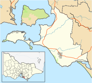
Marysville is a small town, 34 kilometres north-east of Healesville and 41 kilometres south of Alexandra, in the Shire of Murrindindi in Victoria, Australia. The town, which previously had a population of over 500 people, was devastated by the Murrindindi Mill bushfire on 7 February 2009. On 19 February 2009 the official death toll was 45. Around 90% of the town's buildings were destroyed. Prior to the Black Saturday fire the population in 2006 was 519. At the 2011 Census, the population had reduced to 226, by the 2016 Census it had risen to 394.

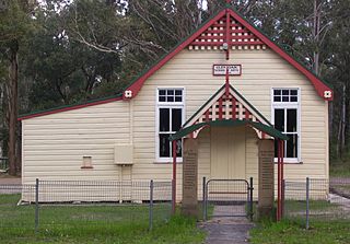
Tarcowie is a town in South Australia. Tarcowie is an aboriginal word meaning "torrential waters". It was named by Governor Musgrave on 20 May 1875. At the 2011 census, Tarcowie had a population of 205, 10 fewer than the 2006 census. The dominant industry in Tarcowie is sheep farming, however in recent times wind farming may be taking over as the main industry for the town. The Tarcowie Landcare Group, an environmental organisation, is based in this town.
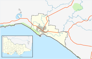
Rowland Flat is a small South Australian town in the Barossa Valley, located on the Barossa Valley Highway between Lyndoch and Tanunda. The town has an elevation of 294m and is nestled at the foot of the Barossa Ranges. It is best known for its wineries, and proximity to Jacobs Creek, Jacobs Creek Visitor's Centre and Novotel Barossa Valley Resort.
Mount Rumney is a semi-rural locality in the local government area (LGA) of Clarence in the Hobart LGA region of Tasmania. The locality is about 7 kilometres (4.3 mi) east of the town of Rosny Park. The 2016 census has a population of 267 for the state suburb of Mount Rumney. It is a suburb of Hobart
Cremorne is a rural residential locality in the local government area (LGA) of Clarence in the Hobart LGA region of Tasmania. The locality is about 21 kilometres (13 mi) south-east of the town of Rosny Park. The 2016 census provides a population of 526 for the state suburb of Cremorne. It is a town located on the South Arm Peninsula on the outskirts of Hobart.
Glen Oak is a small community in the Hunter Region of New South Wales, Australia, shared between the Port Stephens and Dungog local government areas (LGA). Approximately two thirds of the suburb's 45.1 square kilometres (17.4 sq mi) is located within the Port Stephens LGA while the remaining third, which is sparsely populated, is located in Dungog Shire.

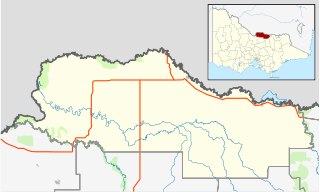
The Shire of Koorda is a local government area in the Wheatbelt region of Western Australia, about 240 kilometres (150 mi) northeast of Perth, the state capital. The Shire covers an area of 2,836 square kilometres (1,095 sq mi) and its seat of government is the town of Koorda.

Kumarina is a town located in Western Australia along the Great Northern Highway between the towns of Meekatharra and Newman. It contains a roadhouse and a caravan park, as well as a small wildlife sanctuary, tavern, motel and restaurant.
Woodford is a township in the Western District of Victoria, Australia. located 9 kilometres (6 mi) north of Warrnambool. At the 2016 census, the population of the combined area was 361.

Somerton is a village between Tamworth and Gunnedah on the Oxley Highway in northern New South Wales Australia. In the 2016 census, there were 277 people in Somerton. Somerton Village adjoins the plentiful Peel River.

Shackleton is a small town in the Wheatbelt region of Western Australia.
Cape Conran is a locality in far-eastern Victoria, Australia. It lies within the Cape Conran Coastal Park located between Marlo and Bemm River about 400 km from Melbourne. The area actually includes two capes: East Cape Conran and West Cape Conran. Both are popular recreational destinations for visitors from nearby towns such as Orbost, as well as further afield, especially in the warmer months.
Boweya North is a town located in the Shire of Moira local government area. According to the 2016 Australian census, the population in the locality was 43 people.
Lockwood is a rural locality in in the City of Greater Bendigo, Victoria.
Argyle is a rural locality in the City of Greater Bendigo in the Australian state of Victoria.
