
Aligarh is a city in the state of Uttar Pradesh in India. It is the administrative headquarters of Aligarh district, and lies 342 kilometres (213 mi) northwest of state capital Lucknow and approximately 130 kilometres (81 mi) southeast of the capital, New Delhi. The cities and districts which adjoin Aligarh are: Gautam Buddha Nagar, Bulandshahr, Sambhal, Badaun, Kasganj, Hathras, Etah and Mathura, as well as Palwal district of Haryana. As of 2011, Aligarh is the 53rd most populous city in India.

Hathras is a historical city in Uttar Pradesh, India. It is the headquarters of Hathras district, formed on 3 May 1997 by merging parts of Aligarh, Mathura and Agra. It is part of the Aligarh Division.

Aligarh is one of the 75 districts in the northern Indian state of Uttar Pradesh. This district is a part of Aligarh Division. The districts which adjoin Aligarh are Gautam Buddha Nagar, Bulandshahr, Sambhal, Badaun, Kasganj, Hathras and Mathura.

Etah district is one of the districts of Uttar Pradesh, India, since 1854. Etah City is the district headquarters. Etah district is a part of Aligarh Division.
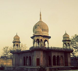
Hathras district is a district of Uttar Pradesh state of India. The city of Hathras is the district headquarters. Hathras district is a part of Aligarh division. The district occupies an area of 1,840 square kilometres (710 sq mi) and has a population of 1,564,708 as of the 2011 census.
Beswan is a town and a nagar panchayat in Aligarh district in the state of Uttar Pradesh, India. Beswan was a jagir which was ruled by Thenua Jats.
Iglas is a town and tehsil in Aligarh district in the Indian state of Uttar Pradesh.
Jalesar is a Nagar Palika in Etah Sub District, Etah district in the Indian state of Uttar Pradesh. There is a fort of Awagarh near Jalesar, Awagarh is 15 kilometres (9.3 mi) from Jalesar It is connected by road to other towns such as Hathras, Etah, Aligarh, Firozabad and Agra.
Jewar is a town and a nagar panchayat in Gautam Buddha Nagar district in the Indian state of Uttar Pradesh. Noida, Dadri and Jewar are the 3 sub-divisions of GB Nagar district, each headed by a SDM.
Khair is a town and a municipal board in Aligarh district in the Indian state of Uttar Pradesh. Khair is the biggest town of Aligarh district. It is situated around 27 km from Aligarh, 114 km from Delhi and 60 km from Mathura.

Qasimpur Power House Colony is a census town in Aligarh district in the Indian state of Uttar Pradesh. It was established for the employees of Harduaganj Thermal Power Station. It is situated on Aligarh-Moradabad highway at a distance of 16 km from Aligarh and 40 km from Khair.
Sadabad is a town and a nagar panchayat in Hathras district in the Indian state of Uttar Pradesh.
Chhoti Ballabh is a village situated in the Gonda block of Iglas tehsil in Aligarh district, Uttar Pradesh, India.
Uttampur is a village in Aligarh district and located 30 km from Aligarh. The village comes in block - Gonda, tehsil - Iglas, district - Aligarh, Uttar Pradesh.
Dahora is a village in the Iglas tehsil, in the Aligarh District of Uttar Pradesh, India, situated 39 km from Aligarh. It lies along the Khair–Taintigaon Road and has a population of roughly 1,200. Dahora is part of the Nagla Jotu Gram Panchayat. As of 2016, Hari Prem Sharma served as Pradhan.

Hathras Junction railway station is on the Kanpur–Delhi section of Howrah–Delhi main line and Howrah–Gaya–Delhi line. It is located in Hathras district in the Indian state of Uttar Pradesh. It serves Hathras and surrounding areas.
Gabhana is a tehsil, block, town and a Nagar panchayat in Aligarh district, 23 km from the district headquarters in the state of Uttar Pradesh, India.
Auhawa Bangar is a village in Nohjhil Block, Mant Tehsil in Mathura District of Uttar Pradesh, India. It belongs to Agra Division. It is located 32 km north of district headquarters Mathura, and 13 km from Nohjhil.
Rawal is a village in Mathura district of Mahavan Tehsil, Uttar Pradesh, India and there are about 409 families living here and it is a small village which is situated in the foothills of river Yamuna.
Jatpura is a village in the Nohjhil block in the Mathura District of Uttar Pradesh, India. Its jurisdiction falls under the Jatpura Panchayat, which belongs to the Agra Division. It is located 53 kilometers north of the district headquarters of Mathura. Jatpura is four km from Nohjhil, and 396 km from the capital of Uttar Pradesh, Lucknow.


