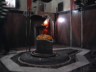
Gyanpur is a town and a nagar panchayat in Bhadohi district in the Indian state of Uttar Pradesh and the administrative headquarters of Bhadohi district.

Baraut is a city and municipal board in Baghpat district, Uttar Pradesh, India.

Bharatganj is a Nagar Panchayat city in district of Allahabad, Uttar Pradesh.

Dhanuha is a census town in Jaunpur district in the state of Uttar Pradesh, India.

Handia is a town and a nagar panchayat in the Allahabad district of the Indian state of Uttar Pradesh.

Iglas is a town and tehsil in Aligarh district in the Indian state of Uttar Pradesh.

Jattari is a town and a Nagar Panchayat in Khair Tehsil of Aligarh district in the Indian state of Uttar Pradesh. It lies on Aligarh – Palwal road 45 km ahead from Aligarh towards Palwal.

Jewar is a town and a nagar panchayat in Gautam Buddha Nagar District in the Indian state of Uttar Pradesh.

Kadipur is a town and a nagar panchayat in Sultanpur district in the Indian state of Uttar Pradesh.

Kauriaganj is a small town and a nagar panchayat in Aligarh district in the Indian state of Uttar Pradesh.

Khair is a city and a municipal board in Aligarh district in the Indian state of Uttar Pradesh. Khair is the biggest town of Aligarh district. It is situated around 114 km from Delhi and 60 km from Mathura.

Kheta Sarai is a town and a nagar panchayat in Jaunpur district of the Indian state of Uttar Pradesh.

Qasimpur Power House Colony is a census town in Aligarh district in the Indian state of Uttar Pradesh. It was established for the employees of Harduaganj Thermal Power Station. It is situated on Aligarh-Moradabad highway at a distance of 16 km from Aligarh and 40 km from Khair.

Shahganj is a city and a municipal board in Jaunpur district in the Indian state of Uttar Pradesh.

Fatehabad is a city in Agra district in the state of Uttar Pradesh, India. It is nearly 35 km south-east of Agra in the direction of Etawah.

Ramnagar is a town in Barabanki district in the state of Uttar Pradesh, India. It is a town, tehsil and a nagar panchayat in Barabanki District in the Indian state of Uttar Pradesh.

Dewa Sharif or Dewa is a town and a nagar panchayat in Barabanki district in the state of Uttar Pradesh, India. It is famous for the shrine of Haji Waris Ali Shah. This town is also known by the name of Dewa Sharif in respect for the shrine. It is about 26 km north-east of capital Lucknow.

Patti is a town and a Nagar Panchayat in Pratapgarh district in the Indian state of Uttar Pradesh.

Kunda is a town and a Tahsil in Pratapgarh district in the Indian state of Uttar Pradesh.

Gabhana is a tehsil, block, town and a Nagar panchayat in Aligarh district, 23 km from district headquarters in the state of Uttar Pradesh, India.


