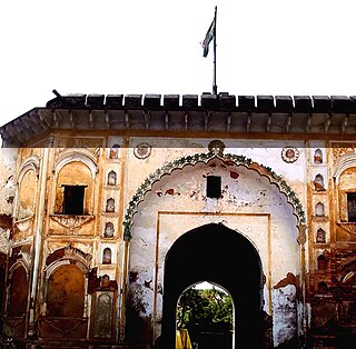
Aligarh district is a district in the state of Uttar Pradesh, India. This district is a part of Aligarh Division. The districts which adjoin Aligarh are Gautam Buddha Nagar, Bulandshahr, Sambhal, Badaun, Kasganj, Hathras and Mathura.

Baraut is a city and municipal board in Baghpat district, Uttar Pradesh, India.

Dhanuha is a census town in Jaunpur district in the state of Uttar Pradesh, India.

Etmadpur is a town (tehsil) in Agra district in the state of Uttar Pradesh, India. It is located eastward 19 km from Agra. It is 274 km far from state capital Lucknow.

Ganj Dundawara is a city and a municipal board in Kasganj District and the Aligarh zone in the state Uttar Pradesh, India.

Handia is a town and a nagar panchayat in the Allahabad district of the Indian state of Uttar Pradesh.

Jattari is a town and a Nagar Panchayat in Khair Tehsil of Aligarh district in the Indian state of Uttar Pradesh. It lies on Aligarh – Palwal road 45 km ahead from Aligarh towards Palwal.

Kairana is a small city and a municipal board in Shamli district of the Indian state of Uttar Pradesh.

Kauriaganj is a small town and a nagar panchayat in Aligarh district in the Indian state of Uttar Pradesh.

Khair is a town and a municipal board in Aligarh district in the Indian state of Uttar Pradesh. Khair is the biggest town of Aligarh district. It is situated around 114 km from Delhi and 60 km from Mathura.

Kheragarh is a town and a nagar panchayat in Agra district in the Indian state of Uttar Pradesh. The distance of the town from Agra is 40 kilometers.

Sadabad is a town and a nagar panchayat in Hathras district in the Indian state of Uttar Pradesh.

Vijaigarh is a town and a nagar panchayat in Aligarh district in the Indian state of Uttar Pradesh.

Dewa Sharif or Dewa is a town and a nagar panchayat in Barabanki district in the state of Uttar Pradesh, India. It is famous for the shrine of Haji Waris Ali Shah. This town is also known by the name of Dewa Sharif in respect for the shrine. It is about 26 km north-east of capital Lucknow.

Badlapur is an administrative division in Jaunpur District in the Indian state of Uttar Pradesh. It was accorded the status of Town Area Nagar Panchayat on 27 June 2014.

Gabhana is a tehsil, block, town and a Nagar panchayat in Aligarh district, 23 km from district headquarters in the state of Uttar Pradesh, India.

Malipura is a locality in Khair City of Aligarh district in the Indian state of Uttar Pradesh. It is situated on Tentigaon Road and Tentigaon Bypass Road.

Sohawal is a town, tehsil and nagar panchayat in Faizabad district in the Indian state of Uttar Pradesh and is subpost office of Faizabad. Sohawal is 24 km west of district headquarters Ayodhya.

Baghirua is a large village located in Bhogaon Tehsil of Mainpuri district in Uttar Pradesh, with a population of 437 families. It falls under Mainpuri Lok Sabha and Kishni Vidhan Sabha constituency.

Challapalli mandal is one of the 50 mandals in the Krishna district of the Indian state of Andhra Pradesh. The headquarters of this mandal are located in Challapalli.


