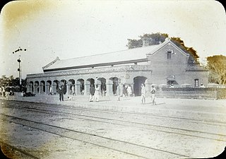
Sitamarhi is an Indian city in the Mithila region of Bihar. It is the district headquarters of the Sitamarhi district in Tirhut Division. The city was named in honour of the goddess Sita, who was born in Sitamarhi in Hinduism.

East Champaran or Purvi Champaran is an administrative district in the state of Bihar in India.The district headquarter is located at Motihari. Prior to 1971, there was a single Champaran District. On 1 December 1971, it was divided into East and West Champaran. In early days the land of East Chamapran was ruled by different kingdoms as Videha, Sunga, Kanvas. It is also believed that Champaran used to be a major part of King Janak's empire. Mahatma Gandhi started his famous Satyagraha movement from here.

Bettiah is a city and the administrative headquarters of West Champaran district - (Tirhut). It is near the Indo-Nepal border, 225 kilometres (140 mi) northwest of Patna, in the state of Bihar, India.

Motihari is a city and headquarters of East Champaran district in the Indian state of Bihar. It is located 80 kilometres west of Muzaffarpur and 152 kilometres northwest of the state capital Patna. In early days the land of Motihari was ruled by different kingdoms as Videha, Sunga, Kanvas. It is also believed that Champaran used to be a major part of King Janak's empire. Mahatma Gandhi started his famous Satyagraha movement from here.

Sitamarhi is one of the districts in the Mithila region of the Indian state of Bihar, India. Dumra is the administrative headquarters of this district. The district is a part of the Tirhut Division and is located along the border of Nepal.

Siwan is a city and nagar parishad in the Indian state of Bihar. It is the administrative headquarters of Siwan district and one of the urban settlements out of three in the district. It is located close to Uttar Pradesh.
Bagaha is a city and a municipality in the district of Pashchim Champaran in the state of Bihar, India. It is a subdivision of Pashchim Champaran district and is a Police District. It is located around 64 kilometres (40 mi) northwest of its district headquarters Bettiah. It is 294 km (183 mi) away from Bihar's state capital Patna.
Chanpatia is a city in Nagar Panchayat situated on the bank of the Burhi Gandak River. It is the administrative headquarters of the Chanpatia block in Paschim Champaran district near the Indo-Nepal border; 18 km from District headquarters Bettiah, 242 km north-west of the capital Patna in the state of Bihar, India. Chanpatia is well-known for its cuisine, such as Marcha Ka chura, Basmati rice, and Handi kabab.
Kataiya is a town and a notified area in Gopalganj district in the Indian state of Bihar.
Lalganj is an important town and Nearest City, (60 kilometres Morden Old City Mehsi), and river port situated in Vaishali district, Bihar.
Lauthaha is a city and a notified area in Purvi Champaran district in the Indian state of Bihar.
Motipur is a town and a notified area in Muzaffarpur district. It is located 14 kilometres south of Mehsi in the Indian state of Bihar. In 2021, Motipur Nagar Panchayat was upgraded to Nagar Parishad.

Sugauli is a city and a notified area in East Champaran district in the Indian state of Bihar. Best known for Treaty of Sagauli, 1816 between the British and Gurkhas and role played in the Satyagraha Movement of Mahatma Gandhi, it is also the setting for Rudyard Kipling's story "Rikki-Tikki-Tavi", and the place where a treaty was signed with Nepal in 1816.
Chakia is a town and a subdivision in East Champaran district in the Indian state of Bihar. Chakia is a sub division of East Champaran district. It is located approximately 48 Kilometres northwest of Muzaffarpur. 32 kilometers southeast of its District headquarters Motihari.
Narahia is a large village in Madhubani district of the Indian state of Bihar. Narahia is also called for the Mithalanchal land of Bihar.
Sahebganj (community development block) is one of the administrative divisions of Muzaffarpur district in the Indian state of Bihar. It belongs to Tirhut Division. It is located 11 km Kilometres Southwest of Mehsi. 57 km towards west from District Headquarters Muzaffarpur.
Saghari Rampur is a village in Aurai block in Muzaffarpur district in the India state of Bihar. Rampur Shambhuta is the gram panchayat of Saghari village. It is located about 45 km away from Muzaffarpur, the district headquarters.

Rampurwa is a village situated in Mehsi, East Champaran District in the Indian state of Bihar. The village is commonly known as Rampurwa among the localities. It lies in the Mirjapur Panchayat region. It is situated at the bank of river Burhi Gandak River on whose bank the village has flourished. It is well connected by road and railways. The nearest city Kaswa Mehsi in Mehsi, which is 2 km from the village. The nearest railway station is Mehsi railway station, which is around 5 km from the village.
Rajepur Nawada is a village in the East Champaran District of Bihar.

Banjari is a large village in Gopalganj District of Bihar, India. It is located 1.3 km towards North-West from the district headquarters Gopalganj. Banjari village code is 1495000. It comes under the administration of Basdila Khas Gram panchayat.


