
Menominee County is a county located in the Upper Peninsula in the U.S. state of Michigan. As of the 2020 census, the population was 23,502. The county seat is Menominee. The county's name comes from an American Indian word meaning "wild rice eater" used to describe a tribe. The county was created in 1861 from area partitioned out of Delta County, under the name of Bleeker. When county government was organized in 1863, the name was changed to Menominee.

West Branch Township is a civil township of Dickinson County in the U.S. state of Michigan. The population was 51 at the 2020 census.
Newton Township is a civil township of Mackinac County in the U.S. state of Michigan. As of 2020, its population was 430.
Chippewa Township is a civil township of Mecosta County in the U.S. state of Michigan. As of the 2020 census, the township population was 1,227.

Cedarville Township is a civil township of Menominee County in the U.S. state of Michigan. The population was 242 as of the 2020 census. The township was established in 1863.

Daggett Township is a civil township of Menominee County in the U.S. state of Michigan. The population was 614 at the 2020 census, down from 714 in 2010. The village of Daggett is located within the township.

Harris Township is a civil township of Menominee County in the U.S. state of Michigan. The population was 2,113 at the 2020 census.

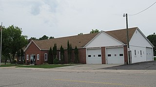
Ingallston Township is a civil township of Menominee County in the U.S. state of Michigan. The population was 924 at the 2020 census.

Mellen Township is a civil township of Menominee County in the U.S. state of Michigan. The population was 1,109 at the 2020 census. It is named after pioneer settler Mellen Smith (1829–1905), who served as the first postmaster at Wallace.

Menominee Township is a civil township of Menominee County in the U.S. state of Michigan. The population was 3,364 at the 2020 census, down from a peak of 4,026 in 1980. The city of Menominee borders the southern end of the township but is administratively autonomous.

Meyer Township is a civil township of Menominee County in the U.S. state of Michigan. The population was 992 at the 2020 census. Most of the population is concentrated in Hermansville, an unincorporated village within the township.

Nadeau Township is a civil township of Menominee County in the U.S. state of Michigan. The population was 1,090 at the 2020 census.

Powers is a village in Menominee County in the U.S. state of Michigan. The population was 381 at the 2020 census, down from 422 in 2010. Located within Spalding Township, it is part of the Marinette micropolitan area.

Stephenson Township is a civil township of Menominee County in the U.S. state of Michigan. The population was 616 at the 2020 census. The city of Stephenson is surrounded by the township but is administered autonomously.
Bushnell Township is a civil township of Montcalm County in the U.S. state of Michigan. As of the 2020 census, the township population was 1,516.
Cato Township is a civil township of Montcalm County in the U.S. state of Michigan. The population was 2,898 at the 2020 census.
Eureka Township is a charter township of Montcalm County in the U.S. state of Michigan. The population was 4,211 at the 2020 census, up from 3,959 in 2010.
Casnovia Township is a civil township of Muskegon County in the U.S. state of Michigan. The population was 2,793 at the 2020 census.
Maple Valley Township is a civil township of Montcalm County in the U.S. state of Michigan. The population was 1,908 at the 2020 census.
Blue Lake Township is a civil township of Muskegon County in the U.S. state of Michigan. As of the 2020 census, the township population was 2,416. One of the largest landowners in the township is the Pathway to Adventure Council of the Boy Scouts of America, which owns Owasippe Scout Reservation. The township is also home to the Blue Lake Fine Arts Camp.


