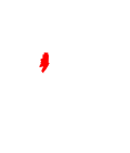
Stephenson Township, Michigan | |
---|---|
Coordinates: 45°24′59″N87°32′49″W / 45.41639°N 87.54694°W | |
Country | United States |
State | Michigan |
County | Menominee |
Area | |
• Total | 41.2 sq mi (107 km2) |
• Land | 40.7 sq mi (105 km2) |
• Water | 0.5 sq mi (1 km2) |
Elevation | 699 ft (213 m) |
Population | |
• Total | 616 |
• Density | 15.1/sq mi (5.8/km2) |
Time zone | UTC-6 (Central (CST)) |
• Summer (DST) | UTC-5 (CDT) |
ZIP Code | |
Area code | 906 |
FIPS code | 26-109-76400 [3] |
GNIS feature ID | 1627125 [4] |
Stephenson Township is a civil township of Menominee County in the U.S. state of Michigan. The population was 616 at the 2020 census. [2] The city of Stephenson is surrounded by the township but is administered autonomously.
The township is south of the center of Menominee County. The city of Stephenson is surrounded by the western part of the township. U.S. Route 41 passes through the township and city, leading south 21 miles (34 km) to Menominee, the county seat, and north 20 miles (32 km) to Powers.
According to the U.S. Census Bureau, Stephenson Township has a total area of 41.2 square miles (107 km2), of which 40.7 square miles (105 km2) are land and 0.5 square miles (1.3 km2), or 1.13%, are water. [1] The Little Cedar River, a south-flowing tributary of the Menominee River, drains the western part of the township, while the Walton River drains the eastern part, starting at North Lake.
Census | Pop. | Note | %± |
---|---|---|---|
1880 | 1,222 | — | |
1890 | 2,279 | 86.5% | |
1900 | 3,006 | 31.9% | |
1910 | 2,913 | −3.1% | |
1920 | 2,828 | −2.9% | |
1930 | 1,409 | [6] | −50.2% |
1940 | 1,543 | 9.5% | |
1950 | 1,675 | 8.6% | |
1960 | 1,646 | −1.7% | |
1970 | 1,507 | −8.4% | |
1980 | 733 | [8] | −51.4% |
1990 | 695 | −5.2% | |
2000 | 716 | 3.0% | |
2010 | 670 | −6.4% | |
2020 | 616 | −8.1% | |
U.S. Decennial Census [9] |
As of the census [3] of 2000, there were 716 people, 283 households, and 215 families residing in the township. By 2020, its population was 616. [2]
Menominee County is a county located in the Upper Peninsula in the U.S. state of Michigan. As of the 2020 census, the population was 23,502. The county seat is Menominee. The county's name comes from an American Indian word meaning "wild rice eater" used to describe a tribe. The county was created in 1861 from area partitioned out of Delta County, under the name of Bleeker. When county government was organized in 1863, the name was changed to Menominee.
Delta County is a county in the Upper Peninsula in the U.S. state of Michigan. As of the 2020 census, the population was 36,903. The county seat is Escanaba. The county was surveyed in 1843 and organized in 1861. Its name originates from the Greek letter delta (Δ), which refers to the triangular shape of the original county which included segments of Menominee, Dickinson, Iron, and Marquette counties. Recreation and forest products are major industries, and crops include hay, corn, small grains, potatoes, and strawberries.
West Branch Township is a civil township of Dickinson County in the U.S. state of Michigan. The population was 51 at the 2020 census.
Cedarville Township is a civil township of Menominee County in the U.S. state of Michigan. The population was 242 as of the 2020 census. The township was established in 1863.
Daggett is a village in Menominee County of the U.S. state of Michigan. The population was 201 at the 2020 census, down from 258 in 2010. The village is located within Daggett Township and is part of the Marinette, WI–MI Micropolitan Statistical Area.
Daggett Township is a civil township of Menominee County in the U.S. state of Michigan. The population was 614 at the 2020 census, down from 714 in 2010. The village of Daggett is located within the township.
Gourley Township is a civil township of Menominee County in the U.S. state of Michigan. The population was 451 at the 2020 census.
Harris Township is a civil township of Menominee County in the U.S. state of Michigan. The population was 2,113 at the 2020 census.
Holmes Township is a civil township of Menominee County in the U.S. state of Michigan. The population was 341 at the 2020 census.
Lake Township is a civil township of Menominee County in the U.S. state of Michigan. The population was 501 at the 2020 census, down from 556 in 2010.
Mellen Township is a civil township of Menominee County in the U.S. state of Michigan. The population was 1,109 at the 2020 census. It is named after pioneer settler Mellen Smith (1829–1905), who served as the first postmaster at Wallace.
Menominee Township is a civil township of Menominee County in the U.S. state of Michigan. The population was 3,364 at the 2020 census, down from a peak of 4,026 in 1980. The city of Menominee borders the southern end of the township but is administratively autonomous.
Meyer Township is a civil township of Menominee County in the U.S. state of Michigan. The population was 992 at the 2020 census. Most of the population is concentrated in Hermansville, an unincorporated village within the township.
Nadeau Township is a civil township of Menominee County in the U.S. state of Michigan. The population was 1,090 at the 2020 census.
Powers is a village in Menominee County in the U.S. state of Michigan. The population was 381 at the 2020 census, down from 422 in 2010. Located within Spalding Township, it is part of the Marinette micropolitan area.
Spalding Township is a civil township of Menominee County in the U.S. state of Michigan. The population was 1,599 at the 2020 census. It is named after Jesse Spalding (1833–1904), who operated a steam sawmill at the village in the township that now bears his name.
Stephenson is a city in Menominee County in the U.S. state of Michigan. The population was 816 at the 2020 census. The city is surrounded by Stephenson Township but is administered autonomously. It is part of the Marinette, WI–MI micropolitan statistical area.
Erie Township is a civil township of Monroe County in the U.S. state of Michigan. The population was 4,299 at the 2020 census. Sharing a southern border with the city of Toledo, Ohio, about 45 miles (72 km) southwest of the city of Detroit, the township is one of the southernmost areas included in the Detroit–Warren–Ann Arbor Combined Statistical Area.
Bushnell Township is a civil township of Montcalm County in the U.S. state of Michigan. As of the 2020 census, the township population was 1,516.
Eureka Township is a charter township of Montcalm County in the U.S. state of Michigan. The population was 4,211 at the 2020 census, up from 3,959 in 2010.
{{cite book}}
: |work=
ignored (help)