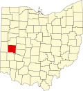
Grayson is an unincorporated community in Miami County, in the U.S. state of Ohio. [1]
A post office called Grayson was established in 1865, and remained in operation until 1888. [2] Besides the post office, Grayson had a large grain elevator. [3]
The Miami Valley is the land area surrounding the Great Miami River in southwest Ohio, USA, and includes the Little Miami, Mad, and Stillwater rivers as well. Geographically, it includes Dayton, Springfield, Middletown, Hamilton, and other communities. The name is derived from the Miami Indians.
Cozaddale is an unincorporated community in southeastern Hamilton Township, Warren County, Ohio, United States. It is two miles west of Pleasant Plain, and three miles north of Goshen, Ohio.
Oregonia is an unincorporated community in northwestern Washington Township, Warren County, Ohio, United States, on the east shore of the Little Miami River about five miles northeast of Lebanon and six miles south of Waynesville. The ZIP Code for Oregonia is 45054.
Fosters is an unincorporated community in southern Warren County, Ohio, United States. It straddles the Little Miami River in Deerfield and Hamilton Townships. It is located about two miles southwest of Hopkinsville, two miles west of Maineville, and two miles northeast of Twenty Mile Stand just off U.S. Route 22/State Route 3, the 3C Highway. The community is in the Kings Local School District and is served by the Maineville post office. The settlement was originally called Foster's Crossing. The community was named after the local Foster family.
West Middletown is an unincorporated community in eastern Madison Township, Butler County, Ohio, United States. It is located on the west shore of the Great Miami River about one mile from Middletown. It had about 200 people in 1905 and was formerly a station on the Cincinnati, Hamilton, and Dayton Railroad. Founded as Madison City, it received the name Heno when it was awarded a post office in 1882. Since there was already another Madison City in Ohio, the postmaster general demanded a name change. According to legend, as old-timers were discussing the new name around the cracker barrel in the general store, a can of Heno tea caught their attention. So the town was named for the tea. But in 1907, the postmaster general decreed the village was within the shadow of Middletown, and only a few postal workers had ever heard of Heno, making it difficult to sort and forward mail to the place. The government ordered the village to accept the name of West Middletown. In 1963 the postmaster general in another decree closed the West Middletown post office, transferring its business to Middletown.
Okeana, originally known as Tariff, is an unincorporated community in central Morgan Township, Butler County, Ohio, United States. It is located on Dry Fork Creek, a tributary of the Great Miami River, on State Route 126 about three miles northwest of Shandon in sections 21 and 26 of R1ET3N of the Congress Lands. It is a mile north of Alert, a mile east of Macedonia, and ten miles southwest of Hamilton. The bulk of addresses served by the Okeana post office are in the Ross Local School District, but parts of the region are in the Southwest Local School District.
Mathers Mill, alternately called Mathers Mills or Mather's Mills, is an unincorporated community in Warren County, Ohio, United States. It is approximately 5 miles east of Lebanon, and 2 miles south of Oregonia in eastern Turtlecreek Township. The area is served by the Oregonia post office, and Lebanon phone exchange and school district. Wilmington Road crosses the Little Miami River and intersects Corwin Road in this area. The bridge is known as the Mathers Mill bridge and the steep hill up out of the valley is sometimes referred to as Mathers Mill Hill.
Phoneton is an unincorporated community in southwestern Bethel Township, Miami County, Ohio, United States, that is located at the junction of the National Road and Old Troy Pike in southwestern Bethel Township, Miami County, Ohio, United States. It is part of the Dayton Metropolitan Statistical Area.
Miamiville is an unincorporated community and census-designated place (CDP) in western Miami Township, Clermont County, Ohio, United States, along the Little Miami River and the Loveland Bike Trail. It had a population of 205 at the 2020 census. It has a post office with the ZIP code 45147.
Camp Dennison is a census-designated place (CDP) just outside Indian Hill in southern Symmes Township, Hamilton County, Ohio, United States. It has a post office with the ZIP code 45111. The population was 384 at the 2010 census.
Ednor is an unincorporated community in Montgomery County, Maryland, United States.
Saint Charles is an unincorporated community in Butler County, in the U.S. state of Ohio.
Outville is an unincorporated community in Licking County, in the U.S. state of Ohio.
Perryton is an unincorporated community in Licking County, in the U.S. state of Ohio.
Frederick is an unincorporated community in Miami County, in the U.S. state of Ohio.
Ginghamsburg is an unincorporated community in Miami County, in the U.S. state of Ohio.
Bloomer is an unincorporated community in Miami County, in the U.S. state of Ohio.
Garland is an unincorporated community in Miami County, in the U.S. state of Ohio.
Kessler is an unincorporated community in Miami County, in the U.S. state of Ohio.
Tadmor is an extinct town in Montgomery County, in the U.S. state of Ohio. Its location, 39°53′45″N84°9′55″W, is now within the Vandalia city limits.
39°59′42″N84°08′40″W / 39.99500°N 84.14444°W