Related Research Articles

Mendocino County is a county located on the North Coast of the U.S. state of California. As of the 2020 census, the population was 91,601. The county seat is Ukiah.

Sonoma County is located in the U.S. state of California. As of the 2020 United States Census, its population was 488,863. Its seat of government and largest city is Santa Rosa.
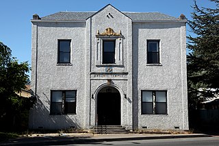
Willits is a city in Mendocino County, California, United States. It is located about 20 miles (32 km) north-northwest of Ukiah, at an elevation of 1,391 feet (424 m). The population was 4,988 at the 2020 census. Willits is at the center of Mendocino County and at the beginning of the county's extensive redwood forests as approached by Highway 101 from the south.

Santa Rosa is a city in and the county seat of Sonoma County, in the North Bay region of the Bay Area in California. Its population as of the 2020 census was 178,127. It is the largest city in California's Wine Country and Redwood Coast. It is the fifth most populous city in the Bay Area after San Jose, San Francisco, Oakland, and Fremont; and the 25th-most populous city in California.

The Eel River is a major river, about 196 miles (315 km) long, in northwestern California. The river and its tributaries form the third-largest watershed entirely in California, draining a rugged area of 3,684 square miles (9,540 km2) in five counties. The river flows generally northward through the Coast Ranges west of the Sacramento Valley, emptying into the Pacific Ocean about 10 miles (16 km) downstream from Fortuna and just south of Humboldt Bay. The river provides groundwater recharge, recreation, and industrial, agricultural and municipal water supply.
The California Western Railroad, AKA Mendocino Railway, popularly called the Skunk Train, is a rail freight and heritage railroad transport railway in Mendocino County, California, United States, running from the railroad's headquarters in the coastal town of Fort Bragg to the interchange with the Northwestern Pacific Railroad at Willits.

Sonoma–Marin Area Rail Transit (SMART) is a rail line and bicycle-pedestrian pathway project in Sonoma and Marin counties of the U.S. state of California. When completed, the entire system will serve a 70-mile (110 km) corridor between Cloverdale in northern Sonoma County and Larkspur Landing in Marin County. In 2023, the system had a ridership of 749,700, or about 2,700 per weekday as of the fourth quarter of 2023.

The Northwestern Pacific Railroad is a 271-mile (436 km) mainline railroad from the ferry connections in Sausalito, California north to Eureka with a connection to the national railroad system at Schellville. The railroad has gone through a history of different ownership and operators but has maintained a generic name of reference as The Northwestern Pacific Railroad, despite no longer being officially named that. Currently, only a 62-mile (100 km) stretch of mainline from Larkspur to the Sonoma County Airport in Windsor and east to Schellville on the “south end” is operated by Sonoma–Marin Area Rail Transit (SMART), which operates both commuter and freight trains with plans for future extension north to Cloverdale. The “north end” from Willits to Eureka is currently out of service, but saved by 2018 legislation to be converted into the Great Redwood Trail.

U.S. Route 101 (US 101) is a major north–south United States Numbered Highway, stretching from Los Angeles, California, to Tumwater, Washington. The California portion of US 101 is one of the last remaining and longest U.S. Routes still active in the state, and the longest highway of any kind in California. US 101 was also one of the original national routes established in 1926. Significant portions of US 101 between the Los Angeles area and the San Francisco Bay Area follow El Camino Real, the commemorative route connecting the former Alta California's 21 missions.

Area codes 707 and 369 are telephone area codes in the North American Numbering Plan (NANP) for the northwestern part of the U.S. state of California. The area codes serve part of the northern San Francisco Bay Area, as well as the North Coast. Major cities in the area codes include Napa, Sebastopol, Vallejo, Benicia, Fairfield, Santa Rosa, Windsor, Healdsburg, Rohnert Park, Petaluma, Fort Bragg, Rio Vista, Crescent City, Eureka, Clearlake, Vacaville, Dixon, and Ukiah. 707 was created by a split of area code 415 on March 1, 1959. Area code 369 was added to the numbering plan area (NPA) on February 1, 2023, to form an overlay numbering plan in the service area.
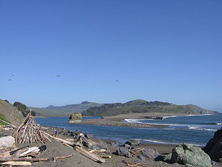
The Russian River is a southward-flowing river that drains 1,485 sq mi (3,850 km2) of Sonoma and Mendocino counties in Northern California. With an annual average discharge of approximately 1,600,000 acre feet (2.0 km3), it is the second-largest river flowing through the nine-county Greater San Francisco Bay Area, with a mainstem 115 mi (185 km) long.

San Francisco and North Pacific Railroad (SF&NP) provided the first extensive standard gauge rail service to Sonoma County and became the southern end of the regional Northwestern Pacific Railroad. Although first conceived of by Asbury Harpending, who had even obtained many of the right of ways, the SF&NP was bought and subsequently constructed by Peter Donahue, who drove the first spike on August 30, 1869.
The environment of California describes results of human habitation of the American State of California.
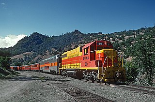
The Eureka Southern Railroad was a shortline freight and excursion railroad that ran over former Northwestern Pacific trackage in California from Willits to Eureka.

Outlet Creek is an Eel River tributary draining the Little Lake Valley northerly through a canyon of the California Coast Ranges. The Northwestern Pacific Railroad bridges the creek twelve times, following it through the canyon. California State Route 162 bridges the creek once, following the canyon closely downstream of Longvale, California, and U.S. Route 101 bridges the creek twice, paralleling it less closely upstream of Longvale. After leaving Quaternary alluvium of the Little Lake Valley, the canyon exposes undivided Cretaceous marine sedimentary and metasedimentary rocks upstream of Longvale and Franciscan Assemblage downstream of Longvale. Outlet Creek provides groundwater recharge, recreation, and agricultural and industrial water supply plus wildlife habitat including cold freshwater habitat for fish migration and spawning.

Mike McGuire is an American politician currently serving as the 52nd President pro tempore of the California State Senate. A Democrat he represents the 2nd Senate district, which encompasses the North Coast region, from Marin County to Del Norte County.
The Wildlands Conservancy is a nonprofit organization with a mission to preserve land for public recreation. It manages 25 preserves, detailed in the list of its preserves, covering over 200,000 acres (81,000 ha) across the western United States. The preserve system encompasses diverse landscapes including mountains, valleys, deserts, rivers, and oceanfront lands. The Wildlands Conservancy buys and restores land, builds public visitor facilities, and provides outdoor education programs for children. All usage is free of charge, attracting over 1.5 million visitors annually.
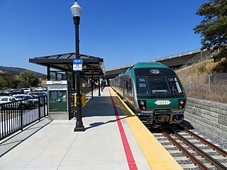
Novato San Marin is a Sonoma–Marin Area Rail Transit station in Novato, California. It opened to preview service on June 29, 2017; and full commuter service commenced on August 25, 2017. It is located on the north side of the city, near where San Marin Drive becomes Atherton Avenue at Redwood Avenue. This was one of two stations planned for Novato in the Initial Operating Segment of SMART service until a third was announced to be partially built for opening at a later date.

Petaluma North station is a planned Sonoma–Marin Area Rail Transit station in Petaluma, California located at Corona Road and North McDowell Boulevard. The station was planned as an infill station to be constructed after the initial phase of the system's construction had been completed. The site may include a 150-space parking facility. In addition to vehicle and bicycle parking, there will be electric vehicle charging stations available at the station.
References
- ↑ "Abandoned North Coast Rail Line Set To Become More Than 300 Miles Of Trail". KPIX 5. March 14, 2022. Retrieved June 11, 2022.
- ↑ "McGuire: Great Redwood Trail Agency holds first meeting this week". Ukiah Daily Journal. March 18, 2022. Retrieved June 13, 2022– via MSN.
- ↑ Mintz, Daniel (April 21, 2022). "Hunerlach named to lead Redwood Trail". Mad River Union. Retrieved June 13, 2022.
- 1 2 Guilfoil, Jackson (February 15, 2022). "California Coastal Conservancy to manage Great Redwood Trail project". Eureka Times-Standard. Retrieved June 14, 2022.
- ↑ Great Redwood Trail | Feasibility, Governance, and Railbanking Report (PDF) (Report). California State Parks. July 2020.
- ↑ Frederiksen, Justine (February 1, 2020). "The Great Redwood Trail: 'It all started in Ukiah'". The Ukiah Daily Journal. Retrieved June 19, 2022.
- ↑ Hartzell, Frank (July 2, 2021). "$16.5 million appropriated for Great Redwood trail; McGuire announces trail will get signs this summer, touts fire safety". The Mendocino Voice. Retrieved June 27, 2022.
- ↑ Frederiksen, Justine (September 17, 2021). "Despite mysterious coal plan, Ukiah City Council OKs next phase of Rail Trail". The Ukiah Daily Journal. Retrieved June 27, 2022.
- ↑ "Willits Rail Trail discussed at community meeting". The Ukiah Daily Journal. March 25, 2022. Retrieved June 13, 2022.
- ↑ "Eel River Canyon Preserve". The Wildlands Conservancy. Retrieved October 25, 2022.
- ↑ "Financier's Northern California Ranch to Become Public Park". U.S. News & World Report. Associated Press. November 17, 2021. Archived from the original on November 18, 2021.
- ↑ Great Redwood Trail | Staff Recommendation (PDF) (Report). Coastal Conservancy. May 5, 2022.
- ↑ Request For Services: Great Redwood Trail Master Plan And Community Outreach Program (Report). California State Coastal Conservancy. Retrieved June 17, 2022.
- ↑ https://kymkemp.com/2023/10/20/wailaki-tribe-submits-resolution-to-oppose-the-great-redwood-trail/
- ↑ "SMART White Paper #8: SMART is both Rail and Trail" (PDF). February 2008. Archived from the original (PDF) on June 13, 2010.
- ↑ "SMART Train & Pathway" . Retrieved July 21, 2014.
- ↑ Kovner, Guy (June 10, 2018). "North Coast's 'Great Redwood Trail' wins approval in California Senate, but lacks funding". Santa Rosa Press Democrat. Retrieved January 7, 2023.
- ↑ Brown, Matt (February 18, 2019). "SMART eyes new funding for Petaluma bike path extension". Sonoma Index-Tribune. Argus–Courrier. Retrieved February 25, 2019.