
KwaZulu-Natal is a province of South Africa that was created in 1994 when the Zulu bantustan of KwaZulu and Natal Province were merged. It is located in the southeast of the country, with a long shoreline on the Indian Ocean and sharing borders with three other provinces and the countries of Mozambique, Eswatini and Lesotho. Its capital is Pietermaritzburg, and its largest city is Durban. It is the second-most populous province in South Africa, with slightly fewer residents than Gauteng.

The Great Trek was a Northward migration of Dutch-speaking settlers who travelled by wagon trains from the Cape Colony into the interior of modern South Africa from 1836 onwards, seeking to live beyond the Cape's British colonial administration. The Great Trek resulted from the culmination of tensions between rural descendants of the Cape's original European settlers, known collectively as Boers, and the British Empire. It was also reflective of an increasingly common trend among individual Boer communities to pursue an isolationist and semi-nomadic lifestyle away from the developing administrative complexities in Cape Town. Boers who took part in the Great Trek identified themselves as voortrekkers, meaning "pioneers", "pathfinders" in Dutch and Afrikaans.

The Boer republics were independent, self-governing republics formed by Dutch-speaking inhabitants of the Cape Colony and their descendants. The founders – variously named Trekboers, Boers and Voortrekkers – settled mainly in the middle, northern, north-eastern and eastern parts of present-day South Africa. Two of the Boer Republics achieved international recognition and complete independence: the South African Republic and the Orange Free State. The republics did not provide for the separation of church and state, initially allowing only the Dutch Reformed Church, and later also other Protestant churches in the Calvinist tradition. The republics came to an end after the Second Boer War of 1899–1902, which resulted in British annexation and later incorporation of their lands into the Union of South Africa.
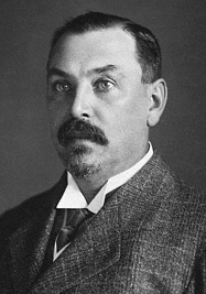
Louis Botha was a South African politician who was the first prime minister of the Union of South Africa – the forerunner of the modern South African state. A Boer war hero during the Second Boer War, he eventually fought to have South Africa become a British Dominion.

Ladysmith is a city in the Uthukela District of KwaZulu-Natal, South Africa. It lies 230 kilometres (140 mi) north-west of Durban and 365 kilometres (227 mi) south-east of Johannesburg. Important industries in the area include food processing, textiles, and tyre production.
Vryheid is a coal mining and cattle ranching town in northern KwaZulu-Natal, South Africa. Vryheid is the Afrikaans word for "freedom".
Kranskop is a small town that is situated on the edge of the Thukela River valley in KwaZulu-Natal, South Africa. It was founded in 1894 as Hopetown but the following confusion with another town of the same name in the Great Karoo, Northern Cape, the name was changed. Kranskop was chosen and is named after two cliff faces that rise 1,175 metres above the Thukela Valley near the town. The name is an Afrikaans word meaning "cliff head."

Kroondal is a village situated in North West Province of South Africa with a large German speaking community. It lies on the N4 road.
The following lists events that happened during 1901 in South Africa.
The following lists events that happened during 1900 in South Africa.
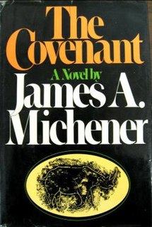
The Covenant is a historical novel by American author James A. Michener, published in 1980.

The Colony of Natal was a British colony in south-eastern Africa. It was proclaimed a British colony on 4 May 1843 after the British government had annexed the Boer Republic of Natalia, and on 31 May 1910 combined with three other colonies to form the Union of South Africa, as one of its provinces. It is now the KwaZulu-Natal province of South Africa.

During the Napoleonic Wars, the Cape Colony was annexed by the British and officially became their colony in 1815. Britain encouraged settlers to the Cape, and in particular, sponsored the 1820 Settlers to farm in the disputed area between the colony and the Xhosa in what is now the Eastern Cape. The changing image of the Cape from Dutch to British excluded the Dutch farmers in the area, the Boers who in the 1820s started their Great Trek to the northern areas of modern South Africa. This period also marked the rise in power of the Zulu under their king Shaka Zulu. Subsequently, several conflicts arose between the British, Boers and Zulus, which led to the Zulu defeat and the ultimate Boer defeat in the Second Anglo-Boer War. However, the Treaty of Vereeniging established the framework of South African limited independence as the Union of South Africa.

The Zulu Kingdom, sometimes referred to as the Zulu Empire or the Kingdom of Zululand, was a monarchy in Southern Africa that extended along the coast of the Indian Ocean from the Tugela River in the south to Pongola River in the north.

The South African Wars, including and commonly referred to as the Confederation Wars, were a series of wars that occurred in the southern portion of the African continent during the later years of the 19th century and the first years of the 20th century. Ethnic, political, and social tensions among European colonial powers, as well as increasing hostilities between these powers and indigenous Africans, led to open conflict in a series of wars and revolts between 1879 and 1915, which had lasting repercussions on the entire region. A key factor behind the growth of these tensions was the pursuit of commerce and resources, both by countries and individuals, especially following the discoveries of diamonds in the region in 1867 and gold in 1862.
Hermannsburg is a small hamlet located in the Province of KwaZulu-Natal in South Africa. It is home to the Hermannsburg School.

Lüneburg is a farming community in eDumbe Local Municipality in the KwaZulu-Natal province of South Africa.
Hermannsburg School, originally Deutsche Schule Hermannsburg, is a private school in Hermannsburg, KwaZulu-Natal, South Africa.
Wonderboy Nxumalo was a South African artist associated with the Ardmore Ceramics workshop.
Ahrens is a railway stop in KwaZulu-Natal, South Africa, 16 km west of Greytown, en route to Kranskop.


