Griggsville Landing, Illinois

Last updated

Griggsville Landing
Griggsville Landing.jpg
Griggsville Landing, 1913
Nicknames: 
  • Phillips' Ferry
  • Phillipsburg
  • Phillips Landing
  • Parkers Landing
USA Illinois location map.svg
Red pog.svg
Griggsville Landing
Coordinates: 39°41′49″N90°38′51″W / 39.69694°N 90.64750°W / 39.69694; -90.64750
CountryUnited States
State Illinois
County Pike County

Griggsville Landing, also known as Phillips Landing or Phillips Ferry, was located in Flint Township, just south of Valley City, Illinois. It is a former town site on the Illinois River in Pike County. The town was a steamboat stop which began sometime in the 1830s. There was a lime kiln there that was part of a commercial lime operation prior to post-Civil War industrial intensification in the lime industry. [1] The town at Griggsville Landing was home to a boat yard, a grist mill and a hotel in addition to the Griggsville Landing Lime Kiln, built around 1850, which is still standing as of 2007. The town was eventually abandoned,[ clarification needed ] rendering it a ghost town.[ citation needed ] Griggsville Landing is adjacent to the Ray Norbut State Fish and Wildlife Area.

Contents

History

Early history

Pike County, Illinois was surveyed by the United States government in 18171819. [2] :43

The site became known as Phillipsburg, then Griggsville Landing, then the landing for Valley City; [3] in 1906, the book Past and Present of Pike County, Illinois, giving this sequence of names, notes that "Valley City is the only town in the township and is on the Wabash Railroad." [2] :80 The same book refers to "Phillips' ferry, the present site of Valley City." [2] :168 In a 1912 county atlas, the name had changed again to Parkers Landing. [4]

Industry

There was a lime kiln there that was part of a commercial lime operation prior to post-Civil War industrial intensification in the lime industry. The town at Griggsville Landing was home to a boat yard, a grist mill and a hotel in addition to the Griggsville Landing Lime Kiln, built around 1850, which is still standing as of 2007.

Boats

Ferry

In 1822, Garrett Van Dusen, the second settler in Flint Township, [2] :80 started a ferry using a canoe, ferrying footmen and swimming horses. [2] :56 [4] [5] Judge William Thomas of Jacksonville, in an 1873 letter, recalled crossing the river here in September 1827:

Passing Colonel Seeley's, I found no other house until I reached Blue river, where Van Deusen had a small grist mill, and I crossed the Illinois river on Van Deusen's ferry. That night I reached Exeter.

[2] :117

Van Deusen later sold the ferry and land claim to Nimrod Phillips. [2] :56 By 1832, the site was referred to as Phillips' Ferry. [2] :53 It was used by Hyrum Smith and his family during the Mormon migration to Missouri. [2] [6] According to Juliet Walker writing for the Illinois Historical Journal, "Until the railroads, the Phillips Ferry Road, as it was commonly called, would remain the most traveled east-west route in the county." [7]

At Valley City, William Windsor (March 4, 1822 – March 12, 1885) ran a horse-powered ferry, and later a steam ferry. [2] :483

Steamboats

The town was a steamboat stop which began sometime in the 1830s. It continued as a steamboat stop until the 1930s. [4]

In 1844, Captain Samuel Rider constructed a boat called Olitippa at Griggsville Landing. [8] The boat was powered by horses and designed to carry freight across low water levels. [8] Rider constructed two steamboats at Griggsville Landing, Timolian and Prairie State. [8]

Decline

Levees

The town was eventually abandoned, rendering it a ghost town due in part because, by Congressional mandate, the United States Army Corps of Engineers constructed levees along the Illinois River leading to flooding of lower elevation settlements along the river. The annual floods as a result of the levees wreaked havoc on Valley City leading to decimation of the town's businesses, abandonment of homes, and the eventual death of the town. [5]

Prior to the levees, Valley City was a vibrant river town with an economy based on commercial fishing, transportation of agricultural products such as hogs packed in oak barrels, apples, and cattle to markets in St. Louis and New Orleans, [4] and a host of small businesses including an ice house that harvested ice from the Illinois River each winter packing it in sawdust and delivering ice to residents of Griggsville some four miles west.

Railroads

When rail service expanded into Pike County in the 1860s and 1870s, reliance on river landings for trade decreased. [4] By 1870, only four steamboats made regular trips between Peoria and St. Louis. [4]

In 1877, Valley City was platted a half-mile north of Griggsville Landing where the railroad crossed the Illinois River. With its proximity to the railroad, Valley City soon displaced Griggsville Landing as an important economic and trade location. [4]

Other factors

Sometime in the late 1990s, the last major plant in Valley City, the Tate Cheese Company, closed its doors for good. After Tate Cheese Company abandoned the processing plant in Valley City there was less interest in the remaining buildings adjacent to the plant. People began to permanently abandon their homes after the Great Flood of 1993 that devastated many homes across the Midwest. [9] [5]

Geography

Griggsville Landing was located at 39°41′49″N90°38′51″W / 39.69694°N 90.64750°W / 39.69694; -90.64750 . [10]

Related Research Articles

<span class="mw-page-title-main">Pike County, Illinois</span> County in Illinois, United States

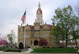
Pike County is a county in the U.S. state of Illinois. It is located between the Mississippi River and the Illinois River in western Illinois. According to the 2020 United States Census, it had a population of 14,739. Its county seat is Pittsfield.

<span class="mw-page-title-main">Cairo, Illinois</span> City in the United States

Cairo is the southernmost city in Illinois and the county seat of Alexander County. A river city, Cairo has the lowest elevation of any location in Illinois and is the only Illinois city to be surrounded by levees. It is in the river-crossed area of Southern Illinois known as "Little Egypt", for which the city is named, after Egypt's capital on the Nile. The city is coterminous with Cairo Precinct.

<span class="mw-page-title-main">Griggsville, Illinois</span> City in Illinois, United States

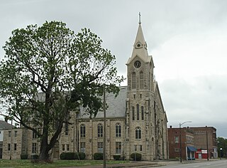
Griggsville is a city in Pike County, Illinois, United States. The population was 1,226 at the 2010 census.

<span class="mw-page-title-main">Valley City, Illinois</span> Village in Illinois, United States

Valley City is a village in Pike County, Illinois, United States. The population was 14 at the 2020 census, making Valley City the smallest incorporated place in Illinois in terms of population. In late December 2015 and early January 2016 the village had flooded, leaving many roads underwater.

<span class="mw-page-title-main">Bernville, Pennsylvania</span> Borough in Pennsylvania, United States

Bernville is a borough in Berks County, Pennsylvania, United States. The population was 955 at the 2010 census. Bernville is bordered by Penn Township to the north, east, and south and by Jefferson Township to the west.

<span class="mw-page-title-main">Republican River</span> River in Colorado, United States

The Republican River is a river in the central Great Plains of North America, rising in the High Plains of eastern Colorado and flowing east 453 miles (729 km) through the U.S. states of Nebraska and Kansas.

<span class="mw-page-title-main">Raritan River</span> Major river in the U.S. state of New Jersey

The Raritan River is a major river of New Jersey. Its watershed drains much of the mountainous area of the central part of the state, emptying into the Raritan Bay on the Atlantic Ocean.

New Hamburg is a small hamlet along the Hudson River in Dutchess County, New York, United States. It is located in the southern corner of the Town Of Poughkeepsie.

Concord is an unincorporated community in Knox County, Tennessee, United States and is listed on the National Register of Historic Places as a historic district, the Concord Village Historic District. The United States Geographic Names Information System classifies Concord as a populated place. It is located in western Knox County, east of Farragut and west of Knoxville. Mail destined for Concord is now addressed to Concord, Knoxville, or Farragut.

The Ray Norbut State Fish and Wildlife Area is a 1,140-acre (460 ha) state park located near Griggsville in Pike County, Illinois. It borders on the Illinois River and is primarily made of steeply sloped bluffland that is part of the river's valley. Heavily wooded, this region is managed for whitetail deer hunting. The Ray Norbut complex also includes Big Blue Island, a 100-acre (40 ha) riparian island in the Illinois River. The park is managed by the Illinois Department of Natural Resources (IDNR).

<span class="mw-page-title-main">Naples Mound 8</span> Archaeological site in Illinois, United States

The Naples Mound 8 is a Havana Hopewell culture mound site located in Pike County, Illinois three miles east of the city of Griggsville. It is the largest mound on the bluff-top in the lower Illinois Valley. The mound was given the name Naples Mound #8 in 1882. The mound was listed on the National Register of Historic Places in 1975.

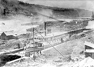
The Griggsville Landing Lime Kiln is located near village of Valley City, Illinois in Pike County. The periodic lime kiln is listed on the National Register of Historic Places, a designation it gained in August 1999. It is actually within the boundaries of the Ray Norbut State Fish and Wildlife Area. The kiln represents an example of an 1850s lime kiln, one of the best-preserved examples of such a kiln. In its heyday the kiln's raw product would have been quicklime. The kiln is one of twelve Pike County sites included in the National Register of Historic Places. Some other examples are the Lyman Scott House, in Summer Hill and the New Philadelphia Town Site, somewhere near Barry, Illinois.

<span class="mw-page-title-main">Buffalo Grove Lime Kiln</span> United States historic place

Buffalo Grove Lime Kiln is one of two old lime kilns in Illinois listed on the National Register of Historic Places. The other is the Griggsville Landing Lime Kiln in Pike County. Buffalo Grove Lime Kiln is located near the Ogle County city of Polo. When in use, the kiln would have produced raw quicklime. The lime kiln was added to the National Register in 2002.

<span class="mw-page-title-main">Steamboats of the Willamette River</span>

The Willamette River flows northwards down the Willamette Valley until it meets the Columbia River at a point 101 miles from the Pacific Ocean, in the U.S. state of Oregon.

<span class="mw-page-title-main">Steamboats of Yaquina Bay and Yaquina River</span>

Yaquina Bay, like Coos Bay, is a shallow coastal bay on the Oregon Coast in the Pacific Northwest of North America. The principal town on Yaquina Bay is Newport, Oregon. The Yaquina River flows into the bay. Until modern roads reached Newport in the late 1920s, the principal transportation method to and from Newport was by ship or boat.

The Great Flood of 1881 was along the Missouri River between April 1, 1881, and April 27, 1881. The flood began around Pierre, South Dakota and struck areas down river in Yankton, South Dakota, Omaha, Nebraska, Council Bluffs, Iowa, Nebraska City, Nebraska, Kansas City, Missouri, and farther south. This was the first detailed reporting of Missouri River flooding, and caused millions of dollars in damage.

Merced Falls is an unincorporated community in Merced County, California. It is located on the north bank of the Merced River 6 miles (9.7 km) east of Snelling, at an elevation of 348 feet . Merced Falls was named for a set of rapids on the Merced River.

Trotter Landing is a ghost town in Tunica County, Mississippi, United States.

Big Blue Island is an uninhabited fluvial island in the Illinois River. Approximately 1.5 mile (2.4 km) long, it is legally part of Detroit Township and Flint Township within Pike County in the U.S. state of Illinois. The mud island is operated for game management purposes as part of the Ray Norbut State Fish and Wildlife Area, although the larger part of the state hunting area is across the river at Griggsville Landing. The island, located at Mile 58 on the Illinois River, is separated by a narrow side channel from adjacent Scott County.

References

  1. The Griggsville Landing Lime Kiln at Ray Norbut State Fish and Wildlife Area, Pike County, Illinois Archived August 1, 2009, at the Wayback Machine , Cultural Resource Program, Illinois Department of Natural Resources, Retrieved January 22, 2007.
  2. 1 2 3 4 5 6 7 8 9 10 Massie, Melville D. (Capt.) (1906). Past and Present of Pike County, Illinois. Chicago: S. J. Clarke Publishing Co. Retrieved August 29, 2007.
  3. Illinois: A Descriptive and Historical Guide. Federal Writers' Project, Illinois. 1939. p. 642. ISBN   9781603540124.
  4. 1 2 3 4 5 6 7 Mansberger, Floyd; Stratton, Christopher (1995). "TRADITIONAL BUILDING CONSTRUCTION IN ILLINOIS: A NATIONAL REGISTER OF HISTORIC PLACES ASSESSMENT OF MULTIPLE PROPERTIES LOCATED ON ILLINOIS DEPARTMENT OF CONSERVATION LAND" (PDF). Fever River Research: 155–158.
  5. 1 2 3 Keith, Jim (January 15, 2021). "Some Illinois ghost towns". The Herald-Times. Retrieved October 12, 2023.
  6. Dewey, Church of Jesus Christ of Latter-day Saints. British (1854). "History of Joseph Smith". Millennial Star. 16: 482 via JSTOR.
  7. Walker, Juliet E. K. (1985). "Entrepreneurial Ventures in the Origin of Nineteenth-Century Agricultural Towns: Pike County, 1823-1880". Illinois Historical Journal. 78 (1): 45–64. ISSN   0748-8149.
  8. 1 2 3 Gould, E. W. (1943). "Early Navigation on the Illinois". Journal of the Illinois State Historical Society (1908-1984). 36 (3): 321–322. ISSN   0019-2287.
  9. Lott, Neal (September 16, 1993). "The Summer of 1993: Flooding in the Midwest and Drought in the Southeast, Technical Report 93-04" (PDF). National Climatic Data Center, NOAA.
  10. U.S. Geological Survey Geographic Names Information System: Griggsville Landing (Locale)