
Charles Lee Tilden Regional Park, also known as Tilden Park or Tilden, [], is a 2,079-acre (841 ha) regional park in the East Bay, part of the San Francisco Bay Area in California. It is between the Berkeley Hills and San Pablo Ridge. Its main entrance is near Kensington, Berkeley, and Richmond. The park is contiguous with Wildcat Canyon Regional Park.

Claremont Canyon Regional Preserve is a small regional park mainly located in the city of Oakland, California, and administered by the East Bay Regional Park District. The park is named for the canyon in which it is situated, Claremont Canyon, out of which Claremont Creek flows on its way to its confluence with Temescal Creek. Previously the canyon was named Harwood's Canyon, and then later as Telegraph Canyon. The name was changed to Claremont by a developer of the nearby Claremont district.

State Route 13 is a state highway in the U.S. state of California. It runs entirely in Alameda County, connecting Interstate 580 in Oakland to Interstate 80/Interstate 580 in Berkeley.
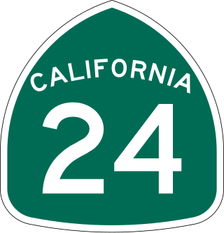
State Route 24 is a heavily traveled east–west state highway in the U.S. state of California that serves the eastern side of the San Francisco Bay Area. A freeway throughout its entire length, it runs from the Interstate 580/Interstate 980 interchange in Oakland, and through the Caldecott Tunnel under the Berkeley Hills, to the Interstate 680 junction in Walnut Creek. It lies in Alameda County, where it is highly urban, and Contra Costa County, where it passes through wooded hillsides and suburbs. SR 24 is a major connection between the San Francisco–Oakland Bay Bridge/MacArthur Maze complex and the inland cities of the East Bay.

The Caldecott Tunnel is a four-bore highway tunnel through the Berkeley Hills between Oakland and Orinda, California. Its four bores carry California State Route 24. Named after Thomas E. Caldecott, former mayor of Berkeley, it opened in 1937 as a two-bore tunnel. The third bore opened in 1964 and the fourth bore in 2013. Currently, the two oldest bores carry eastbound traffic and the two newest bores carry westbound traffic.

Telegraph Avenue is a street that begins, at its southernmost point, in the midst of the historic downtown district of Oakland, California, and ends, at its northernmost point, at the southern edge of the University of California, Berkeley campus in Berkeley, California. It is approximately 4.5 miles (7.2 km) in length.

State Route 35, generally known as Skyline Boulevard for most of its length, is a mostly two-lane state highway in the U.S. state of California. It runs along the ridge of the Santa Cruz Mountains from the high point of State Route 17 near Lexington Reservoir in Santa Clara County to State Route 1 just south of Daly City in San Mateo County, where it crosses SR 1 and loops around Lake Merced to become Sloat Boulevard in San Francisco. SR 35 then continues along Sloat Boulevard until it reaches its terminus when it meets SR 1 again at 19th Avenue.

The Claremont Club & Spa, A Fairmont Hotel is a historic American hotel that is situated at the foot of Claremont Canyon in the Berkeley Hills. Located in the Claremont district, near the intersection of Claremont Avenue and Ashby Avenue, the site straddles the city limits of Berkeley and Oakland. The border between the neighboring cities runs down the former Key System E train right of way that now serves as a pathway between the tennis courts which belong to the Berkeley Tennis Club.
Strawberry Creek is the principal watercourse running through the city of Berkeley, California. Two forks rise in the Berkeley Hills of the California Coast Ranges, and form a confluence at the campus of the University of California, Berkeley. The creek then flows westward across the city to discharge into San Francisco Bay.

The Berkeley Hills are a range of the Pacific Coast Ranges, and overlook the northeast side of the valley that encompasses San Francisco Bay. They were previously called the "Contra Costa Range/Hills", but with the establishment of Berkeley and the University of California, the name was updated by geographers and gazetteers.

Temescal Creek is one of the principal watercourses in the city of Oakland, California, United States.

The Claremont district is a neighborhood straddling the city limits of Oakland and Berkeley in the East Bay section of the San Francisco Bay Area in California, United States. The main thoroughfares are Claremont and Ashby Avenues.
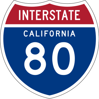
Interstate 80 (I-80) is a transcontinental Interstate Highway in the United States, stretching from San Francisco, California, to Teaneck, New Jersey. The segment of I-80 in California runs east from San Francisco across the San Francisco–Oakland Bay Bridge to Oakland, where it turns north and crosses the Carquinez Bridge before turning back northeast through the Sacramento Valley. I-80 then traverses the Sierra Nevada, cresting at Donner Summit, before crossing into the state of Nevada within the Truckee River Canyon. The speed limit is at most 65 mph (105 km/h) along the entire route instead of the state's maximum of 70 mph (110 km/h) as most of the route is in either urban areas or mountainous terrain. I-80 has portions designated as the Eastshore Freeway and Alan S. Hart Freeway.
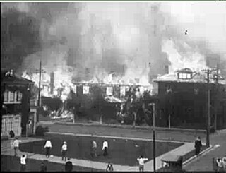
The 1923 Berkeley, California, fire was a conflagration that consumed some 640 structures, including 584 houses in the densely built neighborhoods north of the campus of the University of California in Berkeley, California, on September 17, 1923.

Robert Sibley Volcanic Regional Preserve is located in the Oakland Hills of the East Bay region of the San Francisco Bay Area, California. The park is part of the East Bay Regional Parks District (EBRPD), covers 928 acres (3.76 km2), and lies east of Oakland, partly in Alameda County and partly in Contra Costa County. It can be entered from Oakland via Skyline Boulevard, or from Contra Costa County via Old Tunnel Road.

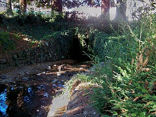
The Northbrae Tunnel, also referred to as the Solano Avenue Tunnel, was built as a commuter electric railroad tunnel in the northern part of Berkeley, California, and was later converted to street use.

Shattuck Avenue is a major city street running north–south through Berkeley and Oakland, California. At its southern end, the street branches from Telegraph Avenue in Oakland's Temescal district, then ends at Indian Rock Park in the Berkeley Hills to the north. Shattuck Avenue is the main street of Berkeley, forming the spine of that city's downtown, and the site of the Gourmet Ghetto in North Berkeley. The street was named for Francis Kittredge Shattuck, an early landowner and booster who later served as Mayor of Oakland. Shattuck was largely responsible for the original construction of the road as well as for a railroad built along its route.

