Capão Bonito is a municipality in the state of São Paulo in Brazil. The population is 47,118 in an area of 1640 km². The elevation is 705 m.

Eldorado is a municipality in the state of São Paulo in Brazil. The population is 15,544 in an area of 1654 km2. Eldorado is one of 29 cities in São Paulo officially recognized as a touristic city, which gives it extra funding.

Ibiúna is a municipality in the state of São Paulo in Brazil. It is part of the Metropolitan Region of Sorocaba. The population is 79,479 in an area of 1058.08 km2. The elevation is 860 m.

Iporanga is a municipality in the state of São Paulo in Brazil. The population is 4,199 in an area of 1152 km². The elevation is 81 m.
Juquiá is a municipality in the state of São Paulo in Brazil. The population is 18,718 in an area of 813 km². The elevation is 17 m.

Juquitiba is a suburban municipality in the southeastern part of the state of São Paulo in Brazil. It is part of the Metropolitan Region of São Paulo. The population is 31,646 in an area of 522.17 km². This name comes from the Tupi language. The southern part of the municipality is heavily forested with the Serra do Mar mountain range, the central and the northern parts are predominantly hilly.

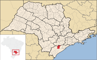
Miracatu is a municipality in the state of São Paulo in Brazil. The population is 19,643 in an area of 1001 km². The elevation is 27 m.

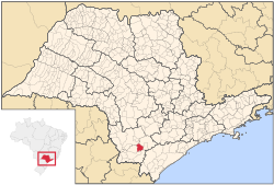
Pedro de Toledo is a municipality in the state of São Paulo in Brazil. The population is 11,421 in an area of 670 square kilometres (260 sq mi).

Ribeirão Grande is a municipality in the state of São Paulo in Brazil. The population is 7,679 in an area of 333 km2. The elevation is 690 m.

Sete Barras is a municipality in the state of São Paulo in Brazil. The population is 12,780 in an area of 1063 km². The elevation is 30 m.

Tapiraí is a municipality in the state of São Paulo in Brazil. It is part of the Metropolitan Region of Sorocaba. The population is 7,766 in an area of 755.10 km². The elevation is 875 m. The city is located in a UNESCO Biosphere Reserve. There are many natural touristic attractions available to tourists during the summer and during the winter the city turns into an escape from the busy days and nights of the big cities surrounding Tapiraí. Tourism in the city is still in a development phase, however, the city already counts with a tourist office and companies specialized in adventure sports like rafting and canoeing.

Guapimirim, is a Brazilian Municipality in the state of Rio de Janeiro around 50km(31 miles) from its state capital, the city of Rio de Janeiro. Its in a region known as Baixada Fluminense and the Greater Rio de Janeiro metropolitan area.

Jeremoabo is a municipality in the state of Bahia in the North-East region of Brazil.

Uruçuca is a municipality in the state of Bahia in the North-East region of Brazil.

Chaval is a municipality in the state of Ceará in the Northeast region of Brazil.

São Geraldo do Araguaia is a municipality in the state of Pará in the Northern region of Brazil.
Buriti dos Montes is a municipality in the state of Piauí in the Northeast region of Brazil.

The Jacupiranga State Park was a state park in São Paulo, Brazil. It covered a large, mountainous region that included untouched Atlantic Forest and land occupied by traditional communities. When the park was created in 1969 the residents could no longer legally practice sustainable farming and extraction of forest resources, leading to land use conflicts, which mounted as the BR-116 highway opened the park to squatters from elsewhere. Eventually, in 2008 the park was combined with surrounding territory and broken up into three smaller state parks and various other units in which sustainable development was allowed.
The Quilombos do Médio Ribeira Environmental Protection Area is an environmental protection area in the state of São Paulo, Brazil. It supports sustainable development of communities of quilombolas, descendants of African slaves.

The Serra do Mar Environmental Protection Area is an environmental protection area in the state of São Paulo, Brazil. It controls land use in an extensive area of Atlantic Forest in the Serra do Mar range.