Gull River (Lake Nipigon)

Last updated
Gull River
Gull River at Hwy 527.jpg
Gull River at Hwy 527
Canada Ontario relief location map.jpg
Red pog.svg
Location of the mouth of the Gull River in Ontario
Location
Country Canada
Province Ontario
Region Northwestern Ontario
District Thunder Bay
Physical characteristics
Source Unnamed lake
  coordinates 49°14′33″N89°52′01″W / 49.24250°N 89.86694°W / 49.24250; -89.86694
  elevation494 m (1,621 ft)
Mouth Gull Bay (Lake Nipigon)
  location
Gull Bay 55
  coordinates
49°49′14″N89°05′19″W / 49.82056°N 89.08861°W / 49.82056; -89.08861
  elevation
259 m (850 ft) [1]
Basin features
River system Great Lakes Basin

The Gull River is a river in Thunder Bay District in Northwestern Ontario, Canada. [2] [3] The river is in the Great Lakes Basin and is a tributary of Lake Nipigon.

Contents

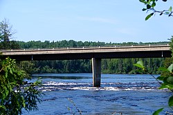
The river is a cold water system, with a number of rapids and waterfalls. The lower 24 km (15 mi) and upper reaches of the river consist of sandy, meandering portions, with numerous loops and oxbow lakes. Its middle section is in a morainal-dominated valley with narrow straight channels where whitewater sections flow over bedrock. [4]

The Gull River is a documented canoe route, linking interior lakes such as Garden and Mooseland Lakes to Lake Nipigon. From Garden Lake Road (Highway 811) to Highway 527, the route is about 100 kilometres (62 mi) long, taking between 5 and 8 days. There are 15 documented portages and few campsites, which are not signed and see little to no maintenance. It is only recommended for experienced paddlers with whitewater skills. [4]

Geography

The river flows from an unnamed lake to Gull Bay on the western side of Lake Nipigon. [3] The river passes through Gull River 55 Indian reserve of the Gull Bay First Nation, located on the south shore of Lake Nipigon.

Tributaries

Significant tributaries of the Gull River are (in upstream order): [1]

History

In 1850, the Robinson Superior Treaty was signed that created the Gull River 55 reserve for the Gull Bay First Nation at the mouth of the Gull River. That same year, the Hudson's Bay Company moved its trading post there from Wabinosh Bay. The post, known as Nipigon or Fort Nipigon, was headquarters of the Nipigon District from 1881 to 1892. In 1900, the post was renamed to Nipigon House, and renamed again in 1954 to Gull Bay. [5]

Fauna

Native fish species are walleye, yellow perch, and northern pike, with lake sturgeon found spawning in the lower portion of the Gull River, east of Detour Lake. [4]

Gull River Provincial Park

Gull River Provincial Park
Location Thunder Bay District, Ontario, Canada
Coordinates 49°41′41″N89°26′31″W / 49.69472°N 89.44194°W / 49.69472; -89.44194 [6]
Area7,194 ha (27.78 sq mi) [7]
DesignationWaterway
Established2003
Governing body Ontario Parks
www.ontarioparks.ca/park/gullriver

The Gull River Provincial Park protects a 80 kilometres (50 mi) long section of the Gull River, as well as part of its tributary Mooseland River, from Highway 811 in the west to the boundary of Gull River 55 Reserve of the Gull Bay First Nation in the east. The park, located about 160 kilometres (99 mi) north of Thunder Bay, is notable for its multi-day canoe camping opportunities. [7]

In addition to the Gull River itself and Mooseland River tributary, the park also protects a large swatch of land around the Gull River headwaters, that nearly surround the 780 hectares (1,900 acres) Kaiashk Provincial Nature Reserve (which may be added to Gull River Provincial Park in the future). [4] The remainder of the Mooseland River, its headwaters, and Mooseland Lake, are protected in the 12,586 hectares (31,100 acres) Garden Pakashkan Conservation Reserve. [8] Furthermore, the Ottertooth Conservation Reserve abuts the Gull River Provincial Park on both sides southwest of Detour Lake. [9]

The landscape in Gull River Provincial Park is characterized by boreal forests with deciduous-dominated mixedwood and jack pine/black spruce mixed stands, as well as wetlands, marshes, and fens. Common trees found in the park are trembling aspen, white birch, white spruce, black spruce, jack pine, balsam fir, and tamarack. [4]

The park has minimal existing development, and no transmission lines, gas pipeline corridors, or major roads cutting across. It is a non-operating park, meaning that there are no facilities or services for visitors. The park can be used for canoeing, hunting, and fishing. [4] [7]

Mammals found in the park include black bear, fisher, lynx, mink, moose, pine marten, red fox, snowshoe hare, and timber wolf. [4]

See also

Related Research Articles

<span class="mw-page-title-main">Lake Abitibi</span> Lake on Ontario / Quebec border, Canada

Lake Abitibi is a shallow lake in northeastern Ontario and western Quebec, Canada. The lake, which lies within the vast Clay Belt, is separated in two distinct portions by a short narrows, making it actually two lakes. Its total area is 931 square kilometres (359 sq mi), and net area 903 square kilometres (349 sq mi). The lake is shallow and studded with islands. Its shores and vicinity are covered with small timber.

<span class="mw-page-title-main">Mattawa River</span> River in Ontario, Canada

The Mattawa River is a river in central Ontario, Canada. It flows east from Trout Lake east of North Bay and enters the Ottawa River at the town of Mattawa. Counting from the head of Trout Lake, it is 76 kilometres (47 mi) long. The river's name comes from the Algonquin word for "meeting of waterways".

<span class="mw-page-title-main">Ogoki River</span> River in Ontario, Canada

The Ogoki River is a river in the Thunder Bay and Cochrane Districts of Ontario. It springs from the wilderness just east of Savant Lake, flowing north of Lake Nipigon to Ogoki, where it joins the Albany River which empties into James Bay. The river is 480 kilometres (300 mi) long.

<span class="mw-page-title-main">Barron River (Ontario)</span> River in Ontario, Canada

The Barron River is a river in the Saint Lawrence River drainage basin in Nipissing District and Renfrew County, Ontario, Canada. It flows from Clemow Lake in northern Algonquin Provincial Park and joins the Petawawa River, whose southern branch it forms, in the municipality of Laurentian Hills, near the municipality of Petawawa.

<span class="mw-page-title-main">Amable du Fond River</span> River in Ontario, Canada

The Amable du Fond River is a river in Nipissing District, in Northern Ontario, Canada.

The Black Sturgeon River is a river in Thunder Bay District, Northwestern Ontario, Canada, located west of the Nipigon River, that flows to Lake Superior.

The Brightsand River is a river in the James Bay drainage basin in Unorganized Thunder Bay District in northwestern Ontario, Canada.

The Obabika River Provincial Park is a provincial park in Ontario, Canada, straddling across the boundaries of the Sudbury, Nipissing, and Timiskaming Districts. While it is named after and includes the Obabika River, the bulk of the park extends north of Obabika Lake to the eastern boundary of Lady Evelyn-Smoothwater Provincial Park.

Blue Jay Creek is a river on Manitoulin Island in Central Manitoulin and Tehkummah townships, Manitoulin District in northeastern Ontario, Canada, and a tributary of Lake Huron.

<span class="mw-page-title-main">Englehart River</span> River in Ontario, Canada

The Englehart River is a river in Timiskaming District in northeastern Ontario, Canada. It is in the Saint Lawrence River drainage basin and is a right tributary of the Blanche River.

<span class="mw-page-title-main">Groundhog River</span> River in Northeastern Ontario, Canada

The Groundhog River is a river in Cochrane District and Sudbury District in Northeastern Ontario, Canada. The river is in the James Bay drainage basin and is a left tributary of the Mattagami River.

The Little White River is a river in the Unorganized North Part of Algoma District in Northeastern Ontario, Canada. It is in the Great Lakes Basin and is a left tributary of the Mississagi River.

The Makobe River is a river in northeastern Ontario, Canada. It is in the Saint Lawrence River drainage basin, and is a left tributary of the Montreal River.

Gravel River Provincial Park is a nature reserve in the Thunder Bay District of Ontario, Canada. It protects an unusual birds-foot delta at the mouth of the Gravel River.

<span class="mw-page-title-main">White Gull Creek</span> River in Saskatchewan

White Gull Creek is a river in the Canadian province of Saskatchewan. The river's source is White Gull Lake, near the south-western boundary of Narrow Hills Provincial Park and near the southern slopes of the Cub Hills. The river travels through boreal forest and muskeg en route to its mouth at the Torch River. The Torch River is a tributary of the Saskatchewan River as it flows into one of North America's largest inland fresh water deltas, the Saskatchewan River Delta. There are no communities nor settlements along the river.

Solace Provincial Park is a remote provincial park in Sudbury District, Ontario, Canada. It was established in 1985 and protects a series of lakes that provide backcountry canoeing opportunities. It is characterized by boreal forest, mostly jack pine conifer forest with mixed forest including white birch. The roadless park, with topography and scenery similar to the adjacent Lady Evelyn-Smoothwater Provincial Park, is considered as "one of the most isolated, wild places in Ontario."

<span class="mw-page-title-main">Kopka River</span> River in Ontario, Canada

The Kopka River is a river in northwestern Ontario, Canada. It forms at the height-of-land west of Lake Nipigon, flowing through rugged wilderness of Ontario's northern boreal forest, and drains into Wabinosh Lake.

St. Raphael Provincial Park is a provincial park in northern Ontario, Canada, roughly halfway between Sioux Lookout and Pickle Lake, straddling the boundary of Kenora and Thunder Bay Districts. It was established on May 22, 2003, and provides backcountry canoeing and camping opportunities.

The Turtle River–White Otter Lake Provincial Park is a large provincial park in Kenora and Rainy River Districts, roughly located between Ignace and Atikokan, Ontario, Canada. It has been recognized as a "natural area with unique biophysical, recreational, and cultural attributes."

The Algoma Headwaters Provincial Park is a large provincial park in Algoma and Sudbury Districts, Ontario, Canada. It is undeveloped remote wilderness located about 90 kilometres (56 mi) northeast of Sault Ste. Marie, with little road access.

References

  1. 1 2 "The Atlas of Canada - Toporama". Natural Resources Canada. 12 September 2016. Retrieved 27 February 2024.
  2. "Gull River". Geographical Names Data Base . Natural Resources Canada . Retrieved 2012-09-09.
  3. 1 2 "Gull River". Atlas of Canada . Natural Resources Canada. 2010-02-04. Retrieved 2012-09-09.{{cite web}}: CS1 maint: url-status (link) Shows the river course highlighted on a topographic map.
  4. 1 2 3 4 5 6 7 "Gull River Provincial Park Management Statement". Ontario Ministry of Natural Resources. 2003. Retrieved 20 February 2024.
  5. "Hudson's Bay Company: Nipigon House". pam.minisisinc.com. Archives of Manitoba - Keystone Archives Descriptive Database. Retrieved 29 February 2024.
  6. "Gull River Provincial Park". Geographical Names Data Base . Natural Resources Canada . Retrieved 20 February 2024.
  7. 1 2 3 "Gull River Provincial Park". www.ontarioparks.com. Ontario Parks. Retrieved 20 February 2024.
  8. "Policy Report C2410: Garden Pakashkan Conservation Reserve". Crown Land Use Policy Atlas. Ministry of Natural Resources Ontario. 31 January 2006. Retrieved 27 February 2024.
  9. "Policy Report C2262: Ottertooth Conservation Reserve". Crown Land Use Policy Atlas. Ministry of Natural Resources Ontario. 31 January 2006. Retrieved 27 February 2024.

Sources