
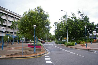
Darwin is the capital city of the Northern Territory, Australia. The city has nearly 53% of the Northern Territory's population, with 139,902 at the 2021 census. It is the smallest, wettest, and most northerly of the Australian capital cities and serves as the Top End's regional centre.

Lincoln National Park is a protected area in the Australian state of South Australia located about 249 kilometres (155 mi) west of the state capital of Adelaide and about 9.5 kilometres (5.9 mi) south of the municipal seat of Port Lincoln. It consists of a mainland area on the Jussieu Peninsula on the south eastern tip of Eyre Peninsula and a number of nearby islands. The national park contains significant sites of natural, indigenous and early European heritage.
Palmerston is a planned satellite city of Darwin, the capital and largest city of Australia's Northern Territory. The city is situated approximately 20 kilometres from Darwin and 10 kilometres from Howard Springs and the surrounding rural areas. Palmerston had a population of 33,695 at the 2016 census, making it the second largest city in the Northern Territory.

Point Reyes National Seashore is a 71,028-acre (287.44 km2) park preserve located on the Point Reyes Peninsula in Marin County, California. As a national seashore, it is maintained by the US National Park Service as an important nature preserve. Some existing agricultural uses are allowed to continue within the park. Clem Miller, a US Congressman from Marin County, wrote and introduced the bill for the establishment of Point Reyes National Seashore in 1962 to protect the peninsula from development which was proposed at the time for the slopes above Drake's Bay.

The Mornington Peninsula is a peninsula located south of Melbourne, Victoria, Australia. It is surrounded by Port Phillip to the west, Western Port to the east and Bass Strait to the south, and is connected to the mainland in the north. Geographically, the peninsula begins its protrusion from the mainland in the area between Pearcedale and an area north of Frankston. The area was originally home to the Mayone-bulluk and Boonwurrung-Balluk clans, and formed part of the Boonwurrung nation's territory prior to European settlement.
The Gove Peninsula is at the northeastern corner of Arnhem Land in the Northern Territory of Australia. The peninsula became strategically important during World War II when a Royal Australian Air Force base was constructed at what is now Gove Airport. The peninsula was involved in a famous court case known as the Gove land rights case, when local Yolngu people tried to claim native title over their traditional lands in 1971, after the Australian Government had granted a mineral lease to a bauxite mining company without consulting the local peoples. Today the land is owned by the Yolngu people.
Mataranka is a town and locality in the Northern Territory of Australia located about 420 km (260 mi.) southeast of the territory capital of Darwin, and 107 km (66 mi.) south of Katherine. At the 2016 census, Mataranka recorded a population of 350. 29.5% of residents are Aboriginal and/or Torres Strait Islander.

The Litchfield Council is a local government area of the Northern Territory of Australia on the eastern and southeastern outskirts of the Darwin-Palmerston urban area. The municipality covers an area of 2,903 square kilometres (1,120.9 sq mi), and was created by the Northern Territory government on 6 September 1985.

The Belyuen Shire is a local government area in the Northern Territory of Australia near Wagait Beach on the Cox Peninsula located across Darwin Harbour from the city of Darwin. The administrative area is centred on the mostly Indigenous community of Belyuen, known officially as Delissaville prior to 1975. Delissaville and its airstrip were named for Benjamin Cohen De Lissa of Queensland, sugar grower and investor in G. T. Bean's failed Port Darwin Sugar Company and the equally unsuccessful Delissa Pioneer Sugar Company.

Tiwi is a northern suburb of the city of Darwin, Northern Territory, Australia. The suburb is bounded by Trower Road, Henbury Avenue and a coastal strip, separating Casuarina Beach and Lee Point Beach. It is in the Local Government Area of City of Darwin. It is home to Dripstone Middle School.
The Wagait Shire is a local government area in the Northern Territory of Australia. The council was established as the Cox Peninsula Community Government Council on 28 April 1995 and renamed with effect from 1 July 2008. The shire is located west of Darwin, as a 15-minute ferry ride, or a 138 kilometres (86 mi) drive on fully sealed roads.

The Copper Coast Council is a local government area in the Australian state of South Australia located at the northern end of the Yorke Peninsula. It was established in 1997 and its seat is in Kadina.

Wagait Beach is a locality approximately 8 km west of Darwin, Northern Territory, Australia, on the opposite side of the harbour. It makes up the Wagait Shire local government area. The population was 461 in 2016. Wagait Beach is not part of Darwin, but many of its residents use the Mandorah ferry to travel to work in Darwin.
Murrumujuk is an outer rural locality of Darwin. It is on the coast of Shoal Bay, south of Gunn Point. The area has been provisionally set aside for a residential subdivision. Murrumujuk is of aboriginal origin.

The Northern Beaches Council is a local government area located in the Northern Beaches region of Sydney, in the state of New South Wales, Australia. The council was formed on 12 May 2016 after the amalgamation of Manly, Pittwater, and Warringah councils.
Vernon Islands is a locality in the Northern Territory of Australia located over land and water in the Clarence Strait including the Vernon Islands and which is located about 55 kilometres (34 mi) north-east of the territory capital of Darwin.
Bynoe Harbour is a locality in the Northern Territory of Australia located about 41 kilometres (25 mi) south-west of the territory capital of Darwin.
Elrundie is a suburb in the Northern Territory of Australia located in Darwin about 13 kilometres (8.1 mi) east of Darwin City overlooking a part of Darwin Harbour known as the East Arm.
East Arm is a suburb in the Northern Territory of Australia located in Darwin about 8 kilometres (5.0 mi) east of Darwin City overlooking a part of Darwin Harbour known as the East Arm. It is the traditional land and waterways of the Larrakia people.


