
Darwin is the capital city of the Northern Territory, Australia. With a population of 139,902 at the 2021 census, the city contains most of the sparsely populated Northern Territory's residents. It is the smallest, wettest, and most northerly of the Australian capital cities and serves as the Top End's regional centre.

Humpty Doo is a town in Australia's Northern Territory, situated just south of the Arnhem Highway, approximately 40 km from Darwin. At the 2016 census, Humpty Doo had a population of 4,313 people. Its local government area is Litchfield Municipality. The town is a popular stopping point for tourists travelling between Darwin and Kakadu National Park, and boasts many attractions of its own. The main industries are agriculture and tourism; however, most residents commute to Darwin or Palmerston for work, and many regard it as a dormitory town.
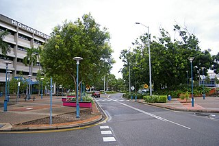
Palmerston is a planned satellite city of Darwin, the capital and largest city of Australia's Northern Territory. The city is situated approximately 20 kilometres from Darwin and 10 kilometres from Howard Springs and the surrounding rural areas. Palmerston had a population of 33,695 at the 2016 census, making it the second largest city in the Northern Territory.

Adelaide River is a small but historically significant town located at the crossing of the Stuart Highway over the Adelaide River in the Northern Territory of Australia. The town is upstream of the Adelaide and Mary River Floodplains Important Bird Area. At the 2021 census, Adelaide River had a population of 317. Adelaide River is part of the Coomalie Shire and is the second largest settlement in the local government area.
Casuarina is one of the northern suburbs of Darwin, the capital of the Northern Territory of Australia. It is the traditional country and waterways of the Larrakia people.

The Litchfield Council is a local government area of the Northern Territory of Australia on the eastern and southeastern outskirts of the Darwin-Palmerston urban area. The municipality covers an area of 2,903 square kilometres (1,120.9 sq mi), and was created by the Northern Territory government on 6 September 1985.

Tiwi is a northern suburb of the city of Darwin, Northern Territory, Australia. The suburb is bounded by Trower Road, Henbury Avenue and a coastal strip, separating Casuarina Beach and Lee Point Beach. It is in the Local Government Area of City of Darwin. It is home to Dripstone Middle School.

Batchelor is a town in the Northern Territory of Australia. The town is the current seat and largest town of the Coomalie Shire local government area. It is located 98 kilometres (61 mi) south of the territory capital, Darwin. A number of residents commute to Darwin and its suburbs for work. In the 2016 census, Batchelor recorded a population of 507 people, with 36% of Aboriginal and Torres Strait Islander origin.

Alawa is a northern suburb of the city of Darwin, Northern Territory, Australia. It is bounded by Trower and Dripstone Roads, Lakeside Drive and the Rapid Creek in the local government area of City of Darwin. It is the traditional country and waterways of the Larrakia people.

Holtze is a locality in Darwin, Northern Territory, Australia. It is 22 km southeast of the Darwin CBD. Its local government area is the Municipality of Litchfield. The locality is mostly a rural area, just north of Palmerston. It was named for Maurice William Holtze (1840–1923), the botanist who established Darwin's Botanical Gardens, and his son Nicholas, who succeeded him as curator.
Bees Creek is an outer rural area of Darwin, Northern Territory, Australia. It is 33 km southeast of the Darwin central business district. It is the council seat of the local government area of the Litchfield Municipality, although most council facilities, public amenities and the actual Municipal offices are in the neighbouring locality of Freds Pass. Bees Creek is mostly rural, with large residential blocks often not served by town sewers or sealed roads. Nevertheless, the area is popular with those wishing to enjoy a rural lifestyle within an easy commuting distance of the city.
Berry Springs is a locality in the Northern Territory of Australia. The locality is a mostly rural area situated on the Cox Peninsula Road and is sparsely populated. A few businesses and a school are located in the locality. In the 2016 census, the population of Berry Springs was 818. It is located 58.5 kilometres (36.4 mi) by road from the Darwin Central Business District and lies within the Litchfield Municipality local government area.
Freds Pass is an outer rural locality in Darwin. The name Fred's Pass originally referred to a gap in the Daly Ranges through which the Fred's Pass Road ran, and was named by surveyor W. P. Auld for his fellow-explorer Fred Litchfield, whose name is also commemorated in the nearby Litchfield shire.
Herbert is an outer rural locality of Darwin. It is 44 km South - east of Darwin. Its Local Government Area is the Litchfield Municipality. The suburb is mostly a rural area. It is situated in the vicinity of Benham and Benjamin Lagoons. It was previously considered as part of Humpty Doo.

Noonamah is an outer rural suburban area of Darwin. it is 45 km southeast of the Darwin CBD. Its Local Government Area is the Litchfield Municipality. The suburb is mostly a rural area, but has been experiencing strong growth in population and development. The Elizabeth River flows through Noonamah towards the East Arm of Darwin Harbour.

Darwinbus is the official operational name of the public bus network which operates within the Greater Darwin region, this includes the satellite cities Palmerston and Casuarina, in addition to the Darwin Rural Area in the Northern Territory. The network is exclusively operated by CDC Northern Territory under a six-year contract with the Northern Territory Government starting from 1 July 2022, and in the financial year prior to the COVID-19 pandemic, carried approximately 3.5 million passengers, equivalent to a 5-6% modeshare. Prior to July 2022, the network was operated by two contractors; CDC Northern Territory, and Territory Transit who had shared operation of the majority of urban bus services.

Northern Territory Fire and Rescue Service, or NTFRS, is the primary provider of fire and rescue services throughout the 1.35 million square km Northern Territory of Australia. It is made up of 27 fire stations, 16 being staffed by volunteer brigade units, 5 being staffed 24 hours a day by career fire fighters, and the remainder by a mix of career and auxiliary fire fighters.
The Black Jungle Conservation Reserve is a protected area in the Northern Territory of Australia near the territorial capital of Darwin. The rural area of Darwin and its development has a contrasting history to the more southern regions and their rural zones. The development of the rural area around Darwin occurred after 1950 as agricultural ventures were trialed. Prior to this the area was tropical savanna with pockets of monsoon rainforest and melaleuca swamps, unchanged for thousands of years, except by the traditional Aboriginal owners of the land who hunted and gathered and managed the landscape with fire. Black Jungle Conservation Reserve is a part of the Adelaide River Coastal Floodplain system which encompasses Black Jungle and Lambells Lagoon Conservation Reserves, Fogg Dam, Leaning Tree Lagoon Nature Park, Melacca Swamp and Djukbinj National Park. These Reserves encompass a range of wetland types and form part of the internationally significant Adelaide River floodplain.
Micket Creek is a locality in the Northern Territory of Australia located about 12 kilometres (7.5 mi) east of the territory capital of Darwin.
Daly is a locality in the Northern Territory of Australia located about 51 kilometres (32 mi) south-east of the territory capital of Darwin.

