
Daly Waters is a town and locality in the Northern Territory of Australia, located about 620 kilometres (390 mi) south of the territory capital of Darwin at the intersection of the Carpentaria Highway and the Stuart Highway. In the 2021 census, the locality of Daly Waters had a population of 55 people.

Newcastle Waters is a town and locality off the Stuart Highway in the Northern Territory. The nearest petrol station and accommodation is found 23 kilometres (14 mi) south at Elliott. The Newcastle Waters School draws most of its few students from the Marlinja homeland community which lies on the northern boundary of the town.

The Litchfield Council is a local government area of the Northern Territory of Australia on the eastern and southeastern outskirts of the Darwin-Palmerston urban area. The municipality covers an area of 2,903 square kilometres (1,120.9 sq mi), and was created by the Northern Territory government on 6 September 1985.

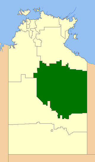
Roper Gulf Regional Council is a local government area of the Northern Territory, Australia. The region covers an area of 185,210 square kilometres (71,510 sq mi) and had a population of 7,397 in June 2018.
The Barkly Region, formerly Barkly Shire, is a local government area of the Northern Territory of Australia, administered by the Barkly Regional Council. The region's main town is Tennant Creek. The region covers an area of 322,713 square kilometres (124,600 sq mi) and had a population of almost 7,400 as at June 2018.
Birdum is a locality in the Northern Territory of Australia located about 493 kilometres (306 mi) south of the territory capital of Darwin.
Durack is an inner-city suburb of Palmerston. It is 22 km southeast of the Darwin CBD. Its local government area is the City of Palmerston. Durack is bound to the north by the Stuart Highway; to the west and south is University Avenue, and to the east is Roystonea Avenue. The suburb consists mostly of recent developments, beginning in the early 1990s, and includes three estates as designated by the developers of the area: Fairway Waters, The Mews, and The Heights.
Berry Springs is a locality in the Northern Territory of Australia. The locality is a mostly rural area situated on the Cox Peninsula Road and is sparsely populated. A few businesses and a school are located in the locality. In the 2016 census, the population of Berry Springs was 818. It is located 58.5 kilometres (36.4 mi) by road from the Darwin Central Business District and lies within the Litchfield Municipality local government area.

Darwin City is a suburb in metropolitan Darwin which comprises the original settlement, the central business district, parkland and other built-up areas. It is the traditional country and waterways of the Larrakia people. It is original site of occupation and includes many of the city's important institutions and landmarks, such as Parliament, Government House, the Northern Territory Supreme Court, Bicentennial Park and the George Brown Darwin Botanic Gardens. The city centre is located in the local government areas of the City of Darwin and the Darwin Waterfront Precinct.
Elliott is a town in Northern Territory of Australia. It is almost halfway between Darwin and Alice Springs on the Stuart Highway. The town is in the Yapurkulangu ward of the Barkly Region. At the 2016 census, Elliott had a population of 339.
Dundee Beach is a locality in the Northern Territory of Australia, located approximately 59 km (37 mi) southwest of the territory capital of Darwin. The 2016 Australian census which was conducted in August 2016 reports that Dundee Beach had 207 people living within its boundaries.
Pamayu is a locality in the Northern Territory of Australia located about 725 kilometres (450 mi) south-east of the territory capital of Darwin.
Ghan is a locality in the Northern Territory of Australia located about 1,470 kilometres (910 mi) south of the territory capital of Darwin at the intersection of Lasseter Highway and Stuart Highway.
Vernon Islands is a locality in the Northern Territory of Australia located over land and water in the Clarence Strait including the Vernon Islands and which is located about 55 kilometres (34 mi) north-east of the territory capital of Darwin.
Micket Creek is a locality in the Northern Territory of Australia located about 12 kilometres (7.5 mi) east of the territory capital of Darwin.
Daly is a locality in the Northern Territory of Australia located about 51 kilometres (32 mi) south-east of the territory capital of Darwin.
Eli Waters is a coastal suburb of Hervey Bay in the Fraser Coast Region, Queensland, Australia. In the 2021 census, Eli Waters had a population of 3,758 people.

Vernon Islands, also known as the Potinga Islands, is an island group in the Northern Territory of Australia located in the Clarence Strait about 55 kilometres (34 mi) north-east of the territory capital of Darwin. The group consists of three islands which were first sighted by Europeans in 1818 on a British navy ship under the command of Phillip Parker King. The group were part of the subject of a successful aboriginal land claim which was resolved after 40 years in 2018 when the Tiwi people received title. All three islands host navigation aids which assist vessels passing through the Clarence Strait. It and some adjoining seabed have had protected area status since 1974 and which has been known as the Vernon Islands Conservation Reserve since 1979. Since 2007, the island group has been located in the locality of Vernon Islands.
Wickham is a locality in the Northern Territory of Australia located about 13 kilometres (8.1 mi) south-east of the territory capital of Darwin City and which overlooks Darwin Harbour.
Weddell is a locality in the Northern Territory of Australia located about 24 kilometres (15 mi) south-east of the territory capital of Darwin City.
