
The Litchfield Council is a local government area of the Northern Territory of Australia on the eastern and southeastern outskirts of the Darwin-Palmerston urban area. The municipality covers an area of 2,903 square kilometres (1,120.9 sq mi), and was created by the Northern Territory government on 6 September 1985.

The Coomalie Community Government Council is a local government area in Australia's Northern Territory, situated south of Darwin and Palmerston. The council governs an area of 2,056 km2 (794 sq mi). The shire had a population of 1,391 in June 2018.

The Victoria Daly Regional Council is a local government area in the Northern Territory of Australia. The shire covers an area of 153,287 square kilometres (59,184 sq mi) and had a population of 3,138 in June 2018.

The West Arnhem Region is a local government area of the Northern Territory, Australia and is administered by the West Arnhem Regional Council. The region covers an area of 49,675 square kilometres (19,180 sq mi) and had a population of 6,902 in June 2018.
The Central Desert Region is a local government area of the Northern Territory, Australia, administered by the Central Desert Regional Council. The council's main towns are Ti-Tree, Yuendumu, and Lajamanu. The Region covers an area of 281,312 square kilometres (108,615 sq mi) and had a population of 4,208 in June 2018.
Birdum is a locality in the Northern Territory of Australia located about 493 kilometres (306 mi) south of the territory capital of Darwin.

Hidden Valley is an eastern suburb in the city of Darwin, in the Northern Territory of Australia. It is the traditional country and waterways of the Larrakia people.
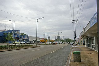
Stuart Park is an inner suburb of the city of Darwin, Northern Territory, Australia. It is the traditional country and waterways of the Larrakia people.

Knuckey Lagoon is an outer suburban area in Darwin. It is 18 kilometres (11 mi) east of the Darwin CBD. Its Local Government Area is the Litchfield Municipality. The suburb is mostly a rural area, on the fringe of Metropolitan Darwin. The area was named by Surveyor General G W Goyder after his Senior Surveyor, Richard Randall Knuckey.
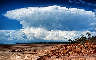
Gunn Point Peninsula located just over an hour from Darwin, Northern Territory, is a fishing, camping and leisure destination.
Darwin River is an outer suburban area in Darwin. The name of the locality derived from the Darwin River which flows through the locality.

Charles Darwin is an eastern suburb in the city of Darwin, in the Northern Territory of Australia. It is the traditional country and waterways of the Larrakia people.
Shoal Bay is a locality in the Northern Territory of Australia located about 20 kilometres (12 mi) east of the territory capital of Darwin.

The West Daly Regional Council is a local government area of the Northern Territory, Australia. The shire covers an area of 14,070 square kilometres (5,430 sq mi) and had a population of 3,649 in June 2018, with over 90% identifying as Aboriginal. During the wet season between late November and early May, travel between the three main communities of Nganmarriyanga, Peppimenarti and Wadeye is limited to air as roads are cut by flooding.
Pamayu is a locality in the Northern Territory of Australia located about 725 kilometres (450 mi) south-east of the territory capital of Darwin.
Tablelands is a locality in the Northern Territory of Australia located about 858 kilometres (533 mi) south-east of the territory capital of Darwin.
Tanami East is a locality in the Northern Territory of Australia located about 510 kilometres (320 mi) south of the territory capital of Darwin.
Ghan is a locality in the Northern Territory of Australia located about 1,470 kilometres (910 mi) south of the territory capital of Darwin at the intersection of Lasseter Highway and Stuart Highway.

Anmatjere is a locality in the Northern Territory of Australia located about 1,088 kilometres (676 mi) south of the territory capital of Darwin.
Wak Wak is a locality in the Northern Territory of Australia located about 55 kilometres (34 mi) east of the territory capital of Darwin.


