
The Litchfield Council is a local government area of the Northern Territory of Australia on the eastern and southeastern outskirts of the Darwin-Palmerston urban area. The municipality covers an area of 2,903 square kilometres (1,120.9 sq mi), and was created by the Northern Territory government on 6 September 1985.

Holtze is a locality in Darwin, Northern Territory, Australia. It is 22 km southeast of the Darwin CBD. Its local government area is the Municipality of Litchfield. The locality is mostly a rural area, just north of Palmerston. It was named for Maurice William Holtze (1840–1923), the botanist who established Darwin's Botanical Gardens, and his son Nicholas, who succeeded him as curator.

Knuckey Lagoon is an outer suburban area in Darwin. It is 18 kilometres (11 mi) east of the Darwin CBD. Its Local Government Area is the Litchfield Municipality. The suburb is mostly a rural area, on the fringe of Metropolitan Darwin. The area was named by Surveyor General G W Goyder after his Senior Surveyor, Richard Randall Knuckey.
Hughes Airfield is an airfield in the Northern Territory of Australia located in the locality of Hughes. It was constructed during World War II for military use. The airfield now functions as a base for aerial firefighting aircraft to protect the outer rural suburbs of Darwin.
Virginia is a locality in the Northern Territory of Australia located about 31 kilometres (19 mi) south east of the Darwin CBD. Its Local Government Area is the Litchfield Municipality. The suburb is mostly a rural area, but has been experiencing strong growth in population and development. Settlement of the suburb began in 1869, after George McLachlan surveyed the small satellite town. Virginia has been used as a name for the area since the 1870s.
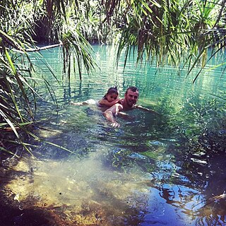
Berry Springs is a locality in the Northern Territory of Australia. The locality is a mostly rural area situated on the Cox Peninsula Road and is sparsely populated. A few businesses and a school are located in the locality. In the 2016 census, the population of Berry Springs was 818. It is located 58.5 kilometres (36.4 mi) by road from the Darwin Central Business District and lies within the Litchfield Municipality local government area.
Freds Pass is an outer rural locality in Darwin. The name Fred's Pass originally referred to a gap in the Daly Ranges through which the Fred's Pass Road ran, and was named by surveyor W. P. Auld for his fellow-explorer Fred Litchfield, whose name is also commemorated in the nearby Litchfield shire.
Hughes is an outer rural locality of Darwin, located approximately 38 km (24 mi) south-west of the city in the Litchfield Municipality. The name of the locality derived from Hughes Airfield constructed in the area during the Second World War. The airfield itself was named after W A Hughes, Director of Mines in the Northern Territory before the war. The airfield is still in occasional use, occupying much of the western half of the locality adjacent to the Stuart Highway. The eastern portion of Hughes, north of Townend Road is characterised by mostly small farms and rural residential development.
Lloyd Creek is an outer rural locality of Darwin. It was named by Fred Litchfield in 1865 after John Vereker Lloyd, who had accompanied Litchfield in exploration. Lloyd Creek was incorporated in 1869.

Charles Darwin is an eastern suburb in the city of Darwin, in the Northern Territory of Australia. It is the traditional Country and waterways of the Larrakia people.
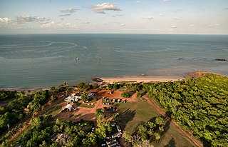
Dundee Beach is a locality in the Northern Territory of Australia, located approximately 59 kilometres southwest of the territory capital of Darwin. The 2016 Australian census which was conducted in August 2016 reported Dundee Beach's population to be 207.
Shoal Bay is a locality in the Northern Territory of Australia located about 20 kilometres (12 mi) east of the territory capital of Darwin.
Bynoe is a locality in the Northern Territory of Australia located about 46 kilometres (29 mi) south-west of the territorial capital of Darwin.
Dundee Downs is a locality in the Northern Territory of Australia located about 52 kilometres (32 mi) south-west of the territory capital of Darwin.
Dundee Forest is a locality in the Northern Territory of Australia located about 58 kilometres (36 mi) south-west of the territory capital of Darwin. The 2016 Australian census which was conducted in August 2016 reports that Dundee Forest had 73 people living within its boundaries.
Bynoe Harbour is a locality in the Northern Territory of Australia located about 41 kilometres (25 mi) south-west of the territory capital of Darwin.
Micket Creek is a locality in the Northern Territory of Australia located about 12 kilometres (7.5 mi) east of the territory capital of Darwin.
Daly is a locality in the Northern Territory of Australia located about 51 kilometres (32 mi) south-east of the territory capital of Darwin.
Wickham is a locality in the Northern Territory of Australia located about 13 kilometres (8.1 mi) south-east of the territory capital of Darwin City and which overlooks Darwin Harbour.
Wak Wak is a locality in the Northern Territory of Australia located about 55 kilometres (34 mi) east of the territory capital of Darwin.

