
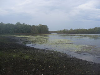
Darwin Harbour is a body of water close to the city of Darwin in the Northern Territory of Australia. It is the traditional waterways of the Larrakia people.

The Litchfield Council is a local government area of the Northern Territory of Australia on the eastern and southeastern outskirts of the Darwin-Palmerston urban area. The municipality covers an area of 2,903 square kilometres (1,120.9 sq mi), and was created by the Northern Territory government on 6 September 1985.

The Coomalie Community Government Council is a local government area in Australia's Northern Territory, situated south of Darwin and Palmerston. The council governs an area of 2,056 km2 (794 sq mi). The shire had a population of 1,391 in June 2018.

Holtze is a locality in Darwin, Northern Territory, Australia. It is 22 km southeast of the Darwin CBD. Its local government area is the Municipality of Litchfield. The locality is mostly a rural area, just north of Palmerston. It was named for Maurice William Holtze (1840–1923), the botanist who established Darwin's Botanical Gardens, and his son Nicholas, who succeeded him as curator.

Knuckey Lagoon is an outer suburban area in Darwin. It is 18 kilometres (11 mi) east of the Darwin CBD. Its Local Government Area is the Litchfield Municipality. The suburb is mostly a rural area, on the fringe of Metropolitan Darwin. The area was named by Surveyor General G W Goyder after his Senior Surveyor, Richard Randall Knuckey.

Acacia Hills is an outer rural locality of Darwin. It is 60 kilometres (37 mi) south of the Darwin CBD in Litchfield Municipality. Named for the acacia shrub that is endemic to the area, the suburb is largely rural land, just north of Manton Dam and west of the Adelaide River. Mango farming is an important local industry. Both the Stuart Highway and Adelaide–Darwin rail corridor pass through the area.
Berry Springs is a locality in the Northern Territory of Australia. The locality is a mostly rural area situated on the Cox Peninsula Road and is sparsely populated. A few businesses and a school are located in the locality. In the 2016 census, the population of Berry Springs was 818. It is located 58.5 kilometres (36.4 mi) by road from the Darwin Central Business District and lies within the Litchfield Municipality local government area.
Manton is an outer rural locality of Darwin. The name is derived from Manton Dam on the Manton River, named by Government Resident B. T. Finniss for his second-in-command James Thomas Manton.
McMinns Lagoon is an outer suburban area in Darwin. It appeared on Goyder's plan of the Survey of Port Darwin and Environs in 1869.

Noonamah is an outer rural suburban area of Darwin. it is 45 km southeast of the Darwin CBD. Its Local Government Area is the Litchfield Municipality. The suburb is mostly a rural area, but has been experiencing strong growth in population and development. The Elizabeth River flows through Noonamah towards the East Arm of Darwin Harbour.

Charles Darwin is an eastern suburb in the city of Darwin, in the Northern Territory of Australia. It is the traditional Country and waterways of the Larrakia people.

Channel Island is a suburb in the Middle Arm region of Darwin in the Northern Territory of Australia. It is located in the local government area of Litchfield. Channel Island Power Station and the Darwin Aquaculture Centre are located on the island.
Charlotte is a locality in the Northern Territory of Australia located about 36 kilometres (22 mi) south of the territorial capital of Darwin.
Koolpinyah is a locality in the Northern Territory of Australia located about 37 kilometres (23 mi) east of the territory capital of Darwin.
Coomalie Creek is a locality in the Northern Territory of Australia located about 72 kilometres (45 mi) south-east of the territory capital of Darwin.
Micket Creek is a locality in the Northern Territory of Australia located about 12 kilometres (7.5 mi) east of the territory capital of Darwin.
Douglas-Daly is a locality in the Northern Territory of Australia located about 154 kilometres (96 mi) south of the territory capital of Darwin.
Daly is a locality in the Northern Territory of Australia located about 51 kilometres (32 mi) south-east of the territory capital of Darwin.
Elrundie is a suburb in the Northern Territory of Australia located in Darwin about 13 kilometres (8.1 mi) east of Darwin City overlooking a part of Darwin Harbour known as the East Arm.
Weddell is a locality in the Northern Territory of Australia located about 24 kilometres (15 mi) south-east of the territory capital of Darwin City.

